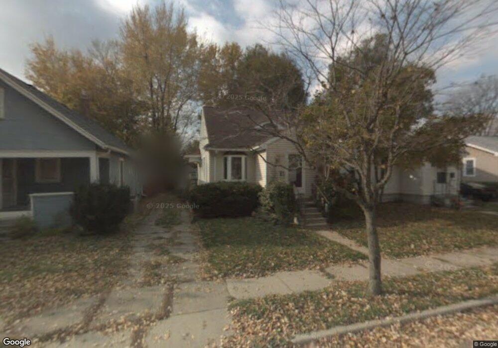
1930 Clifton Ave Lansing, MI 48910
Clifford Park NeighborhoodEstimated Value: $126,000 - $152,000
3
Beds
1
Bath
861
Sq Ft
$161/Sq Ft
Est. Value
About This Home
This home is located at 1930 Clifton Ave, Lansing, MI 48910 and is currently estimated at $138,560, approximately $160 per square foot. 1930 Clifton Ave is a home located in Ingham County with nearby schools including Lyons Elementary School, Pattengill Academy, and Eastern High School.
Ownership History
Date
Name
Owned For
Owner Type
Purchase Details
Closed on
Apr 16, 2013
Sold by
Mckee Robert Paton
Bought by
Mckee Linda Siobhn
Current Estimated Value
Purchase Details
Closed on
Sep 13, 2008
Sold by
Mckee Russell and Mckee Linda Siobhn
Bought by
Mckee Robert Paton and Mckee Linda Siobhn
Purchase Details
Closed on
Apr 7, 2005
Sold by
Mckee Russell
Bought by
Mckee Russell and Mckee Linda Siobhn
Purchase Details
Closed on
Mar 31, 2003
Sold by
Gorsline Francine
Bought by
Mckee Russell
Purchase Details
Closed on
Jul 1, 1994
Create a Home Valuation Report for This Property
The Home Valuation Report is an in-depth analysis detailing your home's value as well as a comparison with similar homes in the area
Home Values in the Area
Average Home Value in this Area
Purchase History
We collect this data history from publicly available records. To have your information removed, we recommend requesting removal directly through your county’s website.
| Date | Buyer | Sale Price | Title Company |
|---|---|---|---|
| Mckee Linda Siobhn | -- | None Available | |
| Mckee Robert Paton | -- | None Available | |
| Mckee Russell | -- | -- | |
| Mckee Russell | $97,000 | Trans | |
| -- | $54,500 | -- |
Source: Public Records
Tax History
| Year | Tax Paid | Tax Assessment Tax Assessment Total Assessment is a certain percentage of the fair market value that is determined by local assessors to be the total taxable value of land and additions on the property. | Land | Improvement |
|---|---|---|---|---|
| 2025 | $2,524 | $57,900 | $8,100 | $49,800 |
| 2024 | $20 | $49,700 | $8,100 | $41,600 |
| 2023 | $2,368 | $46,200 | $8,100 | $38,100 |
| 2022 | $2,136 | $40,600 | $7,600 | $33,000 |
| 2021 | $2,092 | $37,900 | $6,500 | $31,400 |
| 2020 | $2,079 | $37,200 | $6,500 | $30,700 |
| 2019 | $3,486 | $34,900 | $6,500 | $28,400 |
| 2018 | $1,868 | $33,100 | $6,500 | $26,600 |
| 2017 | $1,788 | $33,100 | $6,500 | $26,600 |
| 2016 | $3,096 | $32,100 | $6,500 | $25,600 |
| 2015 | $3,096 | $30,800 | $13,061 | $17,739 |
| 2014 | $3,096 | $30,000 | $16,180 | $13,820 |
Source: Public Records
Map
Nearby Homes
- 2001 Clifton Ave
- 1814 Sunnyside Ave
- 2204 Clifton Ave
- 0 E Mount Hope Ave
- 2303 Devonshire Ave
- 2215 Alpha St
- 2309 S Pennsylvania Ave
- 2515 Harding Ave
- 1735 Lyons Ave
- 1731 Lyons Ave
- 1423 Pontiac St
- 841 Baker St
- 1437 Ada St
- 1601 Bailey St
- 713 E Greenlawn Ave
- 1522 Bailey St
- 1535 Linval St
- 1515 Linval St
- 534 Isbell St
- 630 E Greenlawn Ave
- 1932 Clifton Ave
- 1926 Clifton Ave
- 1922 Clifton Ave
- 1931 Harding Ave
- 1927 Harding Ave
- 1933 Harding Ave
- 1918 Clifton Ave
- 2000 Clifton Ave
- 1923 Harding Ave
- 1916 Clifton Ave
- 1919 Harding Ave
- 1931 Clifton Ave
- 1933 Clifton Ave
- 1929 Clifton Ave
- 1304 Elmore St
- 2004 Clifton Ave
- 1927 Clifton Ave
- 1915 Harding Ave
- 1912 Clifton Ave
- 2005 Harding Ave
Your Personal Tour Guide
Ask me questions while you tour the home.