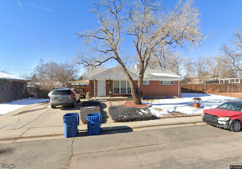
1931 W 73rd Place Denver, CO 80221
Twin Lakes NeighborhoodEstimated Value: $436,212 - $455,000
3
Beds
2
Baths
2,081
Sq Ft
$214/Sq Ft
Est. Value
About This Home
This home is located at 1931 W 73rd Place, Denver, CO 80221 and is currently estimated at $445,803, approximately $214 per square foot. 1931 W 73rd Place is a home located in Adams County with nearby schools including Orchard Park Academy, Colorado Sports Leadership Academy, and Westminster High School.
Ownership History
Date
Name
Owned For
Owner Type
Purchase Details
Closed on
Aug 31, 2022
Sold by
Dellacqua Aquiles A
Bought by
Montes Sara Jane and Dellacqua Aquiles A
Current Estimated Value
Purchase Details
Closed on
Sep 30, 2020
Sold by
Hudson Michale J and Hudson Diane L
Bought by
Lima Aquilles Andre Dellacqua
Home Financials for this Owner
Home Financials are based on the most recent Mortgage that was taken out on this home.
Original Mortgage
$14,728
Interest Rate
2.88%
Mortgage Type
New Conventional
Create a Home Valuation Report for This Property
The Home Valuation Report is an in-depth analysis detailing your home's value as well as a comparison with similar homes in the area
Home Values in the Area
Average Home Value in this Area
Purchase History
We collect this data history from publicly available records. To have your information removed, we recommend requesting removal directly through your county’s website.
| Date | Buyer | Sale Price | Title Company |
|---|---|---|---|
| Montes Sara Jane | -- | None Listed On Document | |
| Lima Aquilles Andre Dellacqua | $375,000 | Legacy Title Agency Llc |
Source: Public Records
Mortgage History
We collect this data history from publicly available records. To have your information removed, we recommend requesting removal directly through your county’s website.
| Date | Status | Borrower | Loan Amount |
|---|---|---|---|
| Previous Owner | Lima Aquilles Andre Dellacqua | $14,728 | |
| Previous Owner | Lima Aquilles Andre Dellacqua | $368,207 |
Source: Public Records
Tax History
| Year | Tax Paid | Tax Assessment Tax Assessment Total Assessment is a certain percentage of the fair market value that is determined by local assessors to be the total taxable value of land and additions on the property. | Land | Improvement |
|---|---|---|---|---|
| 2025 | $3,384 | $30,400 | $6,120 | $24,280 |
| 2024 | $3,384 | $27,940 | $5,630 | $22,310 |
| 2023 | $3,295 | $32,260 | $5,610 | $26,650 |
| 2022 | $3,081 | $25,160 | $5,770 | $19,390 |
| 2021 | $3,142 | $25,160 | $5,770 | $19,390 |
| 2020 | $2,109 | $24,320 | $5,790 | $18,530 |
| 2019 | $2,102 | $24,320 | $5,790 | $18,530 |
| 2018 | $1,459 | $18,980 | $5,620 | $13,360 |
| 2017 | $1,279 | $18,980 | $5,620 | $13,360 |
| 2016 | $813 | $14,140 | $2,710 | $11,430 |
| 2015 | $811 | $7,070 | $1,350 | $5,720 |
| 2014 | -- | $6,640 | $1,110 | $5,530 |
Source: Public Records
Map
Nearby Homes
- 7250 Avrum Dr
- 2220 Samuel Dr
- 7230 Quivas St
- 7220 Avrum Dr
- 7488 Quivas St
- 7201 Avrum Dr
- 2513 W 74th Ave
- 7111 Avrum Dr
- 1301 Worley Dr
- 7255 Mariposa St
- 7020 Avrum Dr
- 2161 Meadowbrook Dr
- 2500 Westchester Dr
- 7211 Bryant St
- 7798 Quivas St
- 7391 Bronco Rd
- 7310 Dale Ct
- 6910 Ruth Way
- 7802 Zuni St
- 1343 Lipan Dr
- 1941 W 73rd Place
- 1920 Samuel Dr
- 1940 Samuel Dr
- 7360 Alan Dr
- 7370 Alan Dr
- 1961 W 73rd Place
- 1926 W 73rd Place
- 1960 Samuel Dr
- 1940 W 73rd Place
- 7350 Alan Dr
- 7380 Alan Dr
- 1950 W 73rd Place
- 1980 Samuel Dr
- 1921 Samuel Dr
- 1941 Samuel Dr
- 1881 Samuel Dr
- 7371 Quivas St
- 2041 W 74th Ave
- 7361 Quivas St
- 1961 Samuel Dr
Your Personal Tour Guide
Ask me questions while you tour the home.