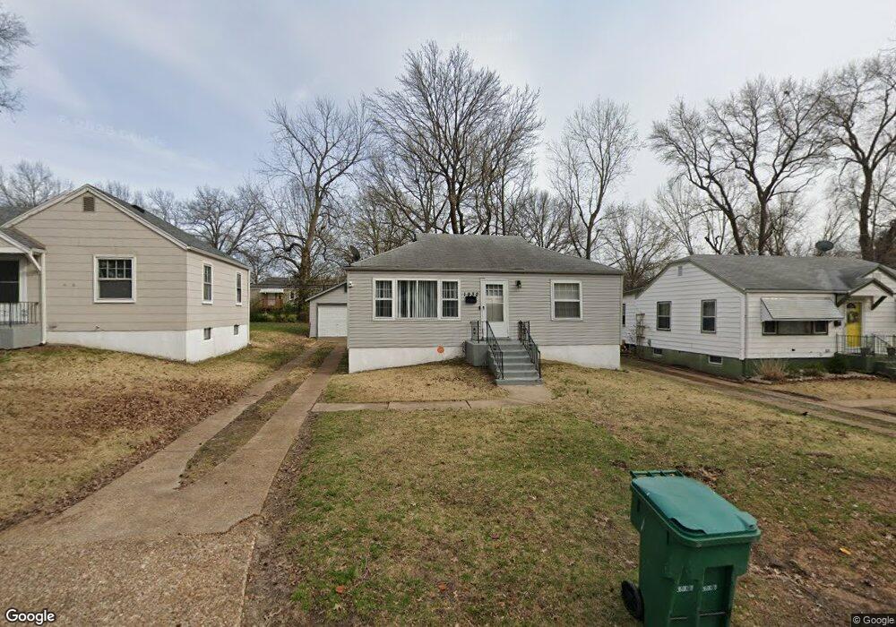
1932 Raft Dr Saint Louis, MO 63133
Estimated Value: $93,000 - $108,000
2
Beds
1
Bath
792
Sq Ft
$126/Sq Ft
Est. Value
About This Home
This home is located at 1932 Raft Dr, Saint Louis, MO 63133 and is currently estimated at $100,095, approximately $126 per square foot. 1932 Raft Dr is a home located in St. Louis County with nearby schools including Normandy High School, The Leadership School, and Christ The King Catholic School.
Ownership History
Date
Name
Owned For
Owner Type
Purchase Details
Closed on
Jan 8, 2007
Sold by
Deutsche Bank National Trust Co
Bought by
Gantt Eulinda Y
Current Estimated Value
Home Financials for this Owner
Home Financials are based on the most recent Mortgage that was taken out on this home.
Original Mortgage
$55,358
Outstanding Balance
$22,569
Interest Rate
6.19%
Mortgage Type
Purchase Money Mortgage
Estimated Equity
$77,526
Purchase Details
Closed on
May 4, 2006
Sold by
White Stephanie
Bought by
Deutsche Bank National Trust Co and Ameriquest Mortgage Securities Inc Asset
Purchase Details
Closed on
Oct 26, 2005
Sold by
Village Square Remodeling Investment Llc
Bought by
White Stephanie
Home Financials for this Owner
Home Financials are based on the most recent Mortgage that was taken out on this home.
Original Mortgage
$63,750
Interest Rate
9.4%
Mortgage Type
Fannie Mae Freddie Mac
Purchase Details
Closed on
May 31, 2005
Sold by
Greeves Clifford
Bought by
Village Square Remodeling Investment Llc
Purchase Details
Closed on
May 23, 2005
Sold by
Powell Construction Llc
Bought by
Greeves Clifford and Clifford Greeves Revocable Trust
Purchase Details
Closed on
May 18, 2004
Sold by
Rick Houseman Lc
Bought by
Powell Construction Llc
Home Financials for this Owner
Home Financials are based on the most recent Mortgage that was taken out on this home.
Original Mortgage
$45,320
Interest Rate
5.81%
Mortgage Type
Purchase Money Mortgage
Purchase Details
Closed on
May 13, 2004
Sold by
Bank One Na
Bought by
Rick Houseman Lc
Home Financials for this Owner
Home Financials are based on the most recent Mortgage that was taken out on this home.
Original Mortgage
$45,320
Interest Rate
5.81%
Mortgage Type
Purchase Money Mortgage
Purchase Details
Closed on
Mar 15, 2004
Sold by
Black Keisha
Bought by
Bank One Na
Purchase Details
Closed on
Feb 24, 1999
Sold by
Advanta Investment Group Llc
Bought by
Black Keisha
Home Financials for this Owner
Home Financials are based on the most recent Mortgage that was taken out on this home.
Original Mortgage
$38,500
Interest Rate
11.37%
Purchase Details
Closed on
Sep 13, 1998
Sold by
Anders Larry P and Anders Jane A
Bought by
Anders Larry P
Purchase Details
Closed on
Aug 26, 1998
Sold by
Bt Realty
Bought by
Advanta Investment Group
Create a Home Valuation Report for This Property
The Home Valuation Report is an in-depth analysis detailing your home's value as well as a comparison with similar homes in the area
Home Values in the Area
Average Home Value in this Area
Purchase History
We collect this data history from publicly available records. To have your information removed, we recommend requesting removal directly through your county’s website.
| Date | Buyer | Sale Price | Title Company |
|---|---|---|---|
| Gantt Eulinda Y | $61,983 | Mokan Title Services Llc | |
| Deutsche Bank National Trust Co | $68,653 | None Available | |
| White Stephanie | $75,000 | Integrity Land Title Co Inc | |
| Village Square Remodeling Investment Llc | $41,000 | Ort | |
| Greeves Clifford | -- | -- | |
| Powell Construction Llc | $44,000 | Capital Title | |
| Rick Houseman Lc | $29,000 | Capital Title | |
| Bank One Na | $33,750 | -- | |
| Black Keisha | $55,000 | -- | |
| Anders Larry P | -- | -- | |
| Advanta Investment Group | -- | -- | |
| Bt Realty | -- | -- | |
| Spinoza Llc | -- | -- |
Source: Public Records
Mortgage History
We collect this data history from publicly available records. To have your information removed, we recommend requesting removal directly through your county’s website.
| Date | Status | Borrower | Loan Amount |
|---|---|---|---|
| Open | Gantt Eulinda Y | $55,358 | |
| Previous Owner | White Stephanie | $63,750 | |
| Previous Owner | Powell Construction Llc | $45,320 | |
| Previous Owner | Black Keisha | $38,500 | |
| Closed | Black Keisha | $16,500 | |
| Closed | Bank One Na | -- |
Source: Public Records
Tax History
| Year | Tax Paid | Tax Assessment Tax Assessment Total Assessment is a certain percentage of the fair market value that is determined by local assessors to be the total taxable value of land and additions on the property. | Land | Improvement |
|---|---|---|---|---|
| 2025 | $889 | $13,700 | $2,220 | $11,480 |
| 2024 | $889 | $9,330 | $2,220 | $7,110 |
| 2023 | $928 | $9,330 | $2,220 | $7,110 |
| 2022 | $1,063 | $9,120 | $1,840 | $7,280 |
| 2021 | $1,020 | $9,120 | $1,840 | $7,280 |
| 2020 | $916 | $7,520 | $1,860 | $5,660 |
| 2019 | $895 | $7,520 | $1,860 | $5,660 |
| 2018 | $1,072 | $8,490 | $1,160 | $7,330 |
| 2017 | $1,079 | $8,490 | $1,160 | $7,330 |
| 2016 | $929 | $6,990 | $1,160 | $5,830 |
| 2015 | $902 | $6,990 | $1,160 | $5,830 |
| 2014 | $1,239 | $9,660 | $1,580 | $8,080 |
Source: Public Records
Map
Nearby Homes
- 2037 Bainbridge Dr
- 2036 Raft Dr
- 2045 Bainbridge Dr
- 7500 Haywood Dr
- 7805 Utica Dr
- 7401 Haywood Dr
- 7752 Mallard Dr
- 7912 Monroe Dr
- 7244 Mallard Dr
- 7331 Wayne Ave
- 7410 Liberty Ave
- 8004 Monroe Ave
- 1506 Bradford Ave
- 1509 Bradford Ave
- 1208 Verl Place
- 7337 Doncaster Dr
- 7530 Trenton Ave
- 8151 Underhill Dr
- 8021 Titus Rd
- 7539 Wayne Ave
- 1936 Raft Dr
- 1928 Raft Dr
- 1924 Raft Dr
- 1940 Raft Dr
- 1927 Bainbridge Dr
- 1931 Bainbridge Dr
- 1923 Bainbridge Dr
- 1944 Raft Dr
- 1920 Raft Dr
- 1935 Bainbridge Dr
- 1919 Bainbridge Dr
- 1931 Raft Dr
- 1925 Raft Dr
- 1935 Raft Dr
- 2001 Bainbridge Dr
- 1915 Bainbridge Dr
- 1939 Raft Dr
- 1948 Raft Dr
- 1916 Raft Dr
- 1943 Raft Dr
Your Personal Tour Guide
Ask me questions while you tour the home.