Estimated Value: $522,233 - $663,000
4
Beds
3
Baths
2,336
Sq Ft
$240/Sq Ft
Est. Value
About This Home
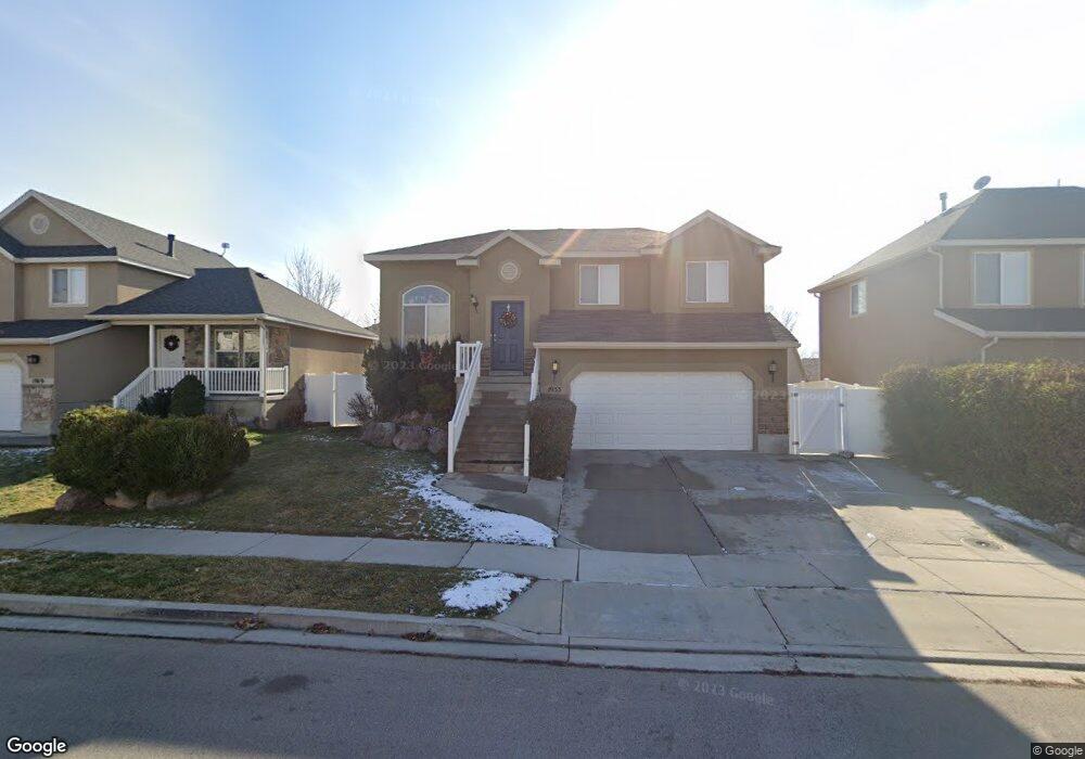
This home is located at 1933 Pointe Meadow Loop, Lehi, UT 84043 and is currently estimated at $559,808, approximately $239 per square foot. 1933 Pointe Meadow Loop is a home located in Utah County with nearby schools including Liberty Hills Elementary School, Skyridge High School, and Ascent Academies of Utah - Lehi Campus.
Ownership History
Date
Name
Owned For
Owner Type
Purchase Details
Closed on
Sep 24, 2007
Sold by
Forsman Erica M and Kessimakis Dale
Bought by
Payeur Gerald Seth and Payeur Lindsay Ann
Current Estimated Value
Purchase Details
Closed on
Jan 12, 2005
Sold by
Ivory Homes Ltd
Bought by
Forsman Erica M and Kessimakis Dale
Home Financials for this Owner
Home Financials are based on the most recent Mortgage that was taken out on this home.
Original Mortgage
$171,578
Interest Rate
5.8%
Mortgage Type
FHA
Create a Home Valuation Report for This Property
The Home Valuation Report is an in-depth analysis detailing your home's value as well as a comparison with similar homes in the area
Home Values in the Area
Average Home Value in this Area
Purchase History
| Date | Buyer | Sale Price | Title Company |
|---|---|---|---|
| Payeur Gerald Seth | -- | Surety Title | |
| Forsman Erica M | -- | Cottonwood Title Insurance |
Source: Public Records
Mortgage History
| Date | Status | Borrower | Loan Amount |
|---|---|---|---|
| Previous Owner | Forsman Erica M | $171,578 |
Source: Public Records
Tax History
| Year | Tax Paid | Tax Assessment Tax Assessment Total Assessment is a certain percentage of the fair market value that is determined by local assessors to be the total taxable value of land and additions on the property. | Land | Improvement |
|---|---|---|---|---|
| 2025 | $2,054 | $260,865 | -- | -- |
| 2024 | $2,054 | $240,405 | $0 | $0 |
| 2023 | $1,913 | $243,045 | $0 | $0 |
| 2022 | $1,809 | $222,860 | $0 | $0 |
| 2021 | $1,602 | $298,400 | $104,700 | $193,700 |
| 2020 | $1,510 | $277,900 | $96,900 | $181,000 |
| 2019 | $1,452 | $277,900 | $96,900 | $181,000 |
| 2018 | $1,518 | $274,700 | $93,700 | $181,000 |
| 2017 | $1,403 | $134,970 | $0 | $0 |
| 2016 | $1,373 | $122,540 | $0 | $0 |
| 2015 | $1,332 | $112,860 | $0 | $0 |
| 2014 | $1,242 | $104,610 | $0 | $0 |
Source: Public Records
Map
Nearby Homes
- 4392 W Bergen Ln
- 1898 W Pointe Meadow Loop
- 2191 W Swift Fox Dr Unit 274
- 999 Empire St
- 1475 N Whisper Hollow Cir
- 424 N Artesian Way W
- 2184 W Cape Fox Way N Unit 220
- 550 S Center St W
- 1060 N Canvasback Dr Unit 405
- 2239 W 1180 St N
- 3812 W 970 N Unit 342
- 1765 N 1100 W
- 1488 N 1700 W
- 2178 W Cape Fox Way Unit 221
- 3000 N Sweetwater
- 2124 W 2180 N
- 2257 W 2120 N
- 1884 N 2145 W
- 1908 N 2230 W
- 2389 W 2350 N
- 1917 Pointe Meadow Loop
- 1917 Pointe Meadow Loop
- 1905 Pointe Meadow Loop
- 1932 Pointe Meadow Loop
- 1917 W Pointe Meadow Loop
- 1933 W Pointe Meadow Loop
- 1893 W Pointe Meadow Loop Unit 819
- 1918 W Pointe Meadow Loop
- 2286 N Pointe Meadow Loop
- 1918 W Pointe Meadow Loop
- 1906 W Pointe Meadow Loop
- 1906 Pointe Meadow Loop
- 2286 N Pointe Meadow Loop
- 1904 W 2250 N
- 1932 W Pointe Meadow Loop
- 1883 W Pointe Meadow Loop
- 1883 W Pointe Meadow Loop
- 1896 W Pointe Meadow Loop
- 1942 Pointe Meadow Loop W
- 1942 W 2250 N
Your Personal Tour Guide
Ask me questions while you tour the home.