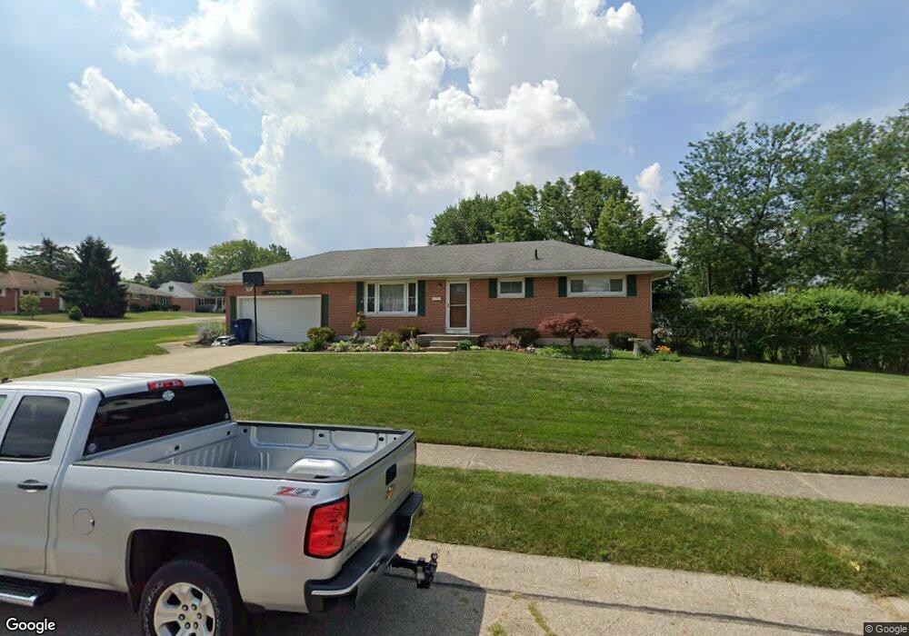
1937 Delmar Dr Springfield, OH 45503
Estimated Value: $217,000 - $241,000
3
Beds
2
Baths
1,075
Sq Ft
$216/Sq Ft
Est. Value
About This Home
This home is located at 1937 Delmar Dr, Springfield, OH 45503 and is currently estimated at $232,000, approximately $215 per square foot. 1937 Delmar Dr is a home located in Clark County with nearby schools including Northridge Elementary School, Kenton Ridge Middle & High School, and Emmanuel Christian Academy.
Ownership History
Date
Name
Owned For
Owner Type
Purchase Details
Closed on
Aug 30, 1995
Sold by
Evilsizor Larry
Bought by
Adams Barry W and Adams Anna
Current Estimated Value
Purchase Details
Closed on
May 1, 1985
Create a Home Valuation Report for This Property
The Home Valuation Report is an in-depth analysis detailing your home's value as well as a comparison with similar homes in the area
Home Values in the Area
Average Home Value in this Area
Purchase History
| Date | Buyer | Sale Price | Title Company |
|---|---|---|---|
| Adams Barry W | $86,900 | -- | |
| -- | $42,200 | -- |
Source: Public Records
Mortgage History
| Date | Status | Borrower | Loan Amount |
|---|---|---|---|
| Closed | Adams Barry W | -- |
Source: Public Records
Tax History
| Year | Tax Paid | Tax Assessment Tax Assessment Total Assessment is a certain percentage of the fair market value that is determined by local assessors to be the total taxable value of land and additions on the property. | Land | Improvement |
|---|---|---|---|---|
| 2025 | $2,073 | $73,270 | $17,240 | $56,030 |
| 2024 | $2,031 | $57,200 | $15,280 | $41,920 |
| 2023 | $2,031 | $57,200 | $15,280 | $41,920 |
| 2022 | $2,056 | $57,200 | $15,280 | $41,920 |
| 2021 | $1,742 | $43,540 | $11,840 | $31,700 |
| 2020 | $1,744 | $43,540 | $11,840 | $31,700 |
| 2019 | $1,777 | $43,540 | $11,840 | $31,700 |
| 2018 | $1,646 | $39,660 | $10,860 | $28,800 |
| 2017 | $1,411 | $38,641 | $10,861 | $27,780 |
| 2016 | $1,401 | $38,641 | $10,861 | $27,780 |
| 2015 | $1,479 | $38,326 | $10,546 | $27,780 |
| 2014 | $1,479 | $38,326 | $10,546 | $27,780 |
| 2013 | $1,444 | $38,326 | $10,546 | $27,780 |
Source: Public Records
Map
Nearby Homes
- 1644 Delmar Dr
- 3972 Covington Dr Unit 3972
- 4028 Ryland Dr Unit 4028
- 1811 Saint Andrews Ct
- 1505 Kingsgate Rd
- 1503 Kingsgate Rd
- 1507 Kingsgate Rd
- 1500 Kingsgate Rd Unit 19430
- 1502 Kingsgate Rd Unit 19432
- 1500 Kingsgate Rd
- 1502 Kingsgate Rd
- 4256 Midfield St Unit 9
- 3631 Kingsgate Ln
- 1415 Montego Dr
- 4322 Midfield St Unit 15
- 4446 Ridgewood Rd E Unit 3
- 4577 Reno Ln Unit 2
- 1341 Student Ave
- 3126 Lakeview Ct Unit 3126
- 4652 Reno Ln Unit 15
- 1951 Elaina Dr
- 1929 Delmar Dr
- 1947 Elaina Dr
- 1921 Delmar Dr
- 1832 Kimberly Ct
- 1940 Delmar Dr
- 1956 Elaina Dr
- 1952 Elaina Dr
- 1932 Delmar Dr
- 1826 Kimberly Ct
- 1946 Delmar Dr
- 1941 Elaina Dr
- 1948 Elaina Dr
- 1915 Delmar Dr
- 1924 Delmar Dr
- 1960 Elaina Dr
- 1838 Kimberly Ct
- 1942 Elaina Dr
- 1918 Delmar Dr
- 1907 Delmar Dr
Your Personal Tour Guide
Ask me questions while you tour the home.