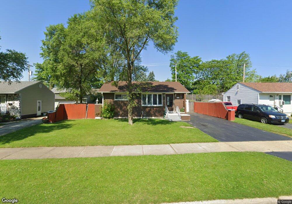
1940 Apache Rd Waukegan, IL 60087
Lake Cogardens NeighborhoodEstimated Value: $245,000 - $276,000
2
Beds
2
Baths
1,252
Sq Ft
$203/Sq Ft
Est. Value
About This Home
This home is located at 1940 Apache Rd, Waukegan, IL 60087 and is currently estimated at $254,496, approximately $203 per square foot. 1940 Apache Rd is a home located in Lake County with nearby schools including Clearview Elementary School, Miguel Juarez Middle School, and Waukegan High School.
Ownership History
Date
Name
Owned For
Owner Type
Purchase Details
Closed on
Sep 29, 2003
Sold by
Howell Ralph L and Howell Jacqueline M
Bought by
Vazquez Jorge A and Vazquez Nancy V
Current Estimated Value
Home Financials for this Owner
Home Financials are based on the most recent Mortgage that was taken out on this home.
Original Mortgage
$133,800
Outstanding Balance
$62,525
Interest Rate
6.23%
Mortgage Type
FHA
Estimated Equity
$191,971
Purchase Details
Closed on
Apr 26, 1999
Sold by
Howell Ralph L and Howell Jacquelyn
Bought by
Howell Ralph L and Howell Jacqueline M
Home Financials for this Owner
Home Financials are based on the most recent Mortgage that was taken out on this home.
Original Mortgage
$51,000
Interest Rate
7.04%
Create a Home Valuation Report for This Property
The Home Valuation Report is an in-depth analysis detailing your home's value as well as a comparison with similar homes in the area
Home Values in the Area
Average Home Value in this Area
Purchase History
| Date | Buyer | Sale Price | Title Company |
|---|---|---|---|
| Vazquez Jorge A | $136,000 | First American Title | |
| Howell Ralph L | -- | Ticor Title |
Source: Public Records
Mortgage History
| Date | Status | Borrower | Loan Amount |
|---|---|---|---|
| Open | Vazquez Jorge A | $133,800 | |
| Previous Owner | Howell Ralph L | $51,000 |
Source: Public Records
Tax History
| Year | Tax Paid | Tax Assessment Tax Assessment Total Assessment is a certain percentage of the fair market value that is determined by local assessors to be the total taxable value of land and additions on the property. | Land | Improvement |
|---|---|---|---|---|
| 2024 | $5,646 | $75,134 | $7,900 | $67,234 |
| 2023 | $4,958 | $67,874 | $7,136 | $60,738 |
| 2022 | $4,958 | $56,711 | $6,798 | $49,913 |
| 2021 | $4,545 | $49,598 | $5,887 | $43,711 |
| 2020 | $4,558 | $46,206 | $5,484 | $40,722 |
| 2019 | $4,534 | $42,340 | $5,025 | $37,315 |
| 2018 | $3,543 | $33,785 | $6,401 | $27,384 |
| 2017 | $3,398 | $29,890 | $5,663 | $24,227 |
| 2016 | $3,086 | $25,973 | $4,921 | $21,052 |
| 2015 | $2,913 | $23,246 | $4,404 | $18,842 |
| 2014 | $3,103 | $23,879 | $5,125 | $18,754 |
| 2012 | $4,455 | $27,880 | $5,553 | $22,327 |
Source: Public Records
Map
Nearby Homes
- 1913 Apache Rd
- 2440 W Cheyenne Rd
- 2500 Dakota Rd
- 1916 Niva Ct
- 2508 W Atlantic Ave
- 12352 W Atlantic Ave
- 2810 W Atlantic Ave
- 2928 W Country Club Ave
- 3000 W Country Club Ave
- 2946 W Country Club Ave
- 3320 Sunset Ave
- 12787 W Grove Ave
- 2223 New York St
- 2629 N Mcaree Rd
- 2432 Yeoman St
- 1005 N Lewis Ave
- 956 Westmoreland Ave
- 3370 W Brooke Ave Unit 410
- 1504 W Glen Flora Ave
- 1810 Linden Ave
- 1934 Apache Rd
- 1946 Apache Rd
- 1939 N Mcaree Rd
- 1945 N Mcaree Rd
- 1933 N Mcaree Rd
- 1928 Apache Rd
- 2008 Apache Rd
- 1945 Apache Rd
- 1927 N Mcaree Rd
- 2001 N Mcaree Rd
- 1939 Apache Rd
- 1933 Apache Rd
- 1922 Apache Rd
- 2441 Chinook Rd
- 2007 N Mcaree Rd Unit 1
- 1921 N Mcaree Rd
- 1927 Apache Rd
- 2014 Apache Rd
- 1914 Apache Rd
- 1921 Apache Rd
Your Personal Tour Guide
Ask me questions while you tour the home.