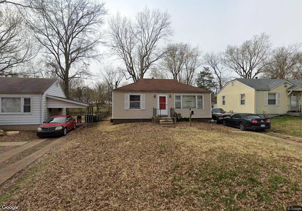
1941 Falcon Dr Saint Louis, MO 63133
Estimated Value: $86,000 - $304,000
About This Home
This home is located at 1941 Falcon Dr, Saint Louis, MO 63133 and is currently estimated at $143,390, approximately $145 per square foot. 1941 Falcon Dr is a home located in St. Louis County with nearby schools including Normandy High School, The Leadership School, and Christ The King Catholic School.
Ownership History
We collect this data history from publicly available records. To have your information removed, we recommend requesting removal directly through your county’s website.
Purchase Details
Purchase Details
Purchase Details
Home Values in the Area
Average Home Value in this Area
Purchase History
We collect this data history from publicly available records. To have your information removed, we recommend requesting removal directly through your county’s website.
| Date | Buyer | Sale Price | Title Company |
|---|---|---|---|
| -- | None Available | ||
| $37,500 | Continental Title Company | ||
| $32,500 | Continental Title Company | ||
| $9,529 | None Available |
Tax History
We collect this data history from publicly available records. To have your information removed, we recommend requesting removal directly through your county’s website.
| Year | Tax Paid | Tax Assessment Tax Assessment Total Assessment is a certain percentage of the fair market value that is determined by local assessors to be the total taxable value of land and additions on the property. | Land | Improvement |
|---|---|---|---|---|
| 2025 | $1,604 | $17,080 | $2,240 | $14,840 |
| 2024 | $1,604 | $17,080 | $2,240 | $14,840 |
| 2023 | $1,675 | $17,080 | $2,240 | $14,840 |
| 2022 | $1,188 | $10,220 | $1,880 | $8,340 |
| 2021 | $1,140 | $10,220 | $1,880 | $8,340 |
| 2020 | $1,212 | $10,030 | $1,880 | $8,150 |
| 2019 | $1,185 | $10,030 | $1,880 | $8,150 |
| 2018 | $1,141 | $9,050 | $1,180 | $7,870 |
| 2017 | $1,149 | $9,050 | $1,180 | $7,870 |
| 2016 | $800 | $5,990 | $1,180 | $4,810 |
| 2015 | $777 | $5,990 | $1,180 | $4,810 |
| 2014 | -- | $7,490 | $1,730 | $5,760 |
Map
- 7805 Utica Dr
- 7809 Utica Dr
- 7743 Monroe Dr
- 2037 Bainbridge Dr
- 1941 Farrell Dr
- 2045 Bainbridge Dr
- 7516 Balfour Dr
- 7500 Haywood Dr
- 7752 Mallard Dr
- 7407 Balfour Dr
- 7401 Haywood Dr
- 1622 Quendo Ave
- 8004 Monroe Ave
- 7410 Liberty Ave
- 7220 Teal Ave
- 7217 Mallard Dr
- 8110 Underhill Dr
- 1506 Bradford Ave
- 1924 Alert Dr
- 8151 Underhill Dr
Ask me questions while you tour the home.