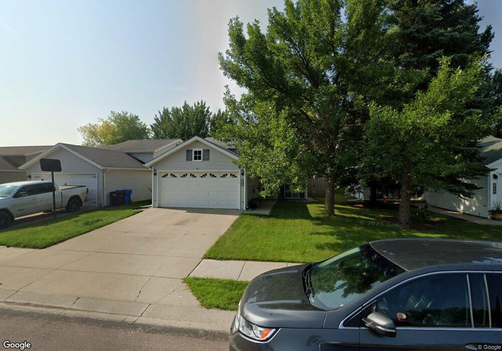
1942 56th Ave S Fargo, ND 58104
Bennett NeighborhoodEstimated Value: $262,000 - $275,000
4
Beds
2
Baths
1,872
Sq Ft
$144/Sq Ft
Est. Value
About This Home
This home is located at 1942 56th Ave S, Fargo, ND 58104 and is currently estimated at $269,400, approximately $143 per square foot. 1942 56th Ave S is a home located in Cass County with nearby schools including Bennett Elementary School, Discovery Middle School, and Fargo Davies High School.
Ownership History
Date
Name
Owned For
Owner Type
Purchase Details
Closed on
Nov 2, 2018
Sold by
Owens Douglas J and Owens Sandra R
Bought by
Christensen Emily and Christensen Trevor
Current Estimated Value
Home Financials for this Owner
Home Financials are based on the most recent Mortgage that was taken out on this home.
Original Mortgage
$197,783
Outstanding Balance
$170,717
Interest Rate
4.6%
Mortgage Type
New Conventional
Estimated Equity
$98,683
Create a Home Valuation Report for This Property
The Home Valuation Report is an in-depth analysis detailing your home's value as well as a comparison with similar homes in the area
Home Values in the Area
Average Home Value in this Area
Purchase History
| Date | Buyer | Sale Price | Title Company |
|---|---|---|---|
| Christensen Emily | $203,900 | Title Co |
Source: Public Records
Mortgage History
| Date | Status | Borrower | Loan Amount |
|---|---|---|---|
| Open | Christensen Emily | $197,783 |
Source: Public Records
Tax History
| Year | Tax Paid | Tax Assessment Tax Assessment Total Assessment is a certain percentage of the fair market value that is determined by local assessors to be the total taxable value of land and additions on the property. | Land | Improvement |
|---|---|---|---|---|
| 2025 | $1,787 | $119,600 | $18,100 | $101,500 |
| 2024 | $2,703 | $112,850 | $18,100 | $94,750 |
| 2023 | $3,099 | $109,550 | $18,100 | $91,450 |
| 2022 | $2,708 | $98,000 | $16,100 | $81,900 |
| 2021 | $2,512 | $92,450 | $16,100 | $76,350 |
| 2020 | $2,259 | $84,050 | $16,100 | $67,950 |
| 2019 | $2,278 | $84,050 | $9,550 | $74,500 |
| 2018 | $2,250 | $84,050 | $9,550 | $74,500 |
| 2017 | $2,227 | $84,050 | $9,550 | $74,500 |
| 2016 | $1,952 | $79,900 | $9,550 | $70,350 |
| 2015 | $1,896 | $72,650 | $6,550 | $66,100 |
| 2014 | $1,943 | $72,650 | $6,550 | $66,100 |
| 2013 | $1,734 | $64,450 | $6,550 | $57,900 |
Source: Public Records
Map
Nearby Homes
- 1935 57th Ave S
- 5743 18th St S
- 5556 18th St S
- 5512 18th St S
- 5323 University Dr S Unit D
- 5144 Rose Creek Pkwy S
- 5855 24th St S Unit 204
- 6132 18th St S
- 5980 24th St S
- 6112 14th St S
- 2009 Rose Creek Blvd S
- 5027 Rose Creek Pkwy S
- 2314 Rose Creek Blvd S
- 6230 21st St S
- 6048 27th St S
- 6270 21st St S
- 6009 27th St S
- 2960 Prairie Farms Cir S
- 2950 Prairie Farms Cir S
- 5756 31st St S
- 1934 56th Ave S
- 1948 56th Ave S
- 1912 56th Ave S
- 1954 56th Ave S
- 5613 20th Street Cir S
- 5607 20th Street Cir S
- 2006 56th Ave S
- 5619 20th Street Cir S
- 1908 56th Ave S
- 5601 20th St S
- 5570 20th St S
- 5601 20th Street Cir S
- 5625 20th Street Cir S
- 5601 20th Street Cir S
- 5619 19 St S
- 2012 56th Ave S
- 1904 56th Ave S
- 5535 19th St S
- 5625 19th St S
- 5564 20th St S
Your Personal Tour Guide
Ask me questions while you tour the home.