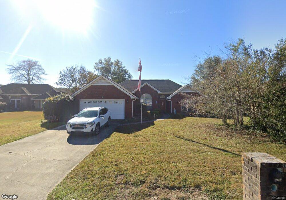
1942 Bluestone Loop Hinesville, GA 31313
Estimated Value: $248,691 - $265,000
3
Beds
2
Baths
1,826
Sq Ft
$142/Sq Ft
Est. Value
About This Home
This home is located at 1942 Bluestone Loop, Hinesville, GA 31313 and is currently estimated at $258,673, approximately $141 per square foot. 1942 Bluestone Loop is a home located in Liberty County with nearby schools including Taylors Creek Elementary School, Lewis Frasier Middle School, and Bradwell Institute.
Ownership History
Date
Name
Owned For
Owner Type
Purchase Details
Closed on
Oct 24, 2016
Sold by
Guertin John J and Guertin Ok I
Bought by
Nunez Kristina M
Current Estimated Value
Home Financials for this Owner
Home Financials are based on the most recent Mortgage that was taken out on this home.
Original Mortgage
$142,600
Outstanding Balance
$112,849
Interest Rate
3.48%
Mortgage Type
VA
Estimated Equity
$145,824
Purchase Details
Closed on
Feb 16, 1996
Sold by
Krebs Paul B
Bought by
Guertin John J and Guertin Ok
Purchase Details
Closed on
Dec 14, 1995
Bought by
Krebs Paul B
Create a Home Valuation Report for This Property
The Home Valuation Report is an in-depth analysis detailing your home's value as well as a comparison with similar homes in the area
Home Values in the Area
Average Home Value in this Area
Purchase History
| Date | Buyer | Sale Price | Title Company |
|---|---|---|---|
| Nunez Kristina M | $142,600 | -- | |
| Guertin John J | $111,200 | -- | |
| Krebs Paul B | $13,000 | -- |
Source: Public Records
Mortgage History
| Date | Status | Borrower | Loan Amount |
|---|---|---|---|
| Open | Nunez Kristina M | $142,600 |
Source: Public Records
Tax History
| Year | Tax Paid | Tax Assessment Tax Assessment Total Assessment is a certain percentage of the fair market value that is determined by local assessors to be the total taxable value of land and additions on the property. | Land | Improvement |
|---|---|---|---|---|
| 2025 | $34 | $90,616 | $18,000 | $72,616 |
| 2024 | $34 | $81,979 | $8,000 | $73,979 |
| 2023 | $23 | $73,398 | $8,000 | $65,398 |
| 2022 | $22 | $60,566 | $8,000 | $52,566 |
| 2021 | $22 | $55,272 | $8,000 | $47,272 |
| 2020 | $21 | $51,519 | $8,000 | $43,519 |
| 2019 | $21 | $52,063 | $8,000 | $44,063 |
| 2018 | $21 | $52,607 | $8,000 | $44,607 |
| 2017 | $1,750 | $53,151 | $8,000 | $45,151 |
| 2016 | $2,419 | $53,695 | $8,000 | $45,695 |
| 2015 | $2,431 | $49,126 | $8,000 | $41,126 |
| 2014 | $2,431 | $53,380 | $10,000 | $43,380 |
| 2013 | -- | $55,098 | $10,000 | $45,098 |
Source: Public Records
Map
Nearby Homes
- 1950 Woking Ct
- 1956 Heathrow Dr
- 1905 Stonehenge Dr
- 122 Joann Lewis Ln
- 505 Rutledge Dr
- 315 Joann Lewis Ln
- 170 Joann Lewis Ln
- 131 Battalion Ln
- 1932 Salisbury Way
- 1936 Heathrow Dr
- 1806 Blair Ct
- 2131 Walberg Dr
- 4.25 AC Barry McCaffrey Blvd
- 401 Barry McCaffrey Blvd Unit E1
- 202 Pitchline Dr
- 101 Wayfair Ln
- 193 Pitchline Dr
- 192 Pitchline Dr
- 205 Pitchline Dr
- 185 Pitchline Dr
- 1940 Bluestone Loop
- 1944 Bluestone Loop
- 1945 Kingston Ln
- 1943 Kingston Ln
- 1946 Bluestone Loop
- 1920 Stonehenge Dr
- 1941 Bluestone Loop
- 1943 Bluestone Loop
- 1947 Kingston Ln
- 1941 Kingston Ln
- 1939 Bluestone Loop
- 1947 Bluestone Loop
- 1945 Bluestone Loop
- 1937 Bluestone Loop
- 1949 Kingston Ln
- 1944 Kingston Ln
- 1942 Kingston Ln
- 1077 Kingston Ln
- 1971 Kingston Ln
- 1916 Stonehenge Dr
Your Personal Tour Guide
Ask me questions while you tour the home.