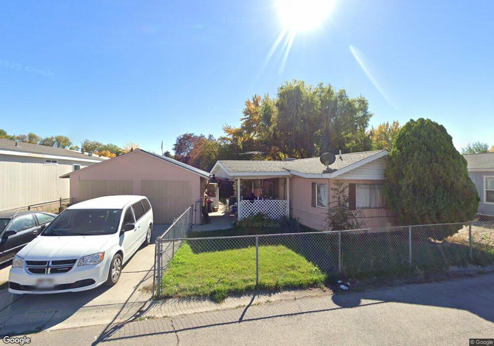
1944 W 500 N Provo, UT 84601
Lakeview Neighborhood
3
Beds
1
Bath
960
Sq Ft
4,356
Sq Ft Lot
About This Home
This home is located at 1944 W 500 N, Provo, UT 84601. 1944 W 500 N is a home located in Utah County with nearby schools including Dixon Middle School, Provo High School, and Freedom Preparatory Academy.
Ownership History
Date
Name
Owned For
Owner Type
Purchase Details
Closed on
May 26, 2023
Sold by
Staker Scott
Bought by
Sanpitch Holdings Llc
Purchase Details
Closed on
Mar 2, 2006
Sold by
Thompson Terry J and Thompson Debra L
Bought by
Montelongo Arturo and Sanchez Alejandra
Home Financials for this Owner
Home Financials are based on the most recent Mortgage that was taken out on this home.
Original Mortgage
$55,000
Interest Rate
6.04%
Mortgage Type
Seller Take Back
Purchase Details
Closed on
Sep 24, 1998
Sold by
Haws Carl G and Haws Maxine Y
Bought by
Thompson Terry J and Hardy Debra L
Home Financials for this Owner
Home Financials are based on the most recent Mortgage that was taken out on this home.
Original Mortgage
$52,250
Interest Rate
6.88%
Mortgage Type
Purchase Money Mortgage
Create a Home Valuation Report for This Property
The Home Valuation Report is an in-depth analysis detailing your home's value as well as a comparison with similar homes in the area
Home Values in the Area
Average Home Value in this Area
Purchase History
| Date | Buyer | Sale Price | Title Company |
|---|---|---|---|
| Sanpitch Holdings Llc | -- | None Listed On Document | |
| Montelongo Arturo | -- | Sundance Title Insurance Ag | |
| Thompson Terry J | -- | -- |
Source: Public Records
Mortgage History
| Date | Status | Borrower | Loan Amount |
|---|---|---|---|
| Previous Owner | Montelongo Arturo | $55,000 | |
| Previous Owner | Thompson Terry J | $52,250 |
Source: Public Records
Tax History
| Year | Tax Paid | Tax Assessment Tax Assessment Total Assessment is a certain percentage of the fair market value that is determined by local assessors to be the total taxable value of land and additions on the property. | Land | Improvement |
|---|---|---|---|---|
| 2025 | $826 | $57,365 | -- | -- |
| 2024 | $826 | $58,025 | $0 | $0 |
| 2023 | $800 | $58,025 | $0 | $0 |
| 2022 | $797 | $61,105 | $0 | $0 |
| 2021 | $438 | $69,300 | $49,700 | $19,600 |
| 2020 | $436 | $64,800 | $45,200 | $19,600 |
| 2019 | $389 | $64,800 | $45,200 | $19,600 |
| 2018 | $414 | $64,800 | $45,200 | $19,600 |
| 2017 | $455 | $32,780 | $0 | $0 |
| 2016 | $335 | $28,925 | $0 | $0 |
| 2015 | $331 | $28,925 | $0 | $0 |
| 2014 | $318 | $28,925 | $0 | $0 |
Source: Public Records
Map
Nearby Homes
- 579 N Geneva Rd
- 255 N 1600 W Unit 148
- 255 N 1600 W Unit 108
- 255 N 1600 W Unit 94
- 255 N 1600 W Unit 73
- 213 N Geneva Rd
- 1903 W 890 N
- 927 Independence Ave
- 2507 W 520 N
- 483 N 2430 W
- 1631 W 50 N
- 1524 Merlin Dr
- 925 N 1760 W
- 1489 Arthur Dr
- 962 Independence Ave
- 986 Independence Ave
- 1375 W 500 N Unit 95
- 1441 Arthur Dr
- 112 S 2120 W
- 146 S 1860 W
- 1934 W 500 N Unit 57
- 1934 W 500 N
- 1954 W 550 St N
- 1937 W 450 N
- 1933 W 500 N Unit 36
- 1967 W 450 N
- 1943 W 550 St N Unit 37
- 1923 W 550 St N
- 1963 W 550 St N
- 1974 W 550 St N
- 1927 W 450 N
- 1952 W 450 N
- 1973 W 500 N
- 1973 W 500 N Unit 40
- 1917 W 450 N Unit 66
- 1984 W 550 St N
- 1972 W 450 N Unit 83
- 1932 W 450 N
- 1983 W 500 N Unit 41
- 1983 W 500 N
Your Personal Tour Guide
Ask me questions while you tour the home.