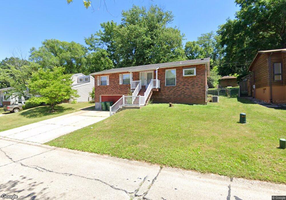
1946 Catlin Dr Barnhart, MO 63012
Estimated Value: $233,000 - $249,000
About This Home
This home is located at 1946 Catlin Dr, Barnhart, MO 63012 and is currently estimated at $240,716, approximately $210 per square foot. 1946 Catlin Dr is a home located in Jefferson County with nearby schools including Windsor High School and St. Joseph Catholic School.
Ownership History
We collect this data history from publicly available records. To have your information removed, we recommend requesting removal directly through your county’s website.
Purchase Details
Home Financials for this Owner
Home Financials are based on the most recent Mortgage that was taken out on this home.Home Values in the Area
Average Home Value in this Area
Purchase History
We collect this data history from publicly available records. To have your information removed, we recommend requesting removal directly through your county’s website.
| Date | Buyer | Sale Price | Title Company |
|---|---|---|---|
| -- | Commonwealth Title |
Mortgage History
We collect this data history from publicly available records. To have your information removed, we recommend requesting removal directly through your county’s website.
| Date | Status | Borrower | Loan Amount |
|---|---|---|---|
| Open | $116,350 |
Tax History
We collect this data history from publicly available records. To have your information removed, we recommend requesting removal directly through your county’s website.
| Year | Tax Paid | Tax Assessment Tax Assessment Total Assessment is a certain percentage of the fair market value that is determined by local assessors to be the total taxable value of land and additions on the property. | Land | Improvement |
|---|---|---|---|---|
| 2025 | $1,619 | $23,500 | $4,800 | $18,700 |
| 2024 | $1,619 | $22,100 | $4,800 | $17,300 |
| 2023 | $1,619 | $22,100 | $4,800 | $17,300 |
| 2022 | $1,434 | $19,600 | $2,300 | $17,300 |
| 2021 | $1,434 | $19,600 | $2,300 | $17,300 |
| 2020 | $1,335 | $17,700 | $1,900 | $15,800 |
| 2019 | $1,333 | $17,700 | $1,900 | $15,800 |
| 2018 | $1,315 | $17,700 | $1,900 | $15,800 |
| 2017 | $1,265 | $17,700 | $1,900 | $15,800 |
| 2016 | $1,155 | $16,100 | $1,900 | $14,200 |
| 2015 | $1,152 | $16,100 | $1,900 | $14,200 |
| 2013 | -- | $15,600 | $1,900 | $13,700 |
Map
- 1954 Parkton Way
- 1955 Parkton Way
- 1910 Catlin Dr
- 1933 Parkton Way
- 2042 Catlin Dr
- 2103 Timber Ln
- 000 State Road M
- 2161 Wilderness Trail
- 1660 Old State Road M
- 7003 Tuckahoe Ct
- 7213 Burgess Dr
- 6788 Haven Hill Rd
- 2258 Parkton Way
- 129 Blue Spruce Ct
- 7098 Ridge Dr
- 7283 Meriwether Ct
- 2135 Birchwood Dr
- 1728 Bayberry Ln
- 400 Lexington Ct
- 2262 Castlegate Dr
- 1953 Catlin Dr
- 1959 Catlin Dr
- 1949 Catlin Dr
- 1970 Parkton Way
- 1965 Catlin Dr
- 1943 Catlin Dr
- 1966 Parkton Way
- 1974 Parkton Way
- 1952 Catlin Dr
- 1964 Catlin Dr
- 1962 Parkton Way
- 1958 Catlin Dr
- 1971 Catlin Dr
- 1937 Catlin Dr
- 1978 Parkton Way
- 1970 Catlin Dr
- 1958 Parkton Way
- 1940 Catlin Dr
- 1979 Catlin Dr
- 1982 Parkton Way
Ask me questions while you tour the home.