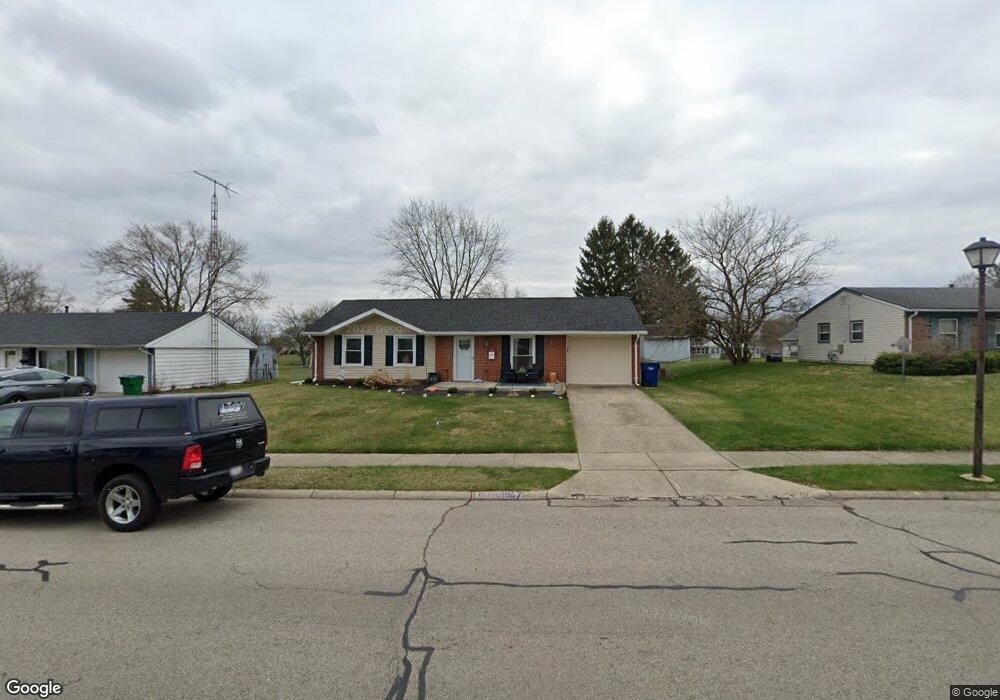
1947 Providence Ave Springfield, OH 45503
Estimated Value: $172,345 - $187,000
About This Home
This home is located at 1947 Providence Ave, Springfield, OH 45503 and is currently estimated at $180,836, approximately $190 per square foot. 1947 Providence Ave is a home located in Clark County with nearby schools including Northridge Elementary School, Kenton Ridge Middle & High School, and Emmanuel Christian Academy.
Ownership History
We collect this data history from publicly available records. To have your information removed, we recommend requesting removal directly through your county’s website.
Purchase Details
Purchase Details
Purchase Details
Home Values in the Area
Average Home Value in this Area
Purchase History
We collect this data history from publicly available records. To have your information removed, we recommend requesting removal directly through your county’s website.
| Date | Buyer | Sale Price | Title Company |
|---|---|---|---|
| $140,000 | None Listed On Document | ||
| $61,900 | -- | ||
| $53,500 | -- |
Mortgage History
We collect this data history from publicly available records. To have your information removed, we recommend requesting removal directly through your county’s website.
| Date | Status | Borrower | Loan Amount |
|---|---|---|---|
| Closed | $35,000 | ||
| Closed | $100,000 | ||
| Closed | $68,000 |
Tax History
We collect this data history from publicly available records. To have your information removed, we recommend requesting removal directly through your county’s website.
| Year | Tax Paid | Tax Assessment Tax Assessment Total Assessment is a certain percentage of the fair market value that is determined by local assessors to be the total taxable value of land and additions on the property. | Land | Improvement |
|---|---|---|---|---|
| 2025 | $3,720 | $47,900 | $8,100 | $39,800 |
| 2024 | $1,527 | $36,430 | $8,290 | $28,140 |
| 2023 | $1,527 | $36,430 | $8,290 | $28,140 |
| 2022 | $1,533 | $36,430 | $8,290 | $28,140 |
| 2021 | $1,363 | $27,780 | $6,430 | $21,350 |
| 2020 | $1,364 | $27,780 | $6,430 | $21,350 |
| 2019 | $1,392 | $27,780 | $6,430 | $21,350 |
| 2018 | $1,247 | $24,050 | $5,360 | $18,690 |
| 2017 | $1,064 | $26,772 | $5,355 | $21,417 |
| 2016 | $1,057 | $26,772 | $5,355 | $21,417 |
| 2015 | $1,229 | $26,772 | $5,355 | $21,417 |
| 2014 | $1,229 | $26,772 | $5,355 | $21,417 |
| 2013 | $1,226 | $26,772 | $5,355 | $21,417 |
Map
- 2011 Providence Ave
- 3151 Vineyard St
- 3215 Nantucket St
- 1918 Devon Dr
- 1858 Devon Dr
- 2943 Tarryton Ln
- 2014 Westboro Ave
- 2022 Westboro Ave
- 2529 Marinette Dr
- 1404 Providence Ave
- 1912 Wedgewood Cir
- 1043 Armsgate Rd
- 2939 Derr Rd
- 2606 Cavins Dr
- 1039 Bradford Dr Unit 42
- 2136 E Home Rd
- 1031 Armsgate Rd Unit 11
- 2442 Greystone Ln
- 2439 Greystone Ln
- 3116 El Camino Dr Unit 3
- 2001 Providence Ave
- 2007 Providence Ave
- 3016 Heritage St
- 1923 Providence Ave
- 2945 Brewster Ct
- 3010 Heritage St
- 1948 Providence Ave
- 2009 Providence Ave
- 1940 Providence Ave
- 2942 Brewster Ct
- 1932 Providence Ave
- 3000 Heritage St
- 3108 Tackett St
- 3109 Tackett St
- 2010 Providence Ave
- 1924 Providence Ave
- 1915 Providence Ave
- 3011 Heritage St
- 2944 Heritage St
- 3116 Tackett St
Ask me questions while you tour the home.