
Seller's Agent in 2026
Alexis Anderson
Keller Williams Realty Atl. Partners
(678) 552-9025
99 Total Sales
Estimated Value: $198,000 - $254,680
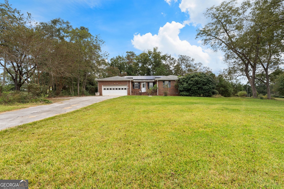
Investors dream! This 3-bedroom, 2.5-bath home offers just over 1,400 sq ft of potential with a spacious layout and a back deck perfect for relaxing or entertaining. Situated outside of a neighborhood with no HOA, this property is ideal for buyers looking to customize and create value. Ready for your vision!
Last Agent to Sell the Property
Keller Williams Realty Atl. Partners License #347461 Listed on: 10/10/2025
We collect this data history from publicly available records. To have your information removed, we recommend requesting removal directly through your county’s website.
| Date | Buyer | Sale Price | Title Company |
|---|---|---|---|
| Stanford David | $200,000 | -- | |
| Hill Raymond F | $155,500 | -- | |
| Dewberry Kenneth M | -- | -- | |
| Dewberry Kenneth M | $135,000 | -- | |
| Stanford Buddy L | $18,000 | -- | |
| Burgess Robin Alvin | $8,000 | -- |
We collect this data history from publicly available records. To have your information removed, we recommend requesting removal directly through your county’s website.
| Date | Status | Borrower | Loan Amount |
|---|---|---|---|
| Previous Owner | Hill Raymond F | $139,950 | |
| Previous Owner | Dewberry Kenneth M | $121,500 |
| Date | Event | Price | List to Sale | Price per Sq Ft |
|---|---|---|---|---|
| 01/16/2026 01/16/26 | Sold | $200,000 | -20.0% | $141 / Sq Ft |
| 01/04/2026 01/04/26 | Pending | -- | -- | -- |
| 12/23/2025 12/23/25 | For Sale | $250,000 | 0.0% | $176 / Sq Ft |
| 12/16/2025 12/16/25 | Pending | -- | -- | -- |
| 12/02/2025 12/02/25 | Price Changed | $250,000 | -9.1% | $176 / Sq Ft |
| 10/10/2025 10/10/25 | For Sale | $275,000 | -- | $194 / Sq Ft |
| Year | Tax Paid | Tax Assessment Tax Assessment Total Assessment is a certain percentage of the fair market value that is determined by local assessors to be the total taxable value of land and additions on the property. | Land | Improvement |
|---|---|---|---|---|
| 2025 | $627 | $84,302 | $13,973 | $70,329 |
| 2024 | $567 | $82,431 | $7,440 | $74,991 |
| 2023 | $567 | $86,884 | $11,946 | $74,939 |
| 2022 | $406 | $56,744 | $6,826 | $49,918 |
| 2021 | $370 | $49,965 | $6,501 | $43,464 |
| 2020 | $369 | $49,965 | $6,501 | $43,464 |
| 2019 | $574 | $48,548 | $12,000 | $36,548 |
| 2018 | $577 | $48,548 | $12,000 | $36,548 |
| 2017 | $577 | $48,548 | $12,000 | $36,548 |
| 2016 | $1,406 | $48,548 | $12,000 | $36,548 |
| 2015 | $1,382 | $48,548 | $12,000 | $36,548 |
| 2014 | $1,371 | $48,548 | $12,000 | $36,548 |
Seller's Agent in 2026
Alexis Anderson
Keller Williams Realty Atl. Partners
(678) 552-9025
99 Total Sales
Seller Co-Listing Agent in 2026
Courtney Helton
Keller Williams Realty Atl. Partners
(678) 850-5788
41 Total Sales
Buyer's Agent in 2026
Randi Greene
Keller Williams Realty Atl. Partners
(770) 328-4582
74 Total Sales
Source: Georgia MLS
MLS Number: 10622996
APN: R01-0007-002
Disclaimer: Certain information contained herein is derived from information provided by parties other than Homes.com. All information provided is deemed reliable, but is not guaranteed to be accurate and should be independently verified.
![]() The data relating to real estate for sale on this web site comes in part from the Broker Reciprocity Program of Georgia MLS. Real estate listings held by brokerage firms other than Redfin are marked with the Broker Reciprocity logo and detailed information about them includes the name of the listing brokers. Information deemed reliable but not guaranteed. Copyright 2026 Georgia MLS. All rights reserved.
The data relating to real estate for sale on this web site comes in part from the Broker Reciprocity Program of Georgia MLS. Real estate listings held by brokerage firms other than Redfin are marked with the Broker Reciprocity logo and detailed information about them includes the name of the listing brokers. Information deemed reliable but not guaranteed. Copyright 2026 Georgia MLS. All rights reserved.
Ask me questions while you tour the home.