195 Atlantic Blvd Key Largo, FL 33037
Estimated Value: $695,000 - $1,177,000
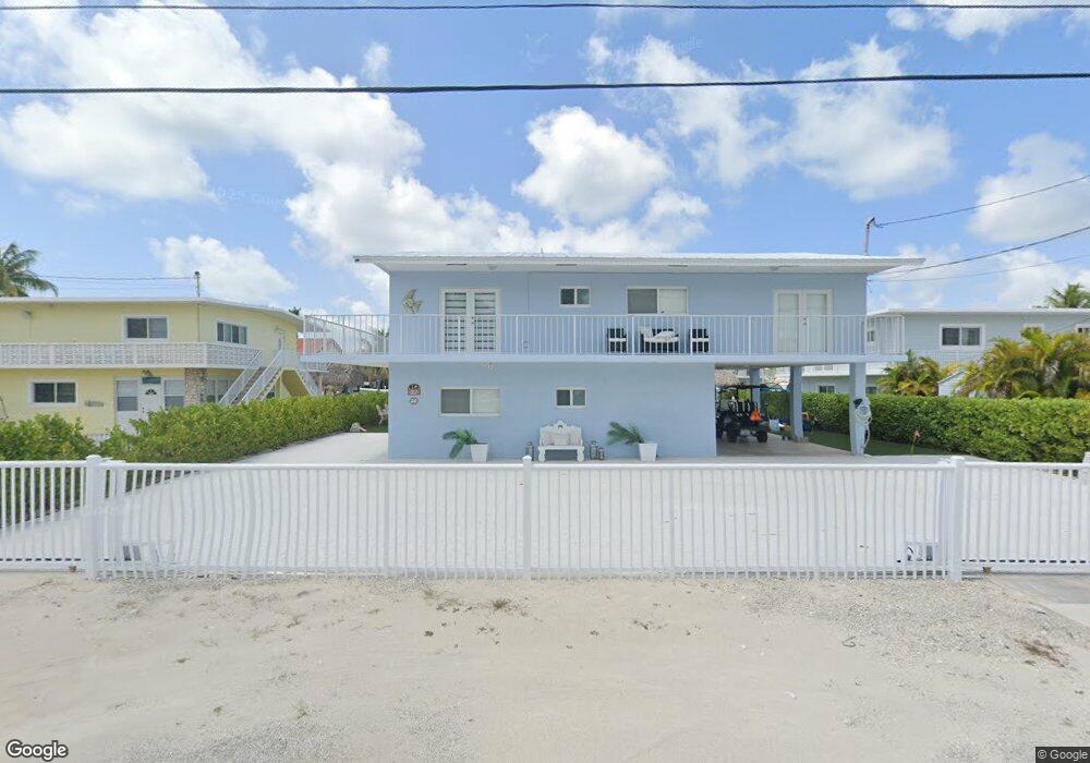
About This Home
This home is located at 195 Atlantic Blvd, Key Largo, FL 33037 and is currently estimated at $909,684, approximately $377 per square foot. 195 Atlantic Blvd is a home located in Monroe County with nearby schools including Key Largo School, Coral Shores High School, and Dolphin Montessori Children's House.
Ownership History
We collect this data history from publicly available records. To have your information removed, we recommend requesting removal directly through your county’s website.
Purchase Details
Purchase Details
Purchase Details
Purchase Details
Home Values in the Area
Average Home Value in this Area
Purchase History
We collect this data history from publicly available records. To have your information removed, we recommend requesting removal directly through your county’s website.
| Date | Buyer | Sale Price | Title Company |
|---|---|---|---|
| $305,000 | Coral Reef Title Company | ||
| $101,000 | -- | ||
| $87,500 | -- | ||
| $75,000 | -- |
Tax History
We collect this data history from publicly available records. To have your information removed, we recommend requesting removal directly through your county’s website.
| Year | Tax Paid | Tax Assessment Tax Assessment Total Assessment is a certain percentage of the fair market value that is determined by local assessors to be the total taxable value of land and additions on the property. | Land | Improvement |
|---|---|---|---|---|
| 2025 | $3,779 | $399,733 | -- | -- |
| 2024 | $3,611 | $388,468 | -- | -- |
| 2023 | $3,611 | $377,154 | $0 | $0 |
| 2022 | $3,524 | $366,169 | $0 | $0 |
| 2021 | $3,612 | $355,504 | $0 | $0 |
| 2020 | $3,601 | $350,596 | $0 | $0 |
| 2019 | $3,544 | $342,714 | $0 | $0 |
| 2018 | $3,563 | $336,324 | $0 | $0 |
| 2017 | $3,472 | $329,407 | $0 | $0 |
| 2016 | $3,497 | $322,632 | $0 | $0 |
| 2015 | $3,534 | $272,885 | $0 | $0 |
| 2014 | $3,659 | $270,639 | $0 | $0 |
Map
- 184 Bahama Ave
- 294 Saint Thomas Ave
- 397 Laguna Ave
- 308 Atlantic Blvd
- 71 Coral Dr
- 258 Caribbean Dr
- 156 Marina Ave
- 483 Bahia Ave
- 64 Seagate Blvd
- 437 Laguna Ave
- 201 Wildwood Cir
- 101 Oleander Cir
- 501 Caribbean Dr
- 87 Marina Ave
- 34 Seagate Blvd
- 34 Seagate Blvd Unit 34
- 30 Seagate Blvd
- 20 Coral Dr
- 300 Ocean Dr Unit 22
- 300 Ocean Dr Unit 26
- 195 Atlantic Blvd
- 194 Atlantic Blvd
- 246 Atlantic Blvd
- 196 Atlantic Blvd
- 193 Atlantic Blvd
- 245 Atlantic Blvd
- 247 Atlantic Blvd
- 197 Atlantic Blvd
- 244 Atlantic Blvd
- 248 Atlantic Blvd
- 192 Atlantic Blvd
- 243 Atlantic Blvd
- 198 Atlantic Blvd
- 249 Atlantic Blvd
- 249 Atlantic Blvd
- 180 Bahama Ave
- 181 Bahama Ave
- 181 Bahama Ave
- 179 Bahama Ave
- 191 Atlantic Blvd
Ask me questions while you tour the home.