Estimated Value: $356,389 - $429,000
About This Home
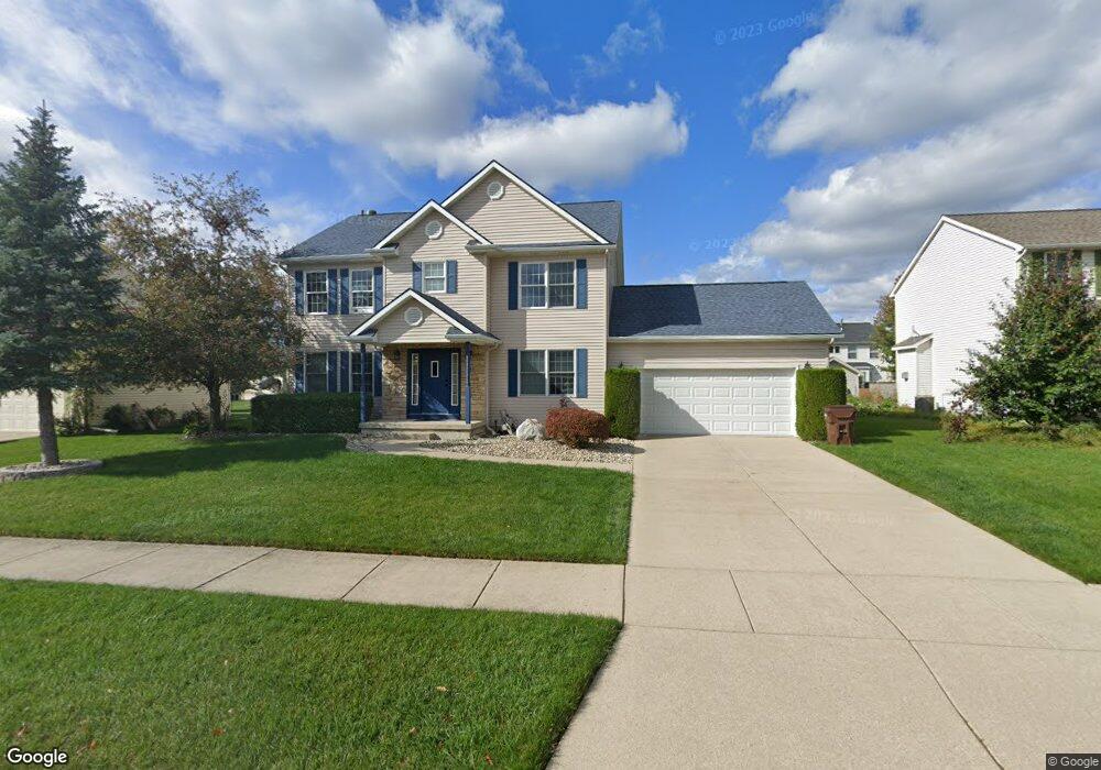
This home is located at 1955 Mockingbird Dr, Holt, MI 48842 and is currently estimated at $384,847, approximately $169 per square foot. 1955 Mockingbird Dr is a home located in Ingham County with nearby schools including Horizon Elementary School, Washington Woods Middle School, and Holt Junior High School.
Ownership History
We collect this data history from publicly available records. To have your information removed, we recommend requesting removal directly through your county’s website.
Purchase Details
Purchase Details
Home Financials for this Owner
Home Financials are based on the most recent Mortgage that was taken out on this home.Purchase Details
Home Financials for this Owner
Home Financials are based on the most recent Mortgage that was taken out on this home.Home Values in the Area
Average Home Value in this Area
Purchase History
We collect this data history from publicly available records. To have your information removed, we recommend requesting removal directly through your county’s website.
| Date | Buyer | Sale Price | Title Company |
|---|---|---|---|
| $230,000 | Tri Title Agency Llc | ||
| $211,900 | -- | ||
| $26,000 | -- |
Mortgage History
We collect this data history from publicly available records. To have your information removed, we recommend requesting removal directly through your county’s website.
| Date | Status | Borrower | Loan Amount |
|---|---|---|---|
| Previous Owner | $169,500 | ||
| Previous Owner | $153,000 |
Tax History
We collect this data history from publicly available records. To have your information removed, we recommend requesting removal directly through your county’s website.
| Year | Tax Paid | Tax Assessment Tax Assessment Total Assessment is a certain percentage of the fair market value that is determined by local assessors to be the total taxable value of land and additions on the property. | Land | Improvement |
|---|---|---|---|---|
| 2025 | $1,421 | $171,100 | $27,400 | $143,700 |
| 2024 | $14 | $165,500 | $24,800 | $140,700 |
| 2023 | $5,324 | $149,600 | $20,800 | $128,800 |
| 2022 | $5,022 | $133,200 | $22,500 | $110,700 |
| 2021 | $4,866 | $132,400 | $17,500 | $114,900 |
| 2020 | $4,956 | $123,300 | $17,500 | $105,800 |
| 2019 | $4,844 | $115,900 | $12,400 | $103,500 |
| 2018 | $4,817 | $104,000 | $12,400 | $91,600 |
| 2017 | $4,387 | $104,000 | $12,400 | $91,600 |
| 2016 | $4,349 | $93,800 | $16,500 | $77,300 |
| 2015 | $4,256 | $87,200 | $32,971 | $54,229 |
| 2014 | $4,256 | $85,100 | $32,971 | $52,129 |
Map
- 5671 Skylar Dr
- 5633 Bittern
- 1776 Kahres Rd
- 2228 Beechnut Trail
- 5386 Auben Ln
- 5360 Holt Rd
- 2288 Chisholm Ct
- 2325 Bush Hill Dr
- 1572 Gander Hill Dr
- 2395 Washington Rd
- V L 00 Holt Rd
- 2380 Houghton Hollow Dr
- 2538 Sanibel Hollow
- 5961 Horstmeyer Rd
- 6145 Lindsey Ln
- 5770 Horstmeyer Rd
- 1463 N Onondaga Rd
- 5815 Caleta Dr
- 5071 Haddon Hall Dr
- 1485 Zuider Rd
Ask me questions while you tour the home.