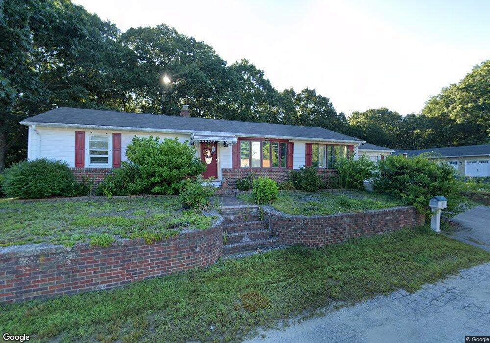
196 Cranston St Woonsocket, RI 02895
Bernon District NeighborhoodEstimated Value: $248,000 - $419,000
3
Beds
1
Bath
1,200
Sq Ft
$300/Sq Ft
Est. Value
About This Home
This home is located at 196 Cranston St, Woonsocket, RI 02895 and is currently estimated at $360,121, approximately $300 per square foot. 196 Cranston St is a home located in Providence County with nearby schools including Woonsocket High School, Founders Academy, and Beacon Charter School.
Ownership History
Date
Name
Owned For
Owner Type
Purchase Details
Closed on
Nov 13, 2003
Sold by
Marchand Anna M Est
Bought by
Inxi Pat and Inxi Nola
Current Estimated Value
Home Financials for this Owner
Home Financials are based on the most recent Mortgage that was taken out on this home.
Original Mortgage
$140,100
Interest Rate
5.81%
Mortgage Type
Purchase Money Mortgage
Create a Home Valuation Report for This Property
The Home Valuation Report is an in-depth analysis detailing your home's value as well as a comparison with similar homes in the area
Home Values in the Area
Average Home Value in this Area
Purchase History
We collect this data history from publicly available records. To have your information removed, we recommend requesting removal directly through your county’s website.
| Date | Buyer | Sale Price | Title Company |
|---|---|---|---|
| Inxi Pat | $201,000 | -- | |
| Inxi Pat | $201,000 | -- |
Source: Public Records
Mortgage History
We collect this data history from publicly available records. To have your information removed, we recommend requesting removal directly through your county’s website.
| Date | Status | Borrower | Loan Amount |
|---|---|---|---|
| Open | Inxi Pat | $150,000 | |
| Closed | Inxi Pat | $140,100 |
Source: Public Records
Tax History
| Year | Tax Paid | Tax Assessment Tax Assessment Total Assessment is a certain percentage of the fair market value that is determined by local assessors to be the total taxable value of land and additions on the property. | Land | Improvement |
|---|---|---|---|---|
| 2025 | $3,993 | $355,600 | $110,700 | $244,900 |
| 2024 | $3,655 | $251,400 | $98,200 | $153,200 |
| 2023 | $3,515 | $251,400 | $98,200 | $153,200 |
| 2022 | $3,515 | $251,400 | $98,200 | $153,200 |
| 2021 | $3,776 | $159,000 | $65,200 | $93,800 |
| 2020 | $3,816 | $159,000 | $65,200 | $93,800 |
| 2018 | $3,829 | $159,000 | $65,200 | $93,800 |
| 2017 | $3,922 | $130,300 | $48,300 | $82,000 |
| 2016 | $4,149 | $130,300 | $48,300 | $82,000 |
| 2015 | $4,766 | $130,300 | $48,300 | $82,000 |
| 2014 | $4,654 | $129,500 | $53,100 | $76,400 |
Source: Public Records
Map
Nearby Homes
- 0 Cranston St
- 0 Laflamme Ave
- 103 Elmore Ave
- 87 Kermit St
- 58 Williams St
- 36 Old Louisquisset Pike Unit 309
- 36 Old Louisquisset Pike Unit 210
- 36 Old Louisquisset Pike Unit 308
- 36 Old Louisquisset Pike Unit 307
- 36 Old Louisquisset Pike Unit 208
- 36 Old Louisquisset Pike Unit 204
- 36 Old Louisquisset Pike Unit 306
- 0 Chester St
- 59 Cooper Ave
- 277 Ward St
- 0 Irving Lot 192 Ave Unit 1383138
- 41 Summit Ave
- 63 Capwell Ave
- 40 Old Louisquisset Pike Unit 801H
- 40 Old Louisquisset Pike Unit 1804
- 172 Cranston St
- 151 Monty Ave
- 219 Cranston St
- 160 Monty Ave
- 137 Monty Ave
- 195 Hemond Ave
- 144 Monty Ave
- 211 Hemond Ave
- 173 Hemond Ave
- 130 Monty Ave
- 127 Monty Ave
- 157 Hemond Ave
- 0 Caron Ave Unit 73342710
- 0 Caron Ave Unit 1379503
- 0 Caron Ave Unit 73210537
- 0 Caron Ave Unit 1354373
- 126 Monty Ave
- 147 Hemond Ave
- 196 Hemond Ave
- 210 Hemond Ave
Your Personal Tour Guide
Ask me questions while you tour the home.