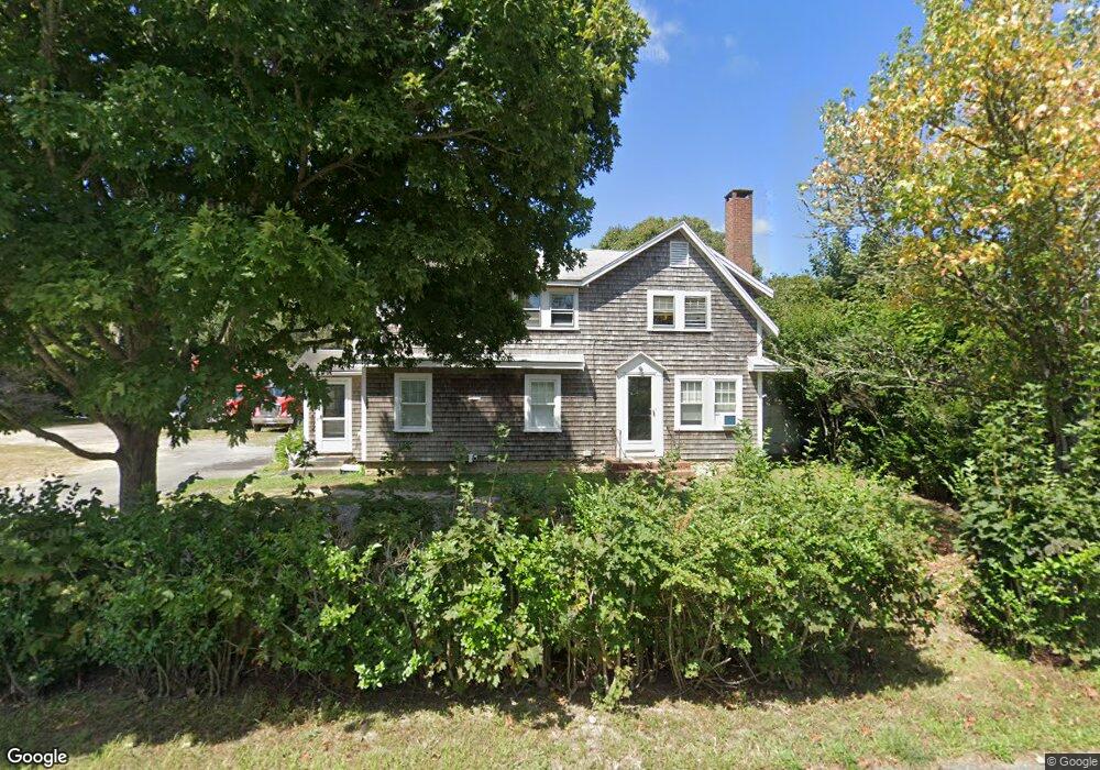
196 Sisson Rd Harwich, MA 02645
Harwich Center NeighborhoodEstimated Value: $541,000 - $668,000
About This Home
This home is located at 196 Sisson Rd, Harwich, MA 02645 and is currently estimated at $598,087, approximately $336 per square foot. 196 Sisson Rd is a home located in Barnstable County with nearby schools including Harwich Elementary School, Chatham Elementary School, and Monomoy Regional Middle School.
Ownership History
We collect this data history from publicly available records. To have your information removed, we recommend requesting removal directly through your county’s website.
Purchase Details
Home Financials for this Owner
Home Financials are based on the most recent Mortgage that was taken out on this home.Home Values in the Area
Average Home Value in this Area
Purchase History
We collect this data history from publicly available records. To have your information removed, we recommend requesting removal directly through your county’s website.
| Date | Buyer | Sale Price | Title Company |
|---|---|---|---|
| $311,500 | None Available |
Mortgage History
We collect this data history from publicly available records. To have your information removed, we recommend requesting removal directly through your county’s website.
| Date | Status | Borrower | Loan Amount |
|---|---|---|---|
| Open | $276,251 |
Tax History
We collect this data history from publicly available records. To have your information removed, we recommend requesting removal directly through your county’s website.
| Year | Tax Paid | Tax Assessment Tax Assessment Total Assessment is a certain percentage of the fair market value that is determined by local assessors to be the total taxable value of land and additions on the property. | Land | Improvement |
|---|---|---|---|---|
| 2025 | $2,696 | $456,100 | $179,700 | $276,400 |
| 2024 | $2,623 | $435,000 | $169,500 | $265,500 |
| 2023 | $2,556 | $384,900 | $154,100 | $230,800 |
| 2022 | $2,551 | $314,500 | $134,000 | $180,500 |
| 2021 | $2,499 | $290,600 | $121,800 | $168,800 |
| 2020 | $2,508 | $287,300 | $120,500 | $166,800 |
| 2019 | $2,472 | $285,100 | $115,600 | $169,500 |
| 2018 | $2,414 | $266,300 | $105,100 | $161,200 |
| 2017 | $2,242 | $249,900 | $91,000 | $158,900 |
| 2016 | $2,212 | $243,900 | $91,000 | $152,900 |
| 2015 | $2,152 | $239,900 | $89,200 | $150,700 |
| 2014 | $2,497 | $284,700 | $91,000 | $193,700 |
Map
- 18 Old Campground
- 10 Notre Dame Ave
- 7 Park St
- 33 Old Colony Rd
- 49 Doane Rd
- 37 Doane Rd
- 14 Harold St Unit 14E
- 14 Harold St Unit 2F
- 14 Harold St Unit 6B
- 14 Harold St Unit 12B
- 14 Harold St Unit 12B
- 14 Harold St Unit 14E
- 3 Crestview Dr
- 9 Jason Ln
- 53 Pleasant St
- 515 Route 28
- 10 Essex Place
- 292 Massachusetts 28 Unit 1
- 405 Lower County Rd Unit 6A
- 405 Lower County Rd Unit 6
Ask me questions while you tour the home.