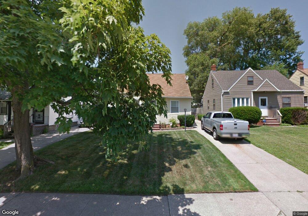
19609 Fairway Ave Maple Heights, OH 44137
Estimated Value: $107,975 - $137,000
3
Beds
1
Bath
910
Sq Ft
$131/Sq Ft
Est. Value
About This Home
This home is located at 19609 Fairway Ave, Maple Heights, OH 44137 and is currently estimated at $119,494, approximately $131 per square foot. 19609 Fairway Ave is a home located in Cuyahoga County with nearby schools including Abraham Lincoln Elementary School, Rockside/ J.F. Kennedy School, and Barack Obama School.
Ownership History
Date
Name
Owned For
Owner Type
Purchase Details
Closed on
Oct 31, 1988
Sold by
Lees Frank G
Bought by
Daniel Patrick D
Current Estimated Value
Purchase Details
Closed on
Mar 28, 1985
Sold by
Lees Frank G and Lees Rosemary
Bought by
Lees Frank G
Purchase Details
Closed on
Jan 1, 1975
Bought by
Lees Frank G and Lees Rosemary
Create a Home Valuation Report for This Property
The Home Valuation Report is an in-depth analysis detailing your home's value as well as a comparison with similar homes in the area
Home Values in the Area
Average Home Value in this Area
Purchase History
| Date | Buyer | Sale Price | Title Company |
|---|---|---|---|
| Daniel Patrick D | $47,500 | -- | |
| Lees Frank G | -- | -- | |
| Lees Frank G | -- | -- |
Source: Public Records
Tax History
| Year | Tax Paid | Tax Assessment Tax Assessment Total Assessment is a certain percentage of the fair market value that is determined by local assessors to be the total taxable value of land and additions on the property. | Land | Improvement |
|---|---|---|---|---|
| 2025 | $2,762 | $33,775 | $6,720 | $27,055 |
| 2024 | $3,066 | $33,775 | $6,720 | $27,055 |
| 2023 | $2,143 | $19,670 | $4,060 | $15,610 |
| 2022 | $2,135 | $19,670 | $4,060 | $15,610 |
| 2021 | $2,273 | $19,670 | $4,060 | $15,610 |
| 2020 | $1,949 | $14,910 | $3,080 | $11,830 |
| 2019 | $1,938 | $42,600 | $8,800 | $33,800 |
| 2018 | $1,844 | $14,910 | $3,080 | $11,830 |
| 2017 | $1,906 | $14,390 | $2,870 | $11,520 |
| 2016 | $1,844 | $14,390 | $2,870 | $11,520 |
| 2015 | $1,841 | $14,390 | $2,870 | $11,520 |
| 2014 | $1,841 | $15,820 | $3,150 | $12,670 |
Source: Public Records
Map
Nearby Homes
- 19931 Raymond St
- 19812 Marvin Rd
- 19411 Marvin Rd
- 5165 Camden Rd
- 18915 Longview Ave
- 18909 Preston Rd
- 18990 Raymond St
- 20600 Watson Rd
- 18851 Raymond St
- 5147 Warrensville Center Rd
- 19520 Maple Heights Blvd
- 20705 Hansen Rd
- 5194 Homewood Ave
- 20715 Watson Rd
- 20111 Mountville Dr
- 19910 Mountville Dr
- 20503 Mountville Dr
- 5127 Erwin St
- 20814 Clare Ave
- 5100 Erwin St
- 19613 Fairway Ave
- 19617 Fairway Ave
- 19601 Fairway Ave
- 19517 Fairway Ave
- 19703 Fairway Ave
- 19650 Mccracken Rd
- 19630 Mccracken Rd
- 19670 Mccracken Rd
- 19690 Mccracken Rd
- 19616 Mccracken Rd
- 19513 Fairway Ave
- 19608 Fairway Ave
- 19612 Fairway Ave
- 19604 Fairway Ave
- 19616 Fairway Ave
- 19600 Fairway Ave
- 19700 Mccracken Rd
- 19509 Fairway Ave
- 19516 Fairway Ave
- 19702 Fairway Ave
Your Personal Tour Guide
Ask me questions while you tour the home.