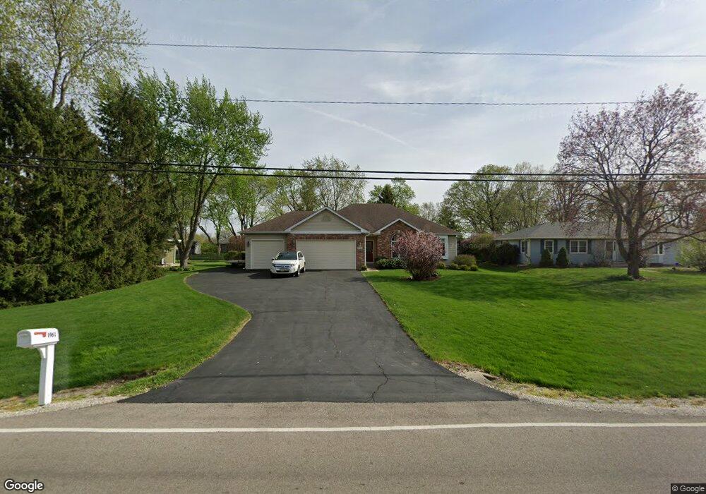
1961 Sheffer Rd Aurora, IL 60502
Indian Creek NeighborhoodEstimated Value: $399,000 - $487,000
About This Home
This home is located at 1961 Sheffer Rd, Aurora, IL 60502 and is currently estimated at $448,412, approximately $273 per square foot. 1961 Sheffer Rd is a home located in Kane County with nearby schools including Mabel O Donnell Elementary School, Simmons Middle School, and East Aurora High School.
Ownership History
We collect this data history from publicly available records. To have your information removed, we recommend requesting removal directly through your county’s website.
Purchase Details
Home Financials for this Owner
Home Financials are based on the most recent Mortgage that was taken out on this home.Home Values in the Area
Average Home Value in this Area
Purchase History
We collect this data history from publicly available records. To have your information removed, we recommend requesting removal directly through your county’s website.
| Date | Buyer | Sale Price | Title Company |
|---|---|---|---|
| $45,000 | Law Title Insurance Co Inc |
Mortgage History
We collect this data history from publicly available records. To have your information removed, we recommend requesting removal directly through your county’s website.
| Date | Status | Borrower | Loan Amount |
|---|---|---|---|
| Closed | $156,700 |
Tax History
We collect this data history from publicly available records. To have your information removed, we recommend requesting removal directly through your county’s website.
| Year | Tax Paid | Tax Assessment Tax Assessment Total Assessment is a certain percentage of the fair market value that is determined by local assessors to be the total taxable value of land and additions on the property. | Land | Improvement |
|---|---|---|---|---|
| 2024 | $6,653 | $147,656 | $18,563 | $129,093 |
| 2023 | $6,414 | $131,930 | $16,586 | $115,344 |
| 2022 | $2,519 | $120,374 | $15,133 | $105,241 |
| 2021 | $5,937 | $112,070 | $14,089 | $97,981 |
| 2020 | $2,785 | $104,097 | $13,087 | $91,010 |
| 2019 | $5,532 | $96,448 | $12,125 | $84,323 |
| 2018 | $3,137 | $84,636 | $11,215 | $73,421 |
| 2017 | $3,421 | $79,390 | $10,334 | $69,056 |
| 2016 | $3,732 | $75,728 | $8,858 | $66,870 |
| 2015 | -- | $66,505 | $7,617 | $58,888 |
| 2014 | -- | $58,073 | $7,326 | $50,747 |
| 2013 | -- | $59,650 | $7,221 | $52,429 |
Map
- 1861 Foxridge Ct Unit 1
- 2030 Westbury Ln Unit 47B
- 2053 Westbury Ln
- 1890 Havenshire Rd Unit 222
- 2067 Stephen St
- 1771 Briarheath Dr
- 1242 Barkston Ln
- 1179 Kingsley Ln
- 1660 Briarheath Dr
- 2341 Courtland Ct
- 1967 Holloway Ct
- 2752 Preserve Cir Unit 13006
- 2732 Preserve Cir Unit 13001
- 2744 Preserve Cir Unit 13004
- 2892 Preserve Cir
- 2736 Preserve Cir Unit 13002
- 1282 Everwood Ln
- 2198 Brookside Ln
- 1127 Courtland Place
- 1740 Stable Ln
- 1960 Stephen St
- 1980 Stephen St
- 1940 Stephen St
- 1990 Stephen St
- 1930 Stephen St
- 1941 Sheffer Rd
- 1981 Sheffer Rd
- 1931 Sheffer Rd
- 1910 Stephen St
- 1911 Sheffer Rd
- 2020 Stephen St Unit 47B
- 1900 Stephen St
- 2023 Westbury Ln Unit 47B
- 1901 Sheffer Rd
- 1849 Foxridge Ct Unit 56
- 1849 Foxridge Ct Unit 1
- 2024 Stephen St Unit 47B
- 881 Felten Rd
- 1825 Foxridge Ct Unit 46
- 1845 Foxridge Ct
Ask me questions while you tour the home.