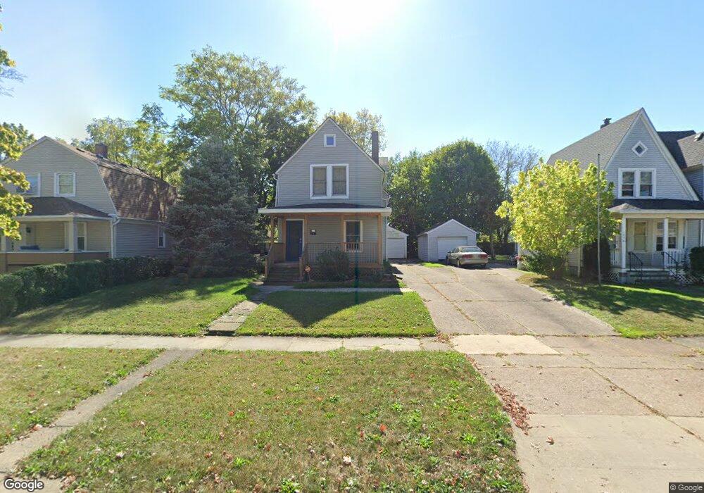
1962 E 29th St Lorain, OH 44055
Estimated Value: $147,371 - $164,000
4
Beds
2
Baths
1,592
Sq Ft
$96/Sq Ft
Est. Value
About This Home
This home is located at 1962 E 29th St, Lorain, OH 44055 and is currently estimated at $152,593, approximately $95 per square foot. 1962 E 29th St is a home located in Lorain County with nearby schools including Palm Elementary School, Southview Middle School, and Lorain High School.
Ownership History
Date
Name
Owned For
Owner Type
Purchase Details
Closed on
May 27, 2021
Sold by
Estate Of Evelyn N Sampson
Bought by
Sampson Eddie G
Current Estimated Value
Create a Home Valuation Report for This Property
The Home Valuation Report is an in-depth analysis detailing your home's value as well as a comparison with similar homes in the area
Home Values in the Area
Average Home Value in this Area
Purchase History
| Date | Buyer | Sale Price | Title Company |
|---|---|---|---|
| Sampson Eddie G | -- | None Available |
Source: Public Records
Tax History
| Year | Tax Paid | Tax Assessment Tax Assessment Total Assessment is a certain percentage of the fair market value that is determined by local assessors to be the total taxable value of land and additions on the property. | Land | Improvement |
|---|---|---|---|---|
| 2024 | $1,407 | $33,292 | $4,802 | $28,490 |
| 2023 | $1,165 | $22,047 | $2,926 | $19,121 |
| 2022 | $1,126 | $22,047 | $2,926 | $19,121 |
| 2021 | $1,126 | $22,047 | $2,926 | $19,121 |
| 2020 | $1,140 | $19,390 | $2,570 | $16,820 |
| 2019 | $1,133 | $19,390 | $2,570 | $16,820 |
| 2018 | $1,112 | $19,390 | $2,570 | $16,820 |
| 2017 | $1,091 | $17,590 | $3,430 | $14,160 |
| 2016 | $1,082 | $17,590 | $3,430 | $14,160 |
| 2015 | $1,021 | $17,590 | $3,430 | $14,160 |
| 2014 | $1,018 | $17,590 | $3,430 | $14,160 |
| 2013 | $1,010 | $17,590 | $3,430 | $14,160 |
Source: Public Records
Map
Nearby Homes
- 1924 E 33rd St
- 2129 E 30th St
- 1829 E 33rd St
- 1816 E 34th St
- 2217 E 32nd St
- 2228 E 30th St
- 1951 E 39th St
- 1685 E 36th St
- V/L Clinton Ave
- 4210 Seneca Ave
- 3885 Dale Ave
- 4061 Gregus Ave
- V/L Pearl Ave
- 3308 Norfolk Ave
- 4095 Laurel Rd
- V/L Grove Ave
- 3946 Dunton Rd
- 3323 Dallas Ave
- 4137 Dunton Rd
- 4608 Gary Ave
Your Personal Tour Guide
Ask me questions while you tour the home.