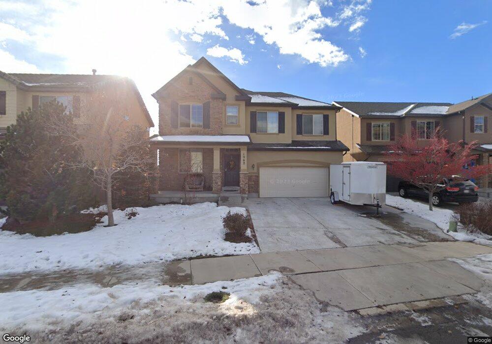
1962 E Brookings Dr Draper, UT 84020
Estimated Value: $693,000 - $770,369
5
Beds
4
Baths
3,872
Sq Ft
$191/Sq Ft
Est. Value
About This Home
This home is located at 1962 E Brookings Dr, Draper, UT 84020 and is currently estimated at $738,592, approximately $190 per square foot. 1962 E Brookings Dr is a home located in Utah County with nearby schools including Ridgeline Elementary School, Timberline Middle School, and Lone Peak High School.
Ownership History
Date
Name
Owned For
Owner Type
Purchase Details
Closed on
Oct 8, 2020
Sold by
Williams Kennie
Bought by
Williams Kennie and Williams Amanda
Current Estimated Value
Home Financials for this Owner
Home Financials are based on the most recent Mortgage that was taken out on this home.
Original Mortgage
$470,250
Outstanding Balance
$418,262
Interest Rate
2.9%
Mortgage Type
New Conventional
Estimated Equity
$320,330
Purchase Details
Closed on
Mar 15, 2018
Sold by
Amin Abdulrazak N and Ahmed Awaz Hassan
Bought by
Richins Brian and Richins Rachel
Home Financials for this Owner
Home Financials are based on the most recent Mortgage that was taken out on this home.
Original Mortgage
$385,000
Interest Rate
4.38%
Mortgage Type
New Conventional
Purchase Details
Closed on
Apr 29, 2011
Sold by
Richmond American Homes Of Utah Inc
Bought by
Amin Abdulrazak N and Ahmed Awaz Hassan
Create a Home Valuation Report for This Property
The Home Valuation Report is an in-depth analysis detailing your home's value as well as a comparison with similar homes in the area
Home Values in the Area
Average Home Value in this Area
Purchase History
| Date | Buyer | Sale Price | Title Company |
|---|---|---|---|
| Williams Kennie | -- | Accommodation | |
| Williams Kennie | -- | Frontier Title Ins Agcy Inc | |
| Richins Brian | -- | Us Title Insurance Agency | |
| Amin Abdulrazak N | -- | First American Union Heights |
Source: Public Records
Mortgage History
| Date | Status | Borrower | Loan Amount |
|---|---|---|---|
| Open | Williams Kennie | $470,250 | |
| Previous Owner | Richins Brian | $385,000 |
Source: Public Records
Tax History
| Year | Tax Paid | Tax Assessment Tax Assessment Total Assessment is a certain percentage of the fair market value that is determined by local assessors to be the total taxable value of land and additions on the property. | Land | Improvement |
|---|---|---|---|---|
| 2025 | $3,210 | $373,835 | -- | -- |
| 2024 | $3,210 | $336,545 | $0 | $0 |
| 2023 | $3,114 | $351,780 | $0 | $0 |
| 2022 | $3,125 | $344,355 | $0 | $0 |
| 2021 | $2,756 | $452,400 | $133,600 | $318,800 |
| 2020 | $2,712 | $425,700 | $106,900 | $318,800 |
| 2019 | $2,320 | $405,800 | $106,900 | $298,900 |
| 2018 | $2,340 | $388,500 | $98,700 | $289,800 |
| 2017 | $2,179 | $192,500 | $0 | $0 |
| 2016 | $2,235 | $185,075 | $0 | $0 |
| 2015 | $2,333 | $182,105 | $0 | $0 |
| 2014 | $1,958 | $159,830 | $0 | $0 |
Source: Public Records
Map
Nearby Homes
- 16065 Timber Brook Dr E
- 16072 S Fielding Hill Ln E Unit 1001
- 2203 E Fair Winns Ln
- 2116 Falcon Ridge Dr
- 15866 Mercer Ct
- 15574 S Mercer Ct Unit 502
- 246 E Levengrove Dr Unit 1066
- 15219 Eagle Crest Dr Unit 141
- 415 E Levengrove Dr Unit 1144
- 421 E Levengrove Dr Unit 1145
- 367 E Levengrove Dr Unit 1138
- 356 E Levengrove Dr Unit 239
- 348 E Levengrove Dr Unit 238
- 353 E Levengrove Dr Unit 1135
- 332 E Levengrove Dr Unit 236
- 409 E Levengrove Dr Unit 1143
- 300 E Levengrove Dr Unit 232
- 324 E Levengrove Dr Unit 235
- 1871 E Vista Ridge Ct
- 2158 Bald Eagle Ct
- 1956 E Brookings Dr
- 1956 E Brookings Dr
- 1966 E Brookings Dr
- 1966 Brookings Dr
- 1952 Brookings Dr
- 1952 E Brookings Dr
- 1972 E Brookings Dr
- 1972 Brookings Dr
- 1963 E Fielding Hill Ln
- 1963 Fielding Hill Ln
- 1967 E Fielding Hill Ln
- 1967 Fielding Hill Ln
- 1957 E Fielding Hill Ln
- 1957 Fielding Hill Ln
- 1973 E Fielding Hill Ln
- 1973 Fielding Hill Ln
- 16032 Brookings Ct
- 16032 S Brookings Ct
- 1948 Brookings Dr
- 1948 E Brookings Dr
Your Personal Tour Guide
Ask me questions while you tour the home.