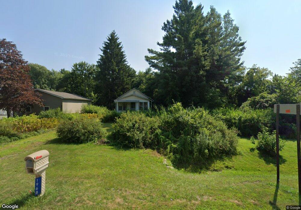
1968 Range Rd Port Huron, MI 48060
Estimated Value: $110,000 - $195,000
Studio
--
Bath
608
Sq Ft
$235/Sq Ft
Est. Value
About This Home
This home is located at 1968 Range Rd, Port Huron, MI 48060 and is currently estimated at $143,107, approximately $235 per square foot. 1968 Range Rd is a home located in St. Clair County with nearby schools including Kimball Elementary School, Central Middle School, and Port Huron High School.
Ownership History
Date
Name
Owned For
Owner Type
Purchase Details
Closed on
Oct 11, 2021
Sold by
Aggeler Julie A and Smith Family Trust
Bought by
East China Bts Retail Llc
Current Estimated Value
Home Financials for this Owner
Home Financials are based on the most recent Mortgage that was taken out on this home.
Original Mortgage
$1,448,000
Interest Rate
3.09%
Mortgage Type
Construction
Purchase Details
Closed on
Apr 28, 2017
Sold by
Pretty Dennison A and Pretty Sharon M
Bought by
Pretty Dennison A and Pretty Sharon M
Purchase Details
Closed on
Jul 19, 2013
Sold by
Pretty Dennison A and Pretty Sharon M
Bought by
Pretty Dennison A and Pretty Sharon M
Purchase Details
Closed on
Apr 1, 2010
Sold by
Braun Matthew and Braun Vicky
Bought by
Lalonde John and Lalonde Betty
Create a Home Valuation Report for This Property
The Home Valuation Report is an in-depth analysis detailing your home's value as well as a comparison with similar homes in the area
Home Values in the Area
Average Home Value in this Area
Purchase History
| Date | Buyer | Sale Price | Title Company |
|---|---|---|---|
| East China Bts Retail Llc | $135,000 | None Available | |
| Pretty Dennison A | -- | None Available | |
| Pretty Dennison A | -- | None Available | |
| Lalonde John | $450,436 | None Available |
Source: Public Records
Mortgage History
| Date | Status | Borrower | Loan Amount |
|---|---|---|---|
| Previous Owner | East China Bts Retail Llc | $1,448,000 |
Source: Public Records
Tax History
| Year | Tax Paid | Tax Assessment Tax Assessment Total Assessment is a certain percentage of the fair market value that is determined by local assessors to be the total taxable value of land and additions on the property. | Land | Improvement |
|---|---|---|---|---|
| 2025 | $1,040 | $63,200 | $0 | $0 |
| 2024 | $1,009 | $48,700 | $0 | $0 |
| 2023 | $946 | $46,800 | $0 | $0 |
| 2022 | $1,379 | $44,400 | $0 | $0 |
| 2020 | $1,311 | $35,100 | $35,100 | $0 |
| 2019 | $1,290 | $37,400 | $0 | $0 |
| 2018 | $1,243 | $37,400 | $0 | $0 |
| 2017 | $1,221 | $27,500 | $0 | $0 |
| 2016 | $789 | $27,500 | $0 | $0 |
| 2015 | -- | $28,700 | $28,700 | $0 |
| 2014 | -- | $27,000 | $27,000 | $0 |
| 2013 | -- | $26,600 | $0 | $0 |
Source: Public Records
Map
Nearby Homes
- 0000 Range Rd
- 1405 Range Rd
- 0 Wall Rd Unit 50185999
- 1814 Leland Rd
- 00 Range Rd
- 1786 Omar Rd
- 00 Howard Rd
- V/L Allen
- 1604 Allen Rd
- 4380 Lapeer Rd
- 0 Allen Rd Unit 20250008597
- 0 Allen Rd Unit 20250008612
- 0 Lapeer Rd Unit 50137357
- 1255 Quain Ln
- 2668 Range Rd
- 284 Rosebud Ct
- 209 Oldbrook Ln
- 174 Meadow Ln
- 104 Oldbrook Ln
- 5035 Burma Rd
Your Personal Tour Guide
Ask me questions while you tour the home.