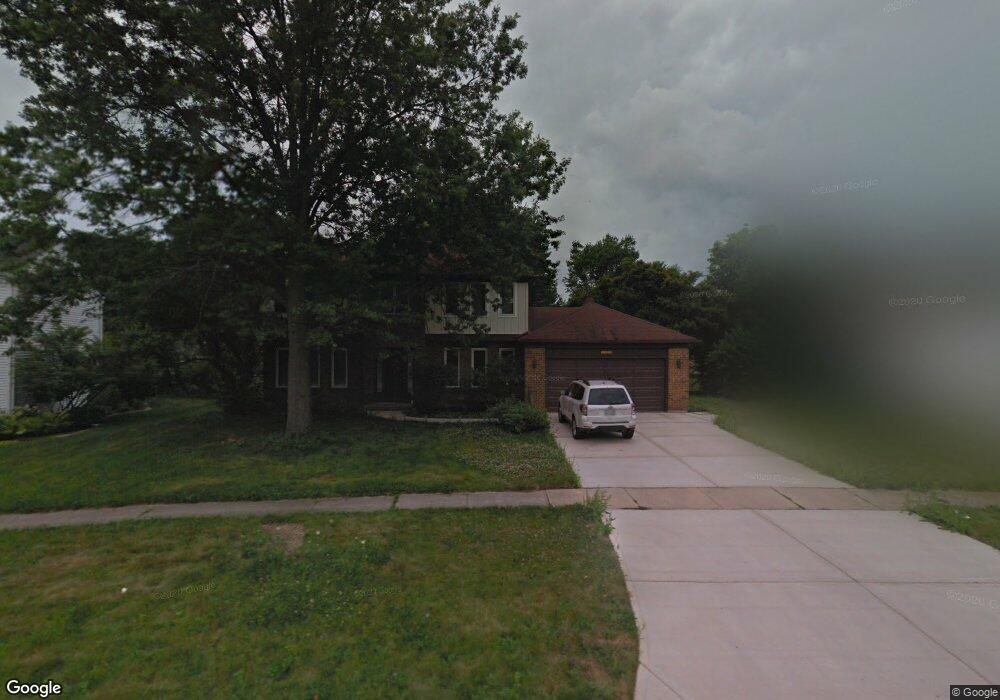
1968 Somerset Ln Wheaton, IL 60189
Stonehedge NeighborhoodEstimated Value: $736,000 - $861,000
5
Beds
4
Baths
2,735
Sq Ft
$291/Sq Ft
Est. Value
About This Home
This home is located at 1968 Somerset Ln, Wheaton, IL 60189 and is currently estimated at $795,780, approximately $290 per square foot. 1968 Somerset Ln is a home located in DuPage County with nearby schools including Whittier Elementary School, Edison Middle School, and Wheaton Warrenville South High School.
Ownership History
Date
Name
Owned For
Owner Type
Purchase Details
Closed on
Aug 18, 2009
Sold by
Witte Oliver R and Witte Priscilla G
Bought by
Meyers Timothy J and Meyers Jean E Ryan
Current Estimated Value
Home Financials for this Owner
Home Financials are based on the most recent Mortgage that was taken out on this home.
Original Mortgage
$220,000
Outstanding Balance
$144,025
Interest Rate
5.29%
Mortgage Type
New Conventional
Estimated Equity
$651,755
Create a Home Valuation Report for This Property
The Home Valuation Report is an in-depth analysis detailing your home's value as well as a comparison with similar homes in the area
Home Values in the Area
Average Home Value in this Area
Purchase History
| Date | Buyer | Sale Price | Title Company |
|---|---|---|---|
| Meyers Timothy J | $380,000 | Republic Title |
Source: Public Records
Mortgage History
| Date | Status | Borrower | Loan Amount |
|---|---|---|---|
| Open | Meyers Timothy J | $220,000 |
Source: Public Records
Tax History
| Year | Tax Paid | Tax Assessment Tax Assessment Total Assessment is a certain percentage of the fair market value that is determined by local assessors to be the total taxable value of land and additions on the property. | Land | Improvement |
|---|---|---|---|---|
| 2024 | $12,755 | $205,906 | $51,778 | $154,128 |
| 2023 | $12,268 | $189,530 | $47,660 | $141,870 |
| 2022 | $11,989 | $179,120 | $45,040 | $134,080 |
| 2021 | $11,952 | $174,870 | $43,970 | $130,900 |
| 2020 | $11,916 | $173,240 | $43,560 | $129,680 |
| 2019 | $11,646 | $168,670 | $42,410 | $126,260 |
| 2018 | $12,029 | $172,080 | $39,960 | $132,120 |
| 2017 | $11,855 | $165,740 | $38,490 | $127,250 |
| 2016 | $11,703 | $159,120 | $36,950 | $122,170 |
| 2015 | $10,823 | $141,800 | $35,250 | $106,550 |
| 2014 | $9,886 | $127,920 | $34,740 | $93,180 |
| 2013 | $9,631 | $128,300 | $34,840 | $93,460 |
Source: Public Records
Map
Nearby Homes
- 141 Loretto Ct
- 1378 Colonial Square
- 51 Somerset Cir
- 30 Danada Dr
- 24 Winners Cup Cir Unit 3
- 26W055 Cree Ln
- 121 Brighton Dr
- 1127 Hibbard Rd
- 2552 Weatherbee Ln
- 1605 Burning Trail
- 1601 W Wiesbrook Rd
- 1S538 Bayberry Ln
- 3S700 Delles Rd
- 1519 Foothill Dr
- Lot 1 Foothill Dr
- 1245 Josiah Rd
- 1028 Lodalia Ct
- 110 E Farnham Ln
- 1219 Golf Ln
- 371 W Arboretum Cir
- 1962 Somerset Ln
- 1974 Somerset Ln
- 1977 Greensboro Dr
- 1985 Greensboro Dr
- 1969 Greensboro Dr
- 1978 Somerset Ln
- 1956 Somerset Ln
- 1963 Somerset Ln
- 1961 Greensboro Dr
- 1983 Somerset Ln
- 1980 Somerset Ln
- 1949 Somerset Ln
- 1950 Somerset Ln
- 733 Buckingham Ct
- 1955 Greensboro Dr
- 737 Buckingham Ct
- 1956 Buckingham Dr
- 1982 Greensboro Dr
- 741 Buckingham Ct
- 1984 Somerset Ln
Your Personal Tour Guide
Ask me questions while you tour the home.