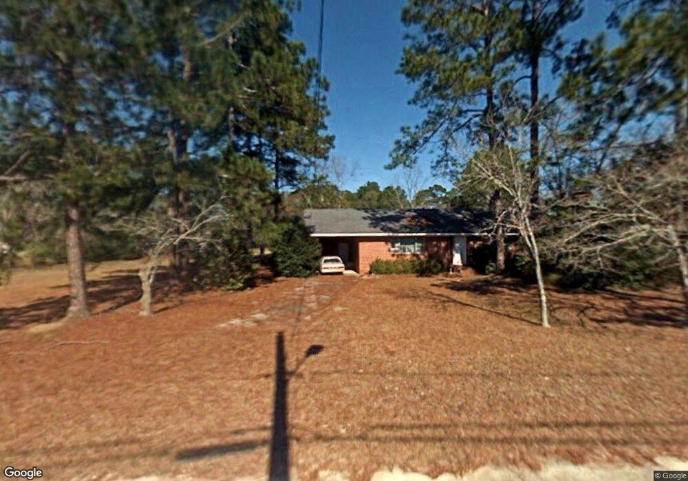
197 Floyd St Baxley, GA 31513
Estimated Value: $74,843 - $132,000
3
Beds
2
Baths
1,320
Sq Ft
$79/Sq Ft
Est. Value
About This Home
This home is located at 197 Floyd St, Baxley, GA 31513 and is currently estimated at $103,961, approximately $78 per square foot. 197 Floyd St is a home located in Appling County with nearby schools including Appling Christian Academy.
Ownership History
Date
Name
Owned For
Owner Type
Purchase Details
Closed on
May 28, 2021
Sold by
Scap Llc
Bought by
Baumgardt Rhonda Nell
Current Estimated Value
Home Financials for this Owner
Home Financials are based on the most recent Mortgage that was taken out on this home.
Original Mortgage
$96,666
Outstanding Balance
$86,708
Interest Rate
3%
Mortgage Type
New Conventional
Estimated Equity
$17,253
Purchase Details
Closed on
Jan 20, 2021
Sold by
Eason Harold B
Bought by
Scap Llc
Purchase Details
Closed on
Jan 23, 2015
Sold by
Eason Jewell Barlow
Bought by
Eason Harold B
Create a Home Valuation Report for This Property
The Home Valuation Report is an in-depth analysis detailing your home's value as well as a comparison with similar homes in the area
Home Values in the Area
Average Home Value in this Area
Purchase History
| Date | Buyer | Sale Price | Title Company |
|---|---|---|---|
| Baumgardt Rhonda Nell | $96,000 | -- | |
| Scap Llc | $51,000 | -- | |
| Eason Harold B | $31,000 | -- |
Source: Public Records
Mortgage History
| Date | Status | Borrower | Loan Amount |
|---|---|---|---|
| Open | Baumgardt Rhonda Nell | $96,666 |
Source: Public Records
Tax History
| Year | Tax Paid | Tax Assessment Tax Assessment Total Assessment is a certain percentage of the fair market value that is determined by local assessors to be the total taxable value of land and additions on the property. | Land | Improvement |
|---|---|---|---|---|
| 2025 | $351 | $54,720 | $7,880 | $46,840 |
| 2024 | $351 | $17,950 | $2,190 | $15,760 |
| 2023 | $380 | $17,950 | $2,190 | $15,760 |
| 2022 | $390 | $12,050 | $2,190 | $9,860 |
| 2021 | $381 | $12,050 | $2,190 | $9,860 |
| 2020 | $393 | $12,050 | $2,190 | $9,860 |
| 2019 | $399 | $12,050 | $2,190 | $9,860 |
| 2018 | $405 | $12,050 | $2,190 | $9,860 |
| 2017 | $124 | $12,050 | $2,190 | $9,860 |
| 2016 | $124 | $12,050 | $2,190 | $9,860 |
| 2015 | $54 | $12,050 | $2,190 | $9,860 |
| 2014 | $185 | $12,050 | $2,190 | $9,860 |
| 2013 | -- | $16,752 | $2,190 | $14,562 |
Source: Public Records
Map
Nearby Homes
- 198 Holmesville Ave
- 199 Anthony St
- 213 Fair St
- 102 Crosby St
- 316 Fair St
- 298 S Main St
- 88 Oak St
- 0 Anthony St Unit 27093
- 001 Piney Grove Church Rd
- 111 W Tollison St
- 0 W Parker St Unit 10547390
- 0 Hwy 341 Unit 23738
- 0 Hwy 341 Unit 10628717
- 7 Burke St
- 18 S Thomas St
- 303 W Parker St
- 207 Thomas St
- 181 N Main St
- 11 Pendleton St
- 390 Bay St
- 157 Floyd St
- 98 Holmesville Ave
- 84 Holmesville Ave
- 138 Holmesville Ave
- 42 Holmesville Ave
- 91 Holmesville Ave
- 85 Wood St
- 67 Holmesville Ave
- 115 Floyd St
- 150 Holmesville Ave
- 136 Floyd St
- 39 Holmesville Ave
- 113 Holmesville Ave
- 137 Holmesville Ave
- 308 Holmesville Ave
- 112 Wood St
- 17 Holmesville Ave
- 92 Wood St
- 92 Floyd St
- 81 Floyd St
Your Personal Tour Guide
Ask me questions while you tour the home.