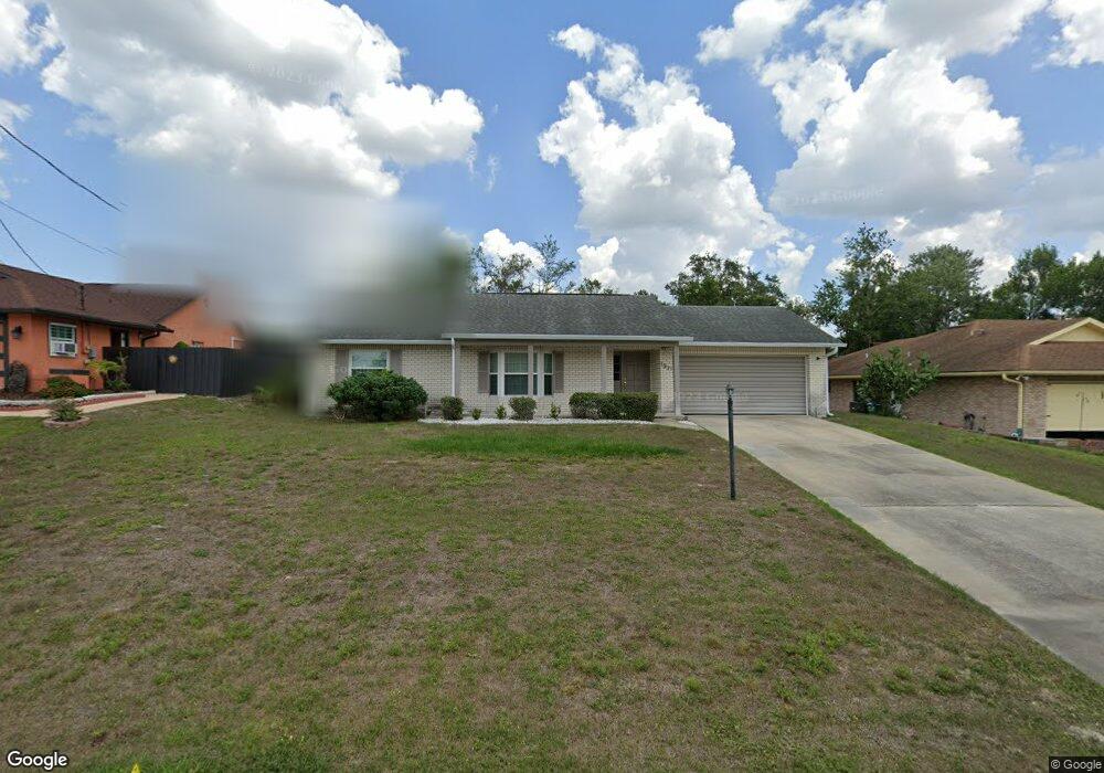
1971 Lindhurst Ave Deltona, FL 32725
Estimated Value: $283,000 - $350,000
3
Beds
2
Baths
1,937
Sq Ft
$158/Sq Ft
Est. Value
About This Home
This home is located at 1971 Lindhurst Ave, Deltona, FL 32725 and is currently estimated at $306,114, approximately $158 per square foot. 1971 Lindhurst Ave is a home located in Volusia County with nearby schools including Deltona Lakes Elementary School, Galaxy Middle School, and Deltona High School.
Ownership History
Date
Name
Owned For
Owner Type
Purchase Details
Closed on
Jun 11, 1998
Sold by
Topp Jean M and Topp Elwin W
Bought by
Gutierrez Antonio and Gutierrez Magda
Current Estimated Value
Home Financials for this Owner
Home Financials are based on the most recent Mortgage that was taken out on this home.
Original Mortgage
$63,000
Outstanding Balance
$11,545
Interest Rate
7.04%
Estimated Equity
$294,569
Purchase Details
Closed on
Apr 15, 1984
Bought by
Gutierrez Antonio and Gutierrez Magda
Purchase Details
Closed on
Dec 15, 1974
Bought by
Gutierrez Antonio and Gutierrez Magda
Create a Home Valuation Report for This Property
The Home Valuation Report is an in-depth analysis detailing your home's value as well as a comparison with similar homes in the area
Home Values in the Area
Average Home Value in this Area
Purchase History
| Date | Buyer | Sale Price | Title Company |
|---|---|---|---|
| Gutierrez Antonio | $70,000 | -- | |
| Gutierrez Antonio | $6,500 | -- | |
| Gutierrez Antonio | $2,200 | -- |
Source: Public Records
Mortgage History
| Date | Status | Borrower | Loan Amount |
|---|---|---|---|
| Open | Gutierrez Antonio | $63,000 |
Source: Public Records
Tax History
| Year | Tax Paid | Tax Assessment Tax Assessment Total Assessment is a certain percentage of the fair market value that is determined by local assessors to be the total taxable value of land and additions on the property. | Land | Improvement |
|---|---|---|---|---|
| 2026 | $1,085 | $79,468 | -- | -- |
| 2025 | $1,085 | $77,379 | -- | -- |
| 2024 | $946 | $75,199 | -- | -- |
| 2023 | $946 | $73,009 | $0 | $0 |
| 2022 | $949 | $70,883 | $0 | $0 |
| 2021 | $980 | $68,818 | $0 | $0 |
| 2020 | $978 | $67,868 | $0 | $0 |
| 2019 | $997 | $66,342 | $0 | $0 |
| 2018 | $987 | $65,105 | $0 | $0 |
| 2017 | $974 | $63,766 | $0 | $0 |
| 2016 | $961 | $62,454 | $0 | $0 |
| 2015 | $980 | $62,020 | $0 | $0 |
| 2014 | $956 | $61,528 | $0 | $0 |
Source: Public Records
Map
Nearby Homes
- 1928 Eden Dr
- 1694 Bismarck Dr
- 1672 Bavon Dr
- 1831 Oakgrove Ave
- 1826 Belspring Ave Unit 65
- 1618 Airmont Ave
- 2055 E Prairie Cir
- 2068 Dixie Belle Ave
- 0 Central Pkwy Unit MFRV4938346
- 2135 E Old Mill Dr
- 1572 Monticello St
- 1564 Monticello St
- 1854 Providence Blvd
- 1850 Providence Blvd
- 1743 E Chapel Dr
- 1708 W Chapel Dr
- 2141 E Old Mill Dr
- 1246 Kearney Ct
- 1266 Gladstone Dr
- 1830 Pennington Ave
- 1963 Lindhurst Ave
- 1972 Matico Ave Unit 15
- 1980 Matico Ave
- 1955 Lindhurst Ave
- 1987 Lindhurst Ave
- 1970 Lindhurst Ave
- 1964 Matico Ave
- 1962 Lindhurst Ave
- 1978 Lindhurst Ave
- 1988 Matico Ave
- 1954 Lindhurst Ave
- 1947 Lindhurst Ave
- 1986 Lindhurst Ave
- 1946 Lindhurst Ave
- 1971 Matico Ave
- 1963 Matico Ave
- 1977 Eden Dr
- 1979 Matico Ave
- 1622 Bismarck Dr
- 1578 Monica St
Your Personal Tour Guide
Ask me questions while you tour the home.