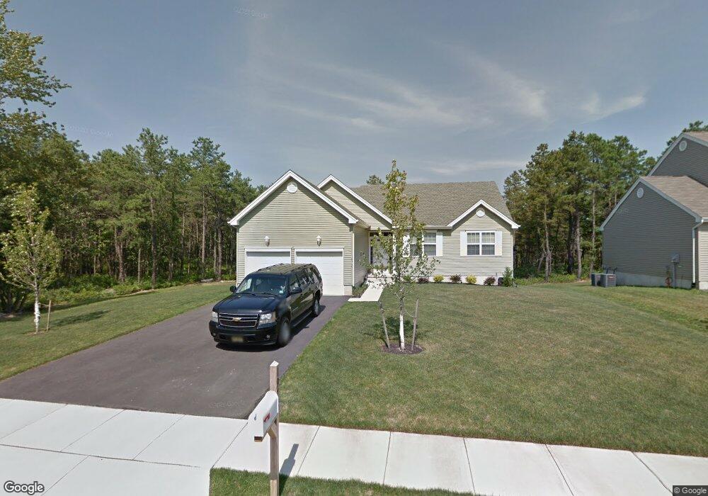
1972 Breakers Dr Barnegat, NJ 08005
Barnegat Township NeighborhoodEstimated Value: $510,000 - $581,000
3
Beds
2
Baths
1,511
Sq Ft
$361/Sq Ft
Est. Value
About This Home
This home is located at 1972 Breakers Dr, Barnegat, NJ 08005 and is currently estimated at $545,849, approximately $361 per square foot. 1972 Breakers Dr is a home with nearby schools including Barnegat High School.
Ownership History
Date
Name
Owned For
Owner Type
Purchase Details
Closed on
Mar 13, 2024
Sold by
Mcconlogue Steven A
Bought by
Mcconlogue Champagne Living Trust and Mcconlogue
Current Estimated Value
Purchase Details
Closed on
Jan 31, 2014
Sold by
Walters Development Co Llc
Bought by
Mcconlogue Steven A
Home Financials for this Owner
Home Financials are based on the most recent Mortgage that was taken out on this home.
Original Mortgage
$248,210
Interest Rate
4.47%
Mortgage Type
New Conventional
Purchase Details
Closed on
Nov 22, 2010
Sold by
Abigal Adams Llc
Bought by
Walters Development Co Llc
Purchase Details
Closed on
Sep 5, 2003
Sold by
Depazza Carl
Bought by
Abigal Adaams Llc
Create a Home Valuation Report for This Property
The Home Valuation Report is an in-depth analysis detailing your home's value as well as a comparison with similar homes in the area
Home Values in the Area
Average Home Value in this Area
Purchase History
| Date | Buyer | Sale Price | Title Company |
|---|---|---|---|
| Mcconlogue Champagne Living Trust | -- | None Listed On Document | |
| Mcconlogue Champagne Living Trust | -- | None Listed On Document | |
| Mcconlogue Steven A | $261,274 | None Available | |
| Walters Development Co Llc | $53,613 | Foundation Title Llc | |
| Abigal Adaams Llc | $35,000 | -- |
Source: Public Records
Mortgage History
| Date | Status | Borrower | Loan Amount |
|---|---|---|---|
| Previous Owner | Mcconlogue Steven A | $248,210 |
Source: Public Records
Tax History
| Year | Tax Paid | Tax Assessment Tax Assessment Total Assessment is a certain percentage of the fair market value that is determined by local assessors to be the total taxable value of land and additions on the property. | Land | Improvement |
|---|---|---|---|---|
| 2025 | $7,618 | $247,100 | $85,800 | $161,300 |
| 2024 | $7,193 | $247,100 | $85,800 | $161,300 |
| 2023 | $6,961 | $247,100 | $85,800 | $161,300 |
| 2022 | $6,961 | $247,100 | $85,800 | $161,300 |
| 2021 | $6,929 | $247,100 | $85,800 | $161,300 |
| 2020 | $6,897 | $247,100 | $85,800 | $161,300 |
| 2019 | $6,795 | $247,100 | $85,800 | $161,300 |
| 2018 | $6,743 | $247,100 | $85,800 | $161,300 |
| 2017 | $6,632 | $247,100 | $85,800 | $161,300 |
| 2016 | $6,496 | $247,100 | $85,800 | $161,300 |
| 2015 | $6,291 | $244,500 | $85,800 | $158,700 |
| 2014 | $6,066 | $35,000 | $35,000 | $0 |
Source: Public Records
Map
Nearby Homes
- 28 Dylan Blvd
- 15 Bobstay Rd
- 16 Half-Hitch Rd
- 16 Half Hitch Rd
- 14 Half-Hitch Rd
- 14 Half Hitch Rd
- 11 Bobstay Rd
- 9 Bobstay Rd
- 8 Half-Hitch Rd
- 24 Wright Rd
- 1999 Breakers Dr
- 6 Jolly Roger Rd
- 4 Jolly Roger Rd
- 8 Jolly Roger Rd
- 187 Compass Rd
- 11 Michael Ave
- 9 Michael Ave
- 248 Compass Rd
- 148 Torpedo Rd
- 4 Minnow Ave
- 1972 Breakers Dr
- 1970 Breakers Dr
- 1970 Breakers Dr
- 1974 Breakers Dr
- 25 Dylan Blvd
- 27 Dylan Blvd
- 23 Dylan Blvd
- 1976 Breakers Dr
- 1976 Breakers Dr
- 1968 Breakers Dr
- 21 Bobstay Rd
- 21 Bobstay Rd
- 1971 Breakers Dr
- 1971 Breakers Dr
- 29 Dylan Blvd
- 1973 Breakers Dr
- 1978 Breakers Dr
- 1978 Breakers Dr
- 20 Bobstay Rd
- 19 Bobstay Rd
Your Personal Tour Guide
Ask me questions while you tour the home.