1974 Shields Rd Dalton, GA 30720
Estimated Value: $195,460 - $231,000
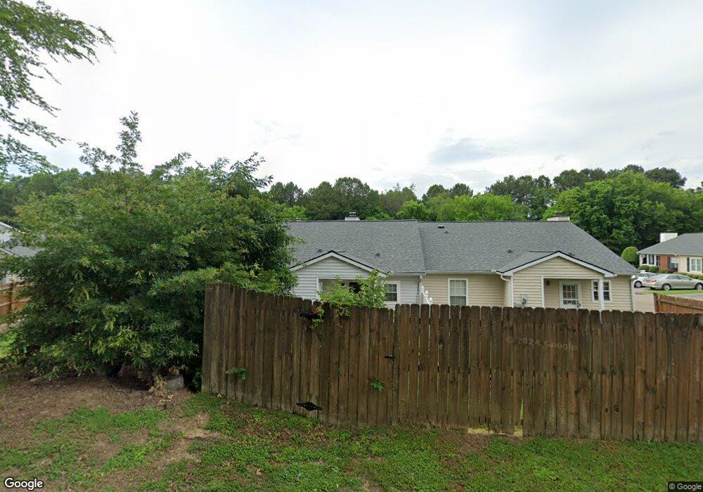
About This Home
This home is located at 1974 Shields Rd, Dalton, GA 30720 and is currently estimated at $207,865, approximately $182 per square foot. 1974 Shields Rd is a home located in Whitfield County with nearby schools including Brookwood Elementary School, Dalton High School, and Rock Hill School.
Ownership History
We collect this data history from publicly available records. To have your information removed, we recommend requesting removal directly through your county’s website.
Purchase Details
Purchase Details
Purchase Details
Purchase Details
Home Financials for this Owner
Home Financials are based on the most recent Mortgage that was taken out on this home.Purchase Details
Purchase Details
Purchase Details
Home Financials for this Owner
Home Financials are based on the most recent Mortgage that was taken out on this home.Purchase Details
Purchase Details
Purchase History
We collect this data history from publicly available records. To have your information removed, we recommend requesting removal directly through your county’s website.
| Date | Buyer | Sale Price | Title Company |
|---|---|---|---|
| -- | None Listed On Document | ||
| $139,900 | -- | ||
| $95,000 | -- | ||
| $101,000 | -- | ||
| $71,000 | -- | ||
| $100,953 | -- | ||
| $100,953 | -- | ||
| $96,881 | -- | ||
| $96,881 | -- | ||
| $89,900 | -- | ||
| $70,000 | -- |
Mortgage History
We collect this data history from publicly available records. To have your information removed, we recommend requesting removal directly through your county’s website.
| Date | Status | Borrower | Loan Amount |
|---|---|---|---|
| Previous Owner | $78,755 | ||
| Previous Owner | $12,145 | ||
| Previous Owner | $96,130 |
Tax History
We collect this data history from publicly available records. To have your information removed, we recommend requesting removal directly through your county’s website.
| Year | Tax Paid | Tax Assessment Tax Assessment Total Assessment is a certain percentage of the fair market value that is determined by local assessors to be the total taxable value of land and additions on the property. | Land | Improvement |
|---|---|---|---|---|
| 2025 | -- | $73,725 | $0 | $73,725 |
| 2024 | -- | $73,725 | $0 | $73,725 |
| 2023 | $198 | $47,181 | $0 | $47,181 |
| 2022 | $141 | $39,278 | $0 | $39,278 |
| 2021 | $141 | $39,278 | $0 | $39,278 |
| 2020 | $147 | $37,707 | $0 | $37,707 |
| 2019 | $156 | $37,707 | $0 | $37,707 |
| 2018 | $151 | $36,219 | $5,040 | $31,179 |
| 2017 | $127 | $33,621 | $5,040 | $28,581 |
| 2016 | $106 | $31,034 | $5,040 | $25,994 |
| 2014 | $88 | $34,472 | $8,200 | $26,272 |
| 2013 | -- | $34,472 | $8,200 | $26,272 |
Map
- 2019 Shields Rd Unit 8
- 1501 Summer Gate Way Unit 10
- 1482 Mineral Springs Rd
- 1908 Fairfield Dr
- 1910 Fairfield Dr
- 1498 Mineral Springs Rd
- 1803 Waterford Place
- 1701 Dug Gap Rd
- 820 Atkinson Dr
- 1706 Habersham Way
- 1123 Ridgeleigh Cir
- 1122 Ridgeleigh Cir
- 2002 Kingsridge Dr
- 1303 Sherwood Dr
- 1620 Ryman Ridge Rd
- 2012 Kingsridge Dr
- 1918 Tara Place
- 1913 Tara Place
- 1508 Braiden Rd
- LOT 35 Ryman Ridge Rd
- 1974 Spring Chase Way
- 1976 Spring Chase Way
- 1972 Spring Chase Way
- 1970 Spring Chase Way
- 1968 Spring Chase Way
- 1966 Spring Chase Way
- 1928 Spring Chase Way
- 1914 Shields Rd
- 1926 Spring Chase Way
- 1916 Spring Chase Way
- 1914 Spring Chase Way
- 1930 Spring Chase Way
- 1918 Spring Chase Way
- 1932 Spring Chase Way
- 1924 Spring Chase Way
- 1920 Spring Chase Way
- 1922 Spring Chase Way
- 1964 Spring Chase Way
- 1964 Shields Rd
- 1934 Shields Rd
Ask me questions while you tour the home.