Estimated Value: $209,000 - $250,000
About This Home
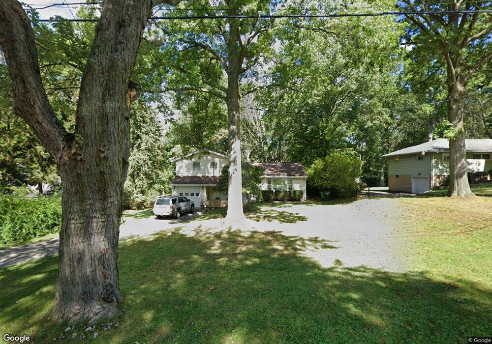
This home is located at 1975 Maple Rd, Stow, OH 44224 and is currently estimated at $236,151, approximately $204 per square foot. 1975 Maple Rd is a home located in Summit County with nearby schools including Stow-Munroe Falls High School, Holy Family Elementary School, and Walsh Jesuit High School.
Ownership History
We collect this data history from publicly available records. To have your information removed, we recommend requesting removal directly through your county’s website.
Purchase Details
Home Financials for this Owner
Home Financials are based on the most recent Mortgage that was taken out on this home.Home Values in the Area
Average Home Value in this Area
Purchase History
We collect this data history from publicly available records. To have your information removed, we recommend requesting removal directly through your county’s website.
| Date | Buyer | Sale Price | Title Company |
|---|---|---|---|
| $139,900 | Village Title Agency |
Mortgage History
We collect this data history from publicly available records. To have your information removed, we recommend requesting removal directly through your county’s website.
| Date | Status | Borrower | Loan Amount |
|---|---|---|---|
| Closed | $139,900 |
Tax History
We collect this data history from publicly available records. To have your information removed, we recommend requesting removal directly through your county’s website.
| Year | Tax Paid | Tax Assessment Tax Assessment Total Assessment is a certain percentage of the fair market value that is determined by local assessors to be the total taxable value of land and additions on the property. | Land | Improvement |
|---|---|---|---|---|
| 2026 | $4,666 | $58,328 | $15,019 | $43,309 |
| 2024 | $3,309 | $58,328 | $15,019 | $43,309 |
| 2023 | $3,309 | $58,328 | $15,019 | $43,309 |
| 2022 | $2,813 | $43,677 | $10,504 | $33,173 |
| 2021 | $2,521 | $43,677 | $10,504 | $33,173 |
| 2020 | $2,478 | $43,670 | $10,500 | $33,170 |
| 2019 | $2,532 | $41,750 | $9,530 | $32,220 |
| 2018 | $2,491 | $41,750 | $9,530 | $32,220 |
| 2017 | $2,561 | $41,750 | $9,530 | $32,220 |
| 2016 | $2,635 | $41,750 | $9,530 | $32,220 |
| 2015 | $2,561 | $41,750 | $9,530 | $32,220 |
| 2014 | $2,563 | $41,750 | $9,530 | $32,220 |
| 2013 | $2,675 | $43,900 | $9,530 | $34,370 |
Map
- 3376 Darrow Rd
- 136 Pinehurst Rd
- 159 Pinehurst Rd
- 161 Pinehurst Rd
- 3496 Marcella Ave
- 3569 Elm Rd
- 100 Silver Valley Blvd Unit C100
- 41 Gaylord Dr
- 3068 Kent Rd Unit 105
- 3068 Kent Rd Unit 206
- 3066 Kent Rd Unit 301
- 113 Olson Spur
- 3648 Northport Dr
- 162 Lake Terrace Dr
- 3668 Elm Rd
- 3394 Stillwood Blvd
- 139 Mulberry Ln
- 2203 Marhofer Ave
- 3031 Silverview Dr
- 3629 Adaline Dr
- 1985 Maple Rd
- 1965 Maple Rd
- 3333 Margaret Ave
- 1995 Maple Rd
- 1968 Maple Rd
- 1986 Maple Rd
- 1955 Maple Rd
- 1966 Maple Rd
- 1976 Maple Rd
- 2005 Maple Rd
- 1945 Maple Rd
- 1996 Maple Rd
- 3349 Margaret Ave
- 1956 Maple Rd
- 1968 Hawthorne Ave
- 1958 Hawthorne Ave
- 1946 Maple Rd
- 2015 Maple Rd
- 2006 Maple Rd
- 3357 Margaret Ave
Ask me questions while you tour the home.