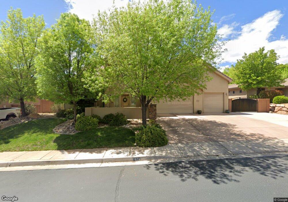
1976 S 2620 Cir E St. George, UT 84790
Estimated Value: $691,000 - $831,000
5
Beds
3
Baths
3,100
Sq Ft
$245/Sq Ft
Est. Value
About This Home
This home is located at 1976 S 2620 Cir E, St. George, UT 84790 and is currently estimated at $758,623, approximately $244 per square foot. 1976 S 2620 Cir E is a home located in Washington County with nearby schools including Crimson View Elementary School, Crimson Cliffs Middle School, and Washington Fields Intermediate School.
Ownership History
Date
Name
Owned For
Owner Type
Purchase Details
Closed on
Feb 24, 2011
Sold by
Mackay Brent C
Bought by
Bundy Brandon C and Bundy Lacey M
Current Estimated Value
Home Financials for this Owner
Home Financials are based on the most recent Mortgage that was taken out on this home.
Original Mortgage
$199,980
Outstanding Balance
$137,147
Interest Rate
4.75%
Mortgage Type
FHA
Estimated Equity
$621,476
Purchase Details
Closed on
Nov 20, 2007
Sold by
Almega Inc
Bought by
Mackay Brent C
Home Financials for this Owner
Home Financials are based on the most recent Mortgage that was taken out on this home.
Original Mortgage
$414,000
Interest Rate
6.38%
Mortgage Type
Purchase Money Mortgage
Purchase Details
Closed on
May 4, 2007
Sold by
Serenity Homes Inc
Bought by
Almega Inc
Home Financials for this Owner
Home Financials are based on the most recent Mortgage that was taken out on this home.
Original Mortgage
$348,000
Interest Rate
6.14%
Mortgage Type
Construction
Create a Home Valuation Report for This Property
The Home Valuation Report is an in-depth analysis detailing your home's value as well as a comparison with similar homes in the area
Purchase History
| Date | Buyer | Sale Price | Title Company |
|---|---|---|---|
| Bundy Brandon C | -- | Southern Utah Title | |
| Mackay Brent C | -- | Equity Title | |
| Almega Inc | -- | Southern Utah Title Co |
Source: Public Records
Mortgage History
| Date | Status | Borrower | Loan Amount |
|---|---|---|---|
| Open | Bundy Brandon C | $199,980 | |
| Previous Owner | Mackay Brent C | $414,000 | |
| Previous Owner | Almega Inc | $348,000 |
Source: Public Records
Tax History
| Year | Tax Paid | Tax Assessment Tax Assessment Total Assessment is a certain percentage of the fair market value that is determined by local assessors to be the total taxable value of land and additions on the property. | Land | Improvement |
|---|---|---|---|---|
| 2025 | $2,723 | $410,740 | $123,750 | $286,990 |
| 2023 | $2,734 | $408,540 | $118,250 | $290,290 |
| 2022 | $2,685 | $377,300 | $96,250 | $281,050 |
| 2021 | $2,350 | $492,500 | $125,000 | $367,500 |
| 2020 | $2,121 | $418,500 | $100,000 | $318,500 |
| 2019 | $2,056 | $396,300 | $100,000 | $296,300 |
| 2018 | $1,979 | $196,955 | $0 | $0 |
| 2017 | $1,809 | $174,790 | $0 | $0 |
| 2016 | $1,885 | $168,465 | $0 | $0 |
| 2015 | $1,938 | $166,210 | $0 | $0 |
| 2014 | $1,819 | $156,970 | $0 | $0 |
Source: Public Records
Map
Nearby Homes
- 2525 E 2150 S
- 1709 Granite Way
- 2745 E Rasmussen Dr
- 2464 E Granite Way
- 1752 S 2760 E
- 2240 E Cobalt Dr Unit 15
- 2240 E Cobalt Dr Unit 9
- 2391 E 2220 S
- 2317 Greystone Dr
- 2567 E Marble Dr
- 2567 E Marble Dr Unit 1110
- 2867 E Granite Way
- 0 Shale Cir
- 0 Cobalt Dr
- 2523 E Marble Dr
- 1622 S Agate Cir
- 0 Shale Dr Unit 26-267749
- 2040 S 3010 E
- 2092 S 3010 E
- 0 Gneiss Dr Unit 26-268063
- 1976 S 2620 East Cir
- 0 S 2620 Cir E
- 1960 S 2620 East Cir
- 3348 S 2620 Cir E
- 3500 S 2620 Cir E Unit Lot 26
- 1988 S 2620 Cir E
- 1975 S 2580 E
- 1988 S 2620 East Cir
- 1959 S 2580 E
- 0 S 2629 Cir E
- 1993 S 2580 E
- 0 Lot 69 Serenity Hills
- 1979 S 2620 East Cir
- 1979 S 2620 Cir E
- 1963 S 2620 East Cir
- 1944 S 2620 East Cir
- 1944 S 2620 Cir E
- 1991 S 2620 East Cir
- 1945 S 2580 E
- 1947 S 2620 East Cir
Your Personal Tour Guide
Ask me questions while you tour the home.