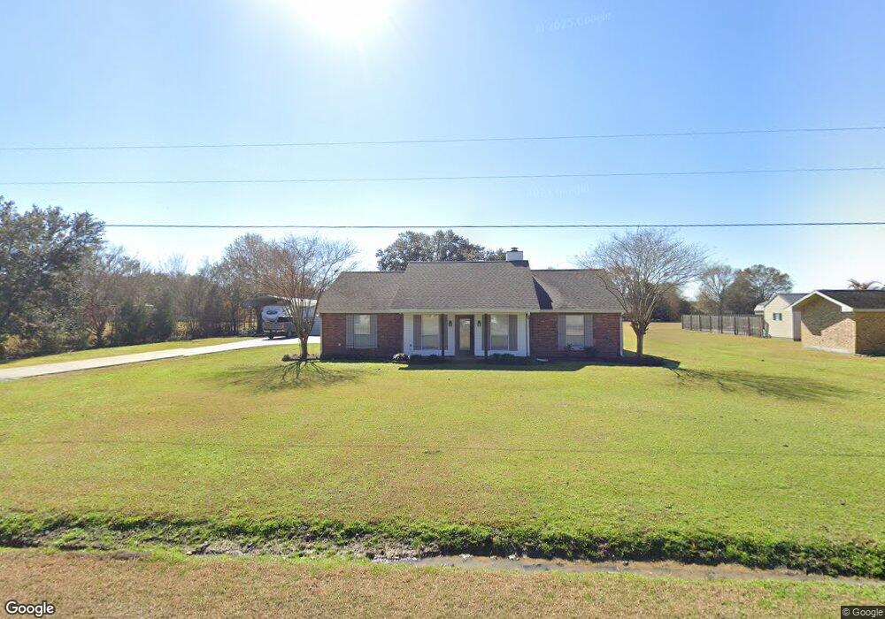
198 Alee Rd Eunice, LA 70535
Estimated Value: $202,000 - $222,410
3
Beds
3
Baths
1,590
Sq Ft
$134/Sq Ft
Est. Value
About This Home
This home is located at 198 Alee Rd, Eunice, LA 70535 and is currently estimated at $213,603, approximately $134 per square foot. 198 Alee Rd is a home located in St. Landry Parish with nearby schools including Eunice Elementary School, Eunice Junior High School, and Central Middle School.
Ownership History
Date
Name
Owned For
Owner Type
Purchase Details
Closed on
Feb 24, 2022
Sold by
Blake Soileau Joshua
Bought by
Delcambre Ashley Lebouef
Current Estimated Value
Home Financials for this Owner
Home Financials are based on the most recent Mortgage that was taken out on this home.
Original Mortgage
$172,000
Outstanding Balance
$160,019
Interest Rate
3.55%
Mortgage Type
New Conventional
Estimated Equity
$53,584
Create a Home Valuation Report for This Property
The Home Valuation Report is an in-depth analysis detailing your home's value as well as a comparison with similar homes in the area
Purchase History
| Date | Buyer | Sale Price | Title Company |
|---|---|---|---|
| Delcambre Ashley Lebouef | -- | New Title Company Name |
Source: Public Records
Mortgage History
| Date | Status | Borrower | Loan Amount |
|---|---|---|---|
| Open | Delcambre Ashley Lebouef | $172,000 |
Source: Public Records
Tax History
| Year | Tax Paid | Tax Assessment Tax Assessment Total Assessment is a certain percentage of the fair market value that is determined by local assessors to be the total taxable value of land and additions on the property. | Land | Improvement |
|---|---|---|---|---|
| 2024 | $9 | $20,600 | $2,360 | $18,240 |
| 2023 | $542 | $19,570 | $2,360 | $17,210 |
| 2022 | $878 | $19,570 | $2,360 | $17,210 |
| 2021 | $711 | $15,840 | $2,360 | $13,480 |
| 2020 | $711 | $15,840 | $2,360 | $13,480 |
| 2019 | $595 | $12,190 | $2,360 | $9,830 |
| 2018 | $598 | $12,190 | $2,360 | $9,830 |
| 2017 | $765 | $15,580 | $2,360 | $13,220 |
| 2015 | $717 | $14,790 | $1,730 | $13,060 |
| 2013 | $716 | $14,790 | $1,730 | $13,060 |
Source: Public Records
Map
Nearby Homes
- 104 Hunter St
- 200 Thayer Ave
- 0 Tbd Unit 2020024590
- 1350 College Rd
- Tbd Johnson Hwy
- 99 University Place
- 1976 Fournerat Rd
- 0 Savannah Unit SWL25001182
- 1311 Bruce Ave
- 1480 W Oak Ave
- Tbd Savannah St
- 1820 Betty St
- 1240 B and B Ave
- 0 Shelly Dr Unit 33 21010419
- 0 Shelly Dr Unit 16 23007151
- 0 Shelly Dr Unit 10 21010409
- 0 Shelly Dr Unit 7 21010407
- 0 Shelly Dr Unit 30 21010427
- 0 Shelly Dr Unit 34 21010417
- 0 Shelly Dr Unit 26 21010429
Your Personal Tour Guide
Ask me questions while you tour the home.