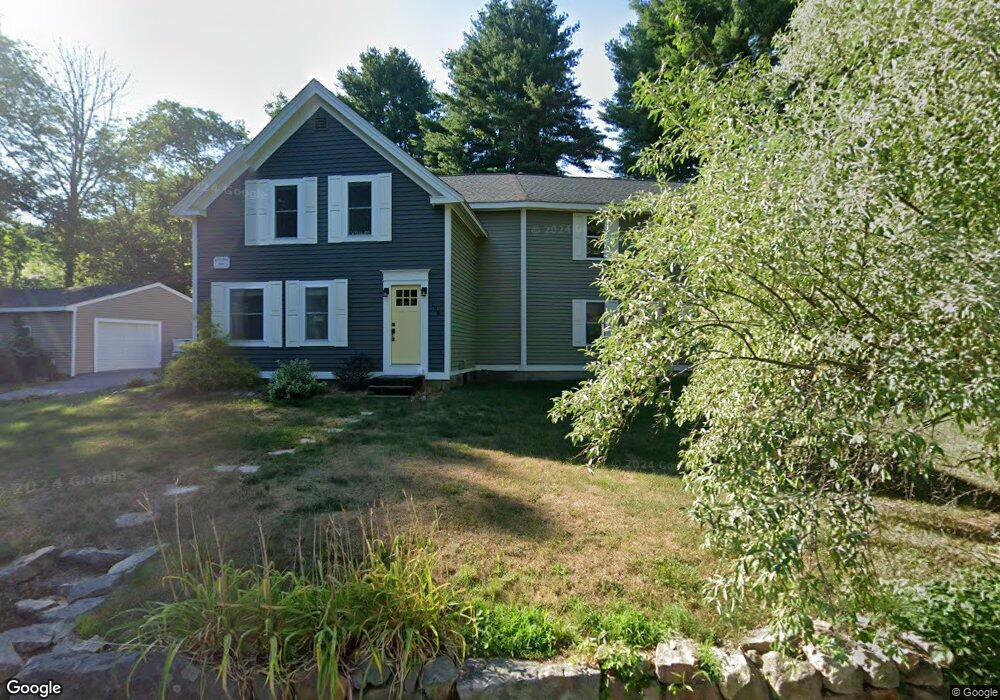
198 Winter St Ashland, MA 01721
Estimated Value: $660,067 - $838,000
About This Home
This home is located at 198 Winter St, Ashland, MA 01721 and is currently estimated at $729,767, approximately $667 per square foot. 198 Winter St is a home located in Middlesex County with nearby schools including William Pittaway Elementary School, David Mindess Elementary School, and Henry E. Warren Elementary School.
Ownership History
We collect this data history from publicly available records. To have your information removed, we recommend requesting removal directly through your county’s website.
Purchase Details
Home Financials for this Owner
Home Financials are based on the most recent Mortgage that was taken out on this home.Purchase Details
Home Financials for this Owner
Home Financials are based on the most recent Mortgage that was taken out on this home.Purchase Details
Home Financials for this Owner
Home Financials are based on the most recent Mortgage that was taken out on this home.Home Values in the Area
Average Home Value in this Area
Purchase History
We collect this data history from publicly available records. To have your information removed, we recommend requesting removal directly through your county’s website.
| Date | Buyer | Sale Price | Title Company |
|---|---|---|---|
| -- | -- | ||
| $297,000 | -- | ||
| $147,000 | -- |
Mortgage History
We collect this data history from publicly available records. To have your information removed, we recommend requesting removal directly through your county’s website.
| Date | Status | Borrower | Loan Amount |
|---|---|---|---|
| Open | $262,950 | ||
| Closed | $283,900 | ||
| Previous Owner | $282,150 | ||
| Previous Owner | $139,600 |
Tax History
We collect this data history from publicly available records. To have your information removed, we recommend requesting removal directly through your county’s website.
| Year | Tax Paid | Tax Assessment Tax Assessment Total Assessment is a certain percentage of the fair market value that is determined by local assessors to be the total taxable value of land and additions on the property. | Land | Improvement |
|---|---|---|---|---|
| 2025 | $7,968 | $624,000 | $267,200 | $356,800 |
| 2024 | $7,843 | $592,400 | $267,200 | $325,200 |
| 2023 | $7,254 | $526,800 | $254,600 | $272,200 |
| 2022 | $7,324 | $461,200 | $231,300 | $229,900 |
| 2021 | $38,493 | $436,500 | $231,300 | $205,200 |
| 2020 | $7,980 | $420,200 | $231,300 | $188,900 |
| 2019 | $6,572 | $403,700 | $231,300 | $172,400 |
| 2018 | $6,491 | $390,800 | $229,000 | $161,800 |
| 2017 | $6,276 | $375,800 | $229,000 | $146,800 |
| 2016 | $6,078 | $357,500 | $226,000 | $131,500 |
| 2015 | $5,856 | $338,500 | $213,100 | $125,400 |
| 2014 | $5,542 | $318,700 | $189,100 | $129,600 |
Map
- 30 Shadow Creek Ln Unit 30
- 167 Myrtle St
- 33 Birch Hill Rd
- 58 Cedar Hill Rd
- 73 Sudbury Rd
- 7 Cahill Park Dr
- 17 Raymond Marchetti St
- 47 Cordaville Rd
- 379 Singletary Ln
- 16 Central St
- 7 Linden St
- 74 Oregon Rd
- 26 Christy Ln
- 10 Metropolitan Ave
- 1116 Waverley
- 7 Liberty St
- 23 Bellmore Rd
- 1500 Worcester Rd Unit 405
- 1500 Worcester Rd Unit 308
- 1500 Worcester Rd Unit 612
- 7 Woodridge Ln
- 214 Winter St
- Lot 9 Burnham Cir
- Lot 10 Burnham Cir
- Lot 11 Burnham Cir
- 11 Woodridge Ln
- 4 Woodridge Ln
- 4 Woodridge Ln
- 8 Woodridge Ln
- Lot 8 Burnham Cir
- Lot 13 Burnham Cir
- 12 Woodridge Ln
- 215 Winter St
- Lot 12 Burnham Cir
- 17 Woodridge Ln
- 66 Strobus Ln
- 16 Woodridge Ln
- 201 Winter St
- 221 Winter St
- 61 Strobus Ln
Ask me questions while you tour the home.