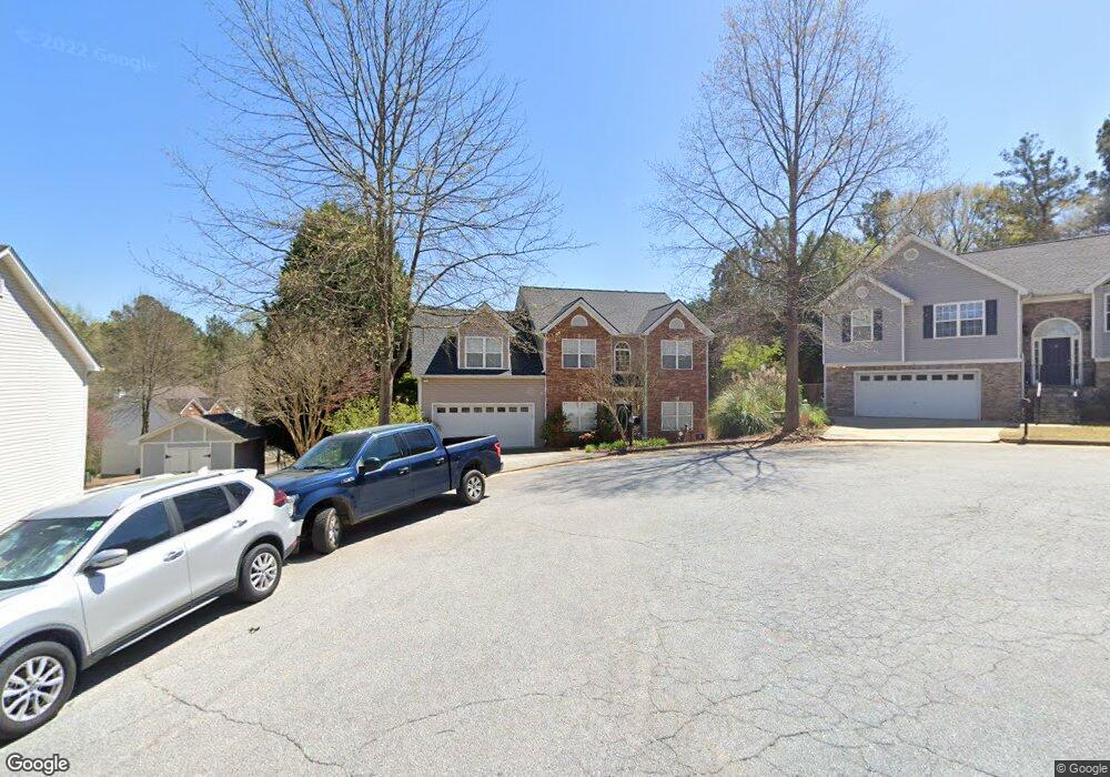
1981 Commonwealth Way Grayson, GA 30017
Estimated Value: $389,006 - $437,000
4
Beds
3
Baths
2,350
Sq Ft
$173/Sq Ft
Est. Value
About This Home
This home is located at 1981 Commonwealth Way, Grayson, GA 30017 and is currently estimated at $406,252, approximately $172 per square foot. 1981 Commonwealth Way is a home located in Gwinnett County with nearby schools including Pharr Elementary School, Couch Middle School, and Grayson High School.
Ownership History
Date
Name
Owned For
Owner Type
Purchase Details
Closed on
Feb 7, 2013
Sold by
Patrick Brett
Bought by
Watson Keeli
Current Estimated Value
Purchase Details
Closed on
Jul 25, 2003
Sold by
Bill Austin Homes Inc
Bought by
Patrick Brett and Watson Keeli
Home Financials for this Owner
Home Financials are based on the most recent Mortgage that was taken out on this home.
Original Mortgage
$33,150
Interest Rate
5.48%
Mortgage Type
New Conventional
Create a Home Valuation Report for This Property
The Home Valuation Report is an in-depth analysis detailing your home's value as well as a comparison with similar homes in the area
Home Values in the Area
Average Home Value in this Area
Purchase History
We collect this data history from publicly available records. To have your information removed, we recommend requesting removal directly through your county’s website.
| Date | Buyer | Sale Price | Title Company |
|---|---|---|---|
| Watson Keeli | -- | -- | |
| Patrick Brett | $165,900 | -- |
Source: Public Records
Mortgage History
We collect this data history from publicly available records. To have your information removed, we recommend requesting removal directly through your county’s website.
| Date | Status | Borrower | Loan Amount |
|---|---|---|---|
| Previous Owner | Patrick Brett | $33,150 | |
| Previous Owner | Patrick Brett | $132,700 |
Source: Public Records
Tax History
| Year | Tax Paid | Tax Assessment Tax Assessment Total Assessment is a certain percentage of the fair market value that is determined by local assessors to be the total taxable value of land and additions on the property. | Land | Improvement |
|---|---|---|---|---|
| 2025 | $4,493 | $169,960 | $26,120 | $143,840 |
| 2024 | $4,364 | $156,920 | $26,120 | $130,800 |
| 2023 | $4,364 | $106,560 | $22,000 | $84,560 |
| 2022 | $3,285 | $106,560 | $22,000 | $84,560 |
| 2021 | $3,173 | $98,960 | $18,000 | $80,960 |
| 2020 | $3,195 | $98,960 | $18,000 | $80,960 |
| 2019 | $2,680 | $78,960 | $12,000 | $66,960 |
| 2018 | $2,680 | $78,960 | $12,000 | $66,960 |
| 2016 | $2,481 | $68,800 | $10,400 | $58,400 |
| 2015 | $2,331 | $62,720 | $10,400 | $52,320 |
| 2014 | -- | $58,400 | $8,000 | $50,400 |
Source: Public Records
Map
Nearby Homes
- 2018 Paper Birch Cove Unit 1
- 1911 Paper Birch Cove
- 1210 Hogan Ridge Dr
- 1231 Hogan Ridge Dr Unit 6
- 1961 Shoreline Trace
- 621 Pineberry Ct
- 1860 Pinehurst View Dr
- 2122 Graystone Pkwy
- 2250 Ridge Forest Dr
- 1992 Graystone Pkwy Unit 3
- 1073 Grayson Pkwy
- 1975 Lakewood Trace Unit 4
- 1445 Hillside Dr SW
- 2269 Reddy Farm Ln
- 2255 Pinehaven Ct
- 475 Brown Dove Ln
- 2505 Sea Turtle Ln
- 1306 Annapolis Way
- 1036 Lakeview Oaks Ct
- 1800 Brandie Elaine Ave
- 1389 Commonwealth Ln
- 1399 Commonwealth Ln
- 1971 Commonwealth Way
- 1409 Commonwealth Ln
- 1991 Commonwealth Way
- 1390 Commonwealth Ln
- 1274 Cone Cir
- 1370 Commonwealth Ln
- 1400 Commonwealth Ln
- 1419 Commonwealth Ln
- 2001 Commonwealth Way
- 1264 Cone Cir
- 1978 Commonwealth Way Unit 89
- 1978 Commonwealth Way
- 1410 Commonwealth Ln
- 1360 Commonwealth Ln
- 1988 Commonwealth Way
- 1284 Cone Cir Unit 2
- 1998 Commonwealth Way
- 1439 Commonwealth Ln
Your Personal Tour Guide
Ask me questions while you tour the home.