1985 Dunmore Place Unit 4 Hoffman Estates, IL 60169
South Hoffman Estates NeighborhoodEstimated Value: $241,000 - $313,000
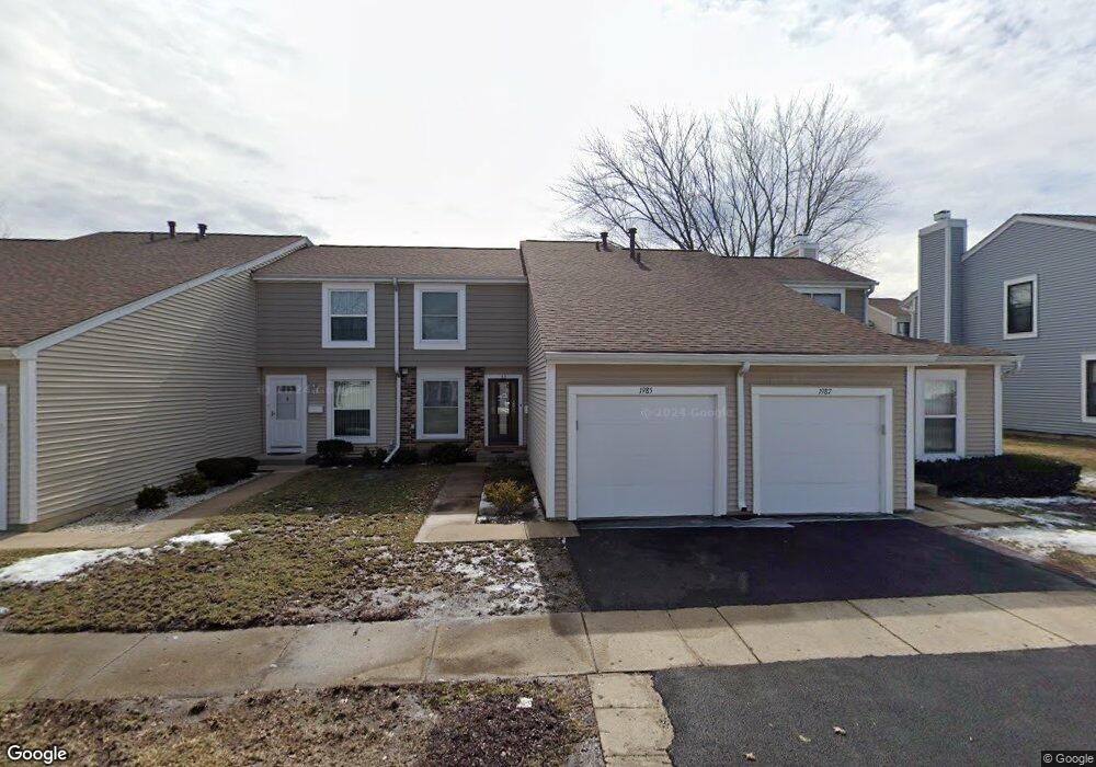
About This Home
This home is located at 1985 Dunmore Place Unit 4, Hoffman Estates, IL 60169 and is currently estimated at $281,480, approximately $204 per square foot. 1985 Dunmore Place Unit 4 is a home located in Cook County with nearby schools including John Muir Literacy Academy, Dwight D Eisenhower Junior High School, and Hoffman Estates High School.
Ownership History
Purchase Details
Purchase Details
Home Financials for this Owner
Home Financials are based on the most recent Mortgage that was taken out on this home.Home Values in the Area
Average Home Value in this Area
Purchase History
We collect this data history from publicly available records. To have your information removed, we recommend requesting removal directly through your county’s website.
| Date | Buyer | Sale Price | Title Company |
|---|---|---|---|
| Shah Mukesh R | -- | None Listed On Document | |
| Shah Mukesh R | $105,000 | -- |
Mortgage History
We collect this data history from publicly available records. To have your information removed, we recommend requesting removal directly through your county’s website.
| Date | Status | Borrower | Loan Amount |
|---|---|---|---|
| Previous Owner | Shah Mukesh R | $78,700 |
Tax History
| Year | Tax Paid | Tax Assessment Tax Assessment Total Assessment is a certain percentage of the fair market value that is determined by local assessors to be the total taxable value of land and additions on the property. | Land | Improvement |
|---|---|---|---|---|
| 2025 | $3,692 | $24,000 | $3,504 | $20,496 |
| 2024 | $3,692 | $18,000 | $3,000 | $15,000 |
| 2023 | $3,517 | $18,000 | $3,000 | $15,000 |
| 2022 | $3,517 | $18,000 | $3,000 | $15,000 |
| 2021 | $4,016 | $15,317 | $2,759 | $12,558 |
| 2020 | $3,997 | $15,317 | $2,759 | $12,558 |
| 2019 | $3,979 | $17,019 | $2,759 | $14,260 |
| 2018 | $3,559 | $14,351 | $2,409 | $11,942 |
| 2017 | $3,515 | $14,351 | $2,409 | $11,942 |
| 2016 | $3,532 | $14,351 | $2,409 | $11,942 |
| 2015 | $3,449 | $13,362 | $2,102 | $11,260 |
| 2014 | $3,405 | $13,362 | $2,102 | $11,260 |
| 2013 | $3,300 | $13,362 | $2,102 | $11,260 |
Map
- 1985 Leiter Way Unit 1102
- 2021 Kensington Ln Unit 3004
- 2027 Kensington Ln Unit 3001
- 2025 Kensington Ln Unit 3002
- 2023 Kensington Ln Unit 3003
- 1987 Oxford Ln Unit 2
- 1993 Leiter Way Unit 10002
- 1996 Leiter Way Unit 14002
- 1992 Leiter Way Unit 14004
- 1991 Leiter Way Unit 10001
- 1995 Leiter Way Unit 10003
- 1773 Raleigh Ln Unit 8161
- 2137 Greystone Place Unit 2
- 1931 Governors Ln Unit 1
- 1840 Huntington Blvd Unit BW511
- 1840 Huntington Blvd Unit 607
- 1975 Kenilworth Cir Unit B
- 1976 Kenilworth Cir Unit E
- 1793 Queensbury Cir
- 1797 Queensbury Cir Unit 5764
- 1983 Dunmore Place Unit 4
- 1987 Dunmore Place Unit 4
- 1981 Dunmore Place Unit 4
- 1989 Dunmore Place
- 1979 Dunmore Place
- 1984 Franklin Place Unit 4
- 1982 Franklin Place Unit 4
- 1991 Dunmore Place Unit 4
- 1986 Franklin Place Unit 4
- 1977 Dunmore Place Unit 4
- 1980 Franklin Place Unit 4
- 1978 Franklin Place Unit 4
- 1993 Dunmore Place Unit 4
- 1988 Franklin Place Unit 4
- 1976 Franklin Place
- 1984 Dunmore Place
- 1986 Dunmore Place Unit 4
- 1986 Dunmore Place Unit 1986
- 1982 Dunmore Place Unit 4
- 1990 Franklin Place Unit 4
Ask me questions while you tour the home.