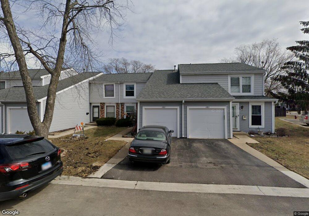
1987 Georgetown Ln Unit 4 Hoffman Estates, IL 60169
South Hoffman Estates NeighborhoodEstimated Value: $271,000 - $299,000
About This Home
This home is located at 1987 Georgetown Ln Unit 4, Hoffman Estates, IL 60169 and is currently estimated at $282,874, approximately $209 per square foot. 1987 Georgetown Ln Unit 4 is a home located in Cook County with nearby schools including John Muir Literacy Academy, Dwight D Eisenhower Junior High School, and Hoffman Estates High School.
Ownership History
Purchase Details
Home Financials for this Owner
Home Financials are based on the most recent Mortgage that was taken out on this home.Home Values in the Area
Average Home Value in this Area
Purchase History
We collect this data history from publicly available records. To have your information removed, we recommend requesting removal directly through your county’s website.
| Date | Buyer | Sale Price | Title Company |
|---|---|---|---|
| Cordova Mario R | $124,600 | -- |
Mortgage History
We collect this data history from publicly available records. To have your information removed, we recommend requesting removal directly through your county’s website.
| Date | Status | Borrower | Loan Amount |
|---|---|---|---|
| Open | Cordova Mario R | $123,550 |
Tax History
| Year | Tax Paid | Tax Assessment Tax Assessment Total Assessment is a certain percentage of the fair market value that is determined by local assessors to be the total taxable value of land and additions on the property. | Land | Improvement |
|---|---|---|---|---|
| 2025 | $4,506 | $25,000 | $3,504 | $21,496 |
| 2024 | $4,506 | $18,000 | $3,000 | $15,000 |
| 2023 | $4,330 | $18,000 | $3,000 | $15,000 |
| 2022 | $4,330 | $18,000 | $3,000 | $15,000 |
| 2021 | $3,832 | $14,768 | $2,759 | $12,009 |
| 2020 | $3,817 | $14,768 | $2,759 | $12,009 |
| 2019 | $3,800 | $16,409 | $2,759 | $13,650 |
| 2018 | $3,733 | $14,883 | $2,409 | $12,474 |
| 2017 | $3,686 | $14,883 | $2,409 | $12,474 |
| 2016 | $3,690 | $14,883 | $2,409 | $12,474 |
| 2015 | $3,460 | $13,396 | $2,102 | $11,294 |
| 2014 | $3,416 | $13,396 | $2,102 | $11,294 |
| 2013 | $3,310 | $13,396 | $2,102 | $11,294 |
Map
- 1987 Oxford Ln Unit 2
- 2021 Kensington Ln Unit 3004
- 2027 Kensington Ln Unit 3001
- 2025 Kensington Ln Unit 3002
- 2023 Kensington Ln Unit 3003
- 1773 Raleigh Ln Unit 8161
- 1985 Leiter Way Unit 1102
- 1936 Whitingham Ln Unit 1
- 2137 Greystone Place Unit 2
- 1931 Governors Ln Unit 1
- 1993 Leiter Way Unit 10002
- 1996 Leiter Way Unit 14002
- 1992 Leiter Way Unit 14004
- 1991 Leiter Way Unit 10001
- 1995 Leiter Way Unit 10003
- 2226 Langdon Place Unit 1
- 1793 Queensbury Cir
- 1840 Huntington Blvd Unit BW511
- 1840 Huntington Blvd Unit 607
- 1797 Queensbury Cir Unit 5764
- 1958 Georgetown Ln Unit 4
- 1960 Georgetown Ln Unit 4
- 1954 Georgetown Ln
- 1952 Georgetown Ln Unit 4
- 2004 Raleigh Place Unit 4
- 1950 Georgetown Ln Unit 4
- 2002 Raleigh Place Unit 4
- 1961 Georgetown Ln Unit 4
- 1975 Chelmsford Place Unit 2
- 2000 Raleigh Place Unit 4
- 1973 Chelmsford Place Unit 2
- 1948 Georgetown Ln Unit 4
- 1963 Georgetown Ln Unit 4
- 1977 Chelmsford Place Unit 2
- 1971 Chelmsford Place Unit 2
- 1998 Raleigh Place Unit 4
- 1951 Georgetown Ln Unit 4
- 1979 Chelmsford Place Unit 2
- 1946 Georgetown Ln
- 1965 Georgetown Ln Unit 4
Ask me questions while you tour the home.