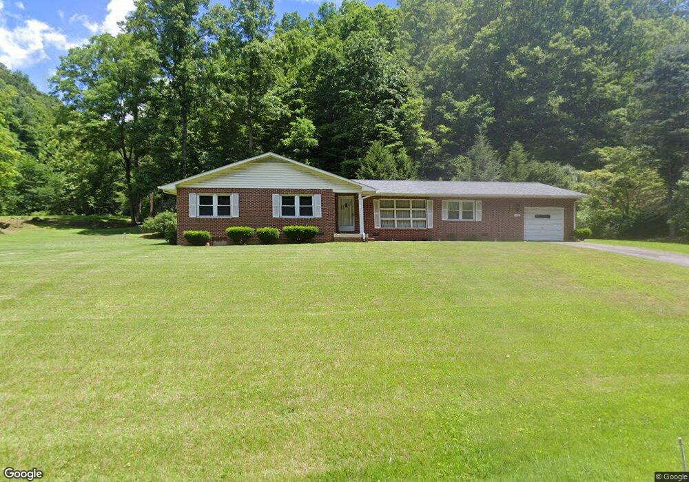
1987 Red Dirt Rd Vansant, VA 24656
Estimated Value: $160,429 - $206,000
About This Home
This home is located at 1987 Red Dirt Rd, Vansant, VA 24656 and is currently estimated at $181,357, approximately $83 per square foot. 1987 Red Dirt Rd is a home located in Buchanan County with nearby schools including Riverview Elementary/Middle School and Grundy High School.
Ownership History
We collect this data history from publicly available records. To have your information removed, we recommend requesting removal directly through your county’s website.
Purchase Details
Home Financials for this Owner
Home Financials are based on the most recent Mortgage that was taken out on this home.Purchase History
We collect this data history from publicly available records. To have your information removed, we recommend requesting removal directly through your county’s website.
| Date | Buyer | Sale Price | Title Company |
|---|---|---|---|
| $120,000 | None Available |
Mortgage History
We collect this data history from publicly available records. To have your information removed, we recommend requesting removal directly through your county’s website.
| Date | Status | Borrower | Loan Amount |
|---|---|---|---|
| Open | $108,000 |
Tax History
We collect this data history from publicly available records. To have your information removed, we recommend requesting removal directly through your county’s website.
| Year | Tax Paid | Tax Assessment Tax Assessment Total Assessment is a certain percentage of the fair market value that is determined by local assessors to be the total taxable value of land and additions on the property. | Land | Improvement |
|---|---|---|---|---|
| 2025 | $450 | $115,400 | $9,100 | $106,300 |
| 2024 | $450 | $115,400 | $9,100 | $106,300 |
| 2023 | $450 | $115,400 | $9,100 | $106,300 |
| 2022 | $450 | $115,400 | $9,100 | $106,300 |
| 2021 | $450 | $115,400 | $9,100 | $106,300 |
| 2020 | $461 | $118,200 | $9,100 | $109,100 |
| 2019 | $461 | $118,200 | $9,100 | $109,100 |
| 2017 | $461 | $118,200 | $9,100 | $109,100 |
| 2016 | $461 | $118,200 | $9,100 | $109,100 |
| 2015 | -- | $98,800 | $11,600 | $87,200 |
Map
- 2477 Leemaster Dr
- 1038 Spicewood Branch Rd
- 1877 Lovers Gap Rd
- 1332 G P Branch Rd
- 18775 Riverside Dr
- 2474 Bear Branch Rd
- 1016 Plum Ln
- 5612 Hurricane Creek Rd
- 2486 Little Prater Rd
- 1020 Steep Fork Rd
- 1148 Sierra Dr
- 8836 Lovers Gap Rd
- 3012 Breeden Branch Rd
- 1148 Russell Hill St
- 1551 Watkins Branch
- 1107 Russell Hill St
- 1336 Watkins St
- 1059 Shady Lane St
- 1030 Holland St
- 1111 Watkins St
- 2021 Red Dirt Rd
- 1933 Red Dirt Rd
- 1923 Red Dirt Rd
- 2024 Red Dirt Rd
- 2078 Red Dirt Rd
- 2115 Red Dirt Rd
- 2080 Red Dirt Rd
- 2147 Red Dirt Rd
- 2167 Red Dirt Rd
- 1783 Red Dirt Rd
- 1710 Red Dirt Rd
- 1770 Red Dirt Rd
- 2274 Red Dirt Rd
- 665B Rr 2
- 44 Rr 1
- 5646 Cranenest Rd
- 1082 Carver Rd
- 2241 Red Dirt Rd
- 2170 Red Dirt Rd
- 2338 Red Dirt Rd
Ask me questions while you tour the home.