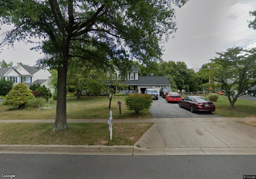
19929 Spurrier Ave Poolesville, MD 20837
Estimated Value: $705,783 - $824,000
Studio
4
Baths
2,240
Sq Ft
$345/Sq Ft
Est. Value
About This Home
This home is located at 19929 Spurrier Ave, Poolesville, MD 20837 and is currently estimated at $773,696, approximately $345 per square foot. 19929 Spurrier Ave is a home located in Montgomery County with nearby schools including Poolesville Elementary School, John H. Poole Middle School, and Poolesville High School.
Ownership History
Date
Name
Owned For
Owner Type
Purchase Details
Closed on
Dec 16, 2002
Sold by
Stottlemyer Laurie J
Bought by
Dickerson Craig M and Dickerson Valerie M
Current Estimated Value
Purchase Details
Closed on
Sep 20, 1999
Sold by
Stottlemyer W U W and Stottlemyer J L
Bought by
Stottlemyer Laurie J
Create a Home Valuation Report for This Property
The Home Valuation Report is an in-depth analysis detailing your home's value as well as a comparison with similar homes in the area
Home Values in the Area
Average Home Value in this Area
Purchase History
| Date | Buyer | Sale Price | Title Company |
|---|---|---|---|
| Dickerson Craig M | $370,000 | -- | |
| Stottlemyer Laurie J | -- | -- |
Source: Public Records
Tax History
| Year | Tax Paid | Tax Assessment Tax Assessment Total Assessment is a certain percentage of the fair market value that is determined by local assessors to be the total taxable value of land and additions on the property. | Land | Improvement |
|---|---|---|---|---|
| 2025 | $8,951 | $702,467 | -- | -- |
| 2024 | $8,951 | $693,200 | $200,000 | $493,200 |
| 2023 | $7,547 | $644,933 | $0 | $0 |
| 2022 | $6,697 | $596,667 | $0 | $0 |
| 2021 | $6,079 | $548,400 | $200,000 | $348,400 |
| 2020 | $6,079 | $546,500 | $0 | $0 |
| 2019 | $6,073 | $544,600 | $0 | $0 |
| 2018 | $6,066 | $542,700 | $200,000 | $342,700 |
| 2017 | $5,898 | $521,500 | $0 | $0 |
| 2016 | -- | $500,300 | $0 | $0 |
| 2015 | $5,301 | $479,100 | $0 | $0 |
| 2014 | $5,301 | $479,100 | $0 | $0 |
Source: Public Records
Map
Nearby Homes
- 19929 Bodmer Ave
- 17413 Hoskinson Rd
- 19110 Tatie Way
- 17100 Evans Way
- 17403 Fyffe Rd
- 17900 Hickman St
- 17116 Chiswell Rd
- 19716 Selby Ave
- 19509 Fisher Ave Unit (LOT 2)
- 19507 Fisher Ave Unit (LOT 3)
- 19505 Fisher Ave Unit (LOT 1)
- 17532 Kohlhoss Rd
- 19603 Seymour Ct
- 17004 Spates Hill Rd
- 19158 Dowden Cir
- 0 Beallsville Rd Unit MDMC2136882
- 19010 Wootton Ave
- 17108 Wild Turkey Way
- 0 Wild Turkey Way
- 21331 Big Woods Rd
- 19933 Spurrier Ave
- 19925 Spurrier Ave
- 19937 Spurrier Ave
- 19921 Spurrier Ave
- 19936 Spurrier Ave
- 19932 Spurrier Ave
- 19941 Spurrier Ave
- 19917 Spurrier Ave
- 19920 Spurrier Ave
- 19940 Spurrier Ave
- 19945 Spurrier Ave
- 19928 Spurrier Ave
- 17240 General Custer Way
- 19924 Spurrier Ave
- 19944 Spurrier Ave
- 19913 Spurrier Ave
- 19948 Spurrier Ave
- 17236 General Custer Way
- 17245 General Custer Way
- 19949 Spurrier Ave
Your Personal Tour Guide
Ask me questions while you tour the home.