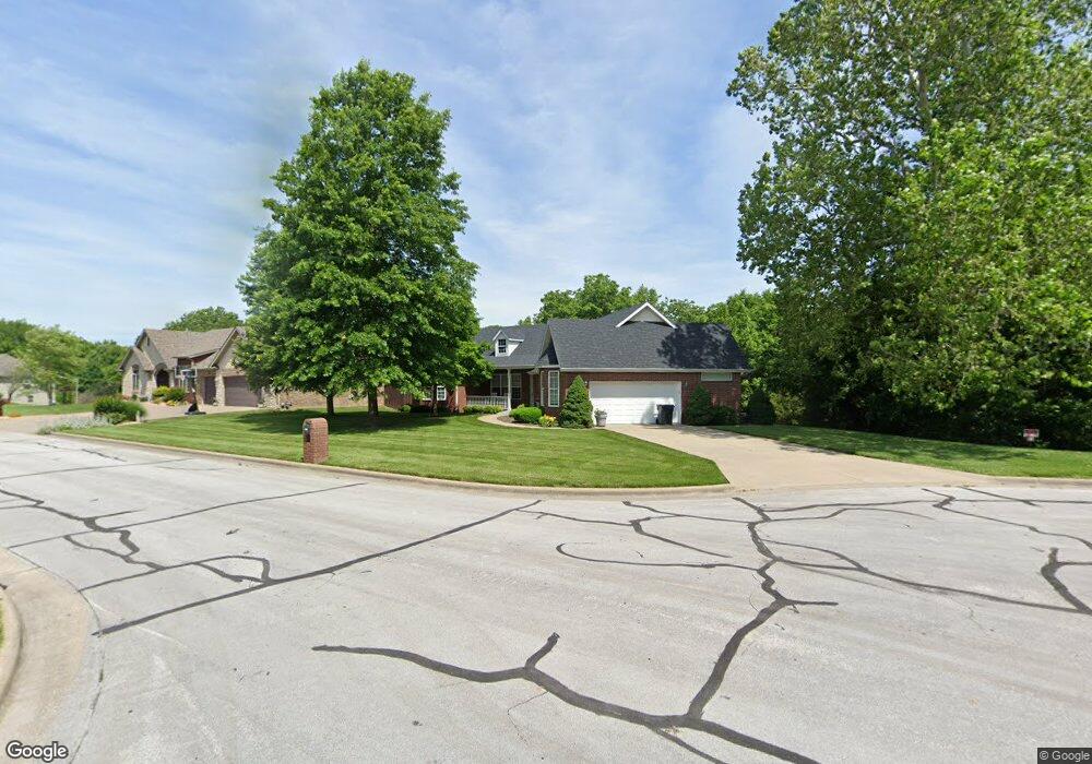
1993 E Burntwood Dr Springfield, MO 65803
Estimated Value: $329,580 - $358,000
About This Home
This home is located at 1993 E Burntwood Dr, Springfield, MO 65803 and is currently estimated at $341,145, approximately $173 per square foot. 1993 E Burntwood Dr is a home located in Greene County with nearby schools including Pleasant View K-8 School, Hillcrest High School, and Dayspring Christian School.
Ownership History
We collect this data history from publicly available records. To have your information removed, we recommend requesting removal directly through your county’s website.
Purchase Details
Home Financials for this Owner
Home Financials are based on the most recent Mortgage that was taken out on this home.Purchase Details
Purchase History
We collect this data history from publicly available records. To have your information removed, we recommend requesting removal directly through your county’s website.
| Date | Buyer | Sale Price | Title Company |
|---|---|---|---|
| -- | None Listed On Document | ||
| -- | None Available |
Mortgage History
We collect this data history from publicly available records. To have your information removed, we recommend requesting removal directly through your county’s website.
| Date | Status | Borrower | Loan Amount |
|---|---|---|---|
| Open | $199,500 |
Tax History
We collect this data history from publicly available records. To have your information removed, we recommend requesting removal directly through your county’s website.
| Year | Tax Paid | Tax Assessment Tax Assessment Total Assessment is a certain percentage of the fair market value that is determined by local assessors to be the total taxable value of land and additions on the property. | Land | Improvement |
|---|---|---|---|---|
| 2025 | $2,533 | $46,840 | $7,700 | $39,140 |
| 2024 | $2,379 | $41,100 | $5,700 | $35,400 |
| 2023 | $2,367 | $41,100 | $5,700 | $35,400 |
| 2022 | $2,168 | $36,900 | $5,700 | $31,200 |
| 2021 | $2,074 | $36,900 | $5,700 | $31,200 |
| 2020 | $2,097 | $35,420 | $5,700 | $29,720 |
| 2019 | $2,038 | $35,420 | $5,700 | $29,720 |
| 2018 | $1,796 | $31,050 | $5,320 | $25,730 |
| 2017 | $1,780 | $31,050 | $5,320 | $25,730 |
| 2016 | $1,776 | $31,050 | $5,320 | $25,730 |
| 2015 | $1,763 | $31,050 | $5,320 | $25,730 |
| 2014 | $1,741 | $30,690 | $5,320 | $25,370 |
Map
- 2393 E Valley Water Mill Rd
- 2415 E Valley Water Mill Rd
- 3628 N Aspen Cir
- 3363 N Wildan Ct
- 4260 N State Highway H
- 3319 N Dysart Ave
- 4541b N Lanier Ln
- 4541 N Lanier Ln
- 3983 N Courtney Cir
- 1570 E Snider St
- 1348 E Arlington St
- 3734 N Rogers Ave
- 3454 N Prince Ln
- 3107 N Neergard Ave
- 1502 E McClernon St
- 3301 N Fremont Ave
- 1255 E Bonaire Dr
- 2264 E Nora St
- 1050 E Camorene St
- 2325 E Livingston St
- 1987 E Burntwood Dr
- 3826 N Mill Ridge Ave
- 1994 E Burntwood Dr
- 2000 E Burntwood Dr
- 3814 N Mill Ridge Ave
- 2006 E Burntwood Dr
- 1995 E Wheatridge Dr
- 3827 N Mill Ridge Ave
- 3786 N Valley Place
- 1989 E Wheatridge Dr
- 1969 E Burntwood Dr
- 3780 N Valley Place
- 1970 E Burntwood Dr
- 1977 E Wheatridge Dr
- 0 N Valley Place
- 1996 E Wheatridge Dr
- 3774 N Mill Ridge Ave
- 1971 E Wheatridge Dr
- 3776 N Valley Place
- 1964 E Burntwood Dr
Ask me questions while you tour the home.