Estimated Value: $303,000 - $445,000
About This Home
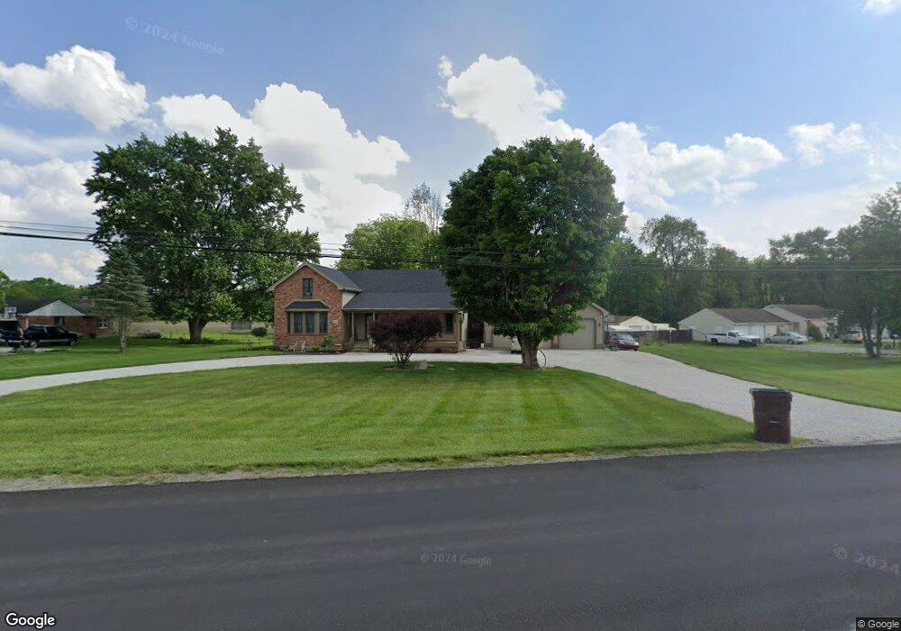
This home is located at 1996 E State Route 55, Troy, OH 45373 and is currently estimated at $370,412, approximately $130 per square foot. 1996 E State Route 55 is a home located in Miami County with nearby schools including Miami East Elementary School, Miami East Junior High School, and Miami East High School.
Ownership History
We collect this data history from publicly available records. To have your information removed, we recommend requesting removal directly through your county’s website.
Purchase Details
Home Financials for this Owner
Home Financials are based on the most recent Mortgage that was taken out on this home.Purchase Details
Purchase Details
Home Financials for this Owner
Home Financials are based on the most recent Mortgage that was taken out on this home.Purchase Details
Home Financials for this Owner
Home Financials are based on the most recent Mortgage that was taken out on this home.Purchase Details
Purchase History
We collect this data history from publicly available records. To have your information removed, we recommend requesting removal directly through your county’s website.
| Date | Buyer | Sale Price | Title Company |
|---|---|---|---|
| $275,000 | None Available | ||
| -- | Orner Dan R | ||
| -- | None Available | ||
| $231,900 | -- | ||
| $185,000 | -- | ||
| $65,000 | -- |
Mortgage History
We collect this data history from publicly available records. To have your information removed, we recommend requesting removal directly through your county’s website.
| Date | Status | Borrower | Loan Amount |
|---|---|---|---|
| Open | $220,000 | ||
| Previous Owner | -- | ||
| Previous Owner | $148,000 |
Tax History
We collect this data history from publicly available records. To have your information removed, we recommend requesting removal directly through your county’s website.
| Year | Tax Paid | Tax Assessment Tax Assessment Total Assessment is a certain percentage of the fair market value that is determined by local assessors to be the total taxable value of land and additions on the property. | Land | Improvement |
|---|---|---|---|---|
| 2025 | $3,651 | $116,980 | $13,480 | $103,500 |
| 2024 | $3,651 | $78,580 | $11,410 | $67,170 |
| 2023 | $2,697 | $78,580 | $11,410 | $67,170 |
| 2022 | $2,769 | $78,580 | $11,410 | $67,170 |
| 2021 | $2,282 | $60,450 | $8,790 | $51,660 |
| 2020 | $2,293 | $60,450 | $8,790 | $51,660 |
| 2019 | $2,330 | $60,450 | $8,790 | $51,660 |
| 2018 | $2,320 | $58,910 | $6,690 | $52,220 |
| 2017 | $2,298 | $58,910 | $6,690 | $52,220 |
| 2016 | $1,839 | $58,910 | $6,690 | $52,220 |
| 2015 | $1,861 | $56,670 | $6,440 | $50,230 |
| 2014 | $1,861 | $56,670 | $6,440 | $50,230 |
| 2013 | $1,871 | $56,670 | $6,440 | $50,230 |
Map
- 2120 E State Route 55
- 2033 Lefevre Rd
- 0 E State Route 55 Unit K30-005510
- 0 E State Route 55 Unit K30-005520
- 1233 Heritage Dr
- 1141 Lee Rd
- 1234 Gettysburg Dr
- 1655 Saratoga Dr
- 1142 Lee Rd
- 617 Locust Ln
- 1367 Sheridan Ct
- 1728 Hunters Ridge Dr
- 486 Locust Ln
- 1417 Skylark Dr
- 0 St Rt 718 Unit Lot 1
- 1766 Saratoga Dr
- 1178 Stonyridge Ave
- 810 Meadow Ln
- 1337 Maplecrest Dr
- 1263 Cole Harbor Dr
- 1974 E State Route 55
- 2008 Ohio 55
- 2008 E State Route 55
- 1960 E Staunton Rd
- 2030 E State Route 55
- 1948 E Staunton Rd
- 1948 Old Staunton Rd
- 1936 E Staunton Rd
- 2050 E State Route 55
- 1928 E Staunton Rd
- 1928 Old Staunton Rd
- 1879 Old Staunton Rd
- 2066 E State Route 55
- 1890 E Staunton Rd
- 2086 E State Route 55
- 2021 Woodcliffe Dr
- 1995 Woodcliffe Dr
- 1989 Woodcliffe Dr
- 1870 Old Staunton Rd
- 1981 Woodcliffe Dr
Ask me questions while you tour the home.