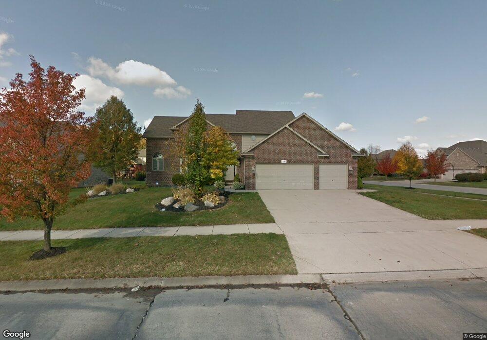
19961 Mapleton Dr Macomb, MI 48044
Macomb AreaEstimated Value: $504,000 - $586,000
About This Home
This home is located at 19961 Mapleton Dr, Macomb, MI 48044 and is currently estimated at $541,761, approximately $186 per square foot. 19961 Mapleton Dr is a home located in Macomb County with nearby schools including Cherokee Elementary School, Wyandot Middle School, and Chippewa Valley High School.
Ownership History
We collect this data history from publicly available records. To have your information removed, we recommend requesting removal directly through your county’s website.
Purchase Details
Purchase Details
Home Financials for this Owner
Home Financials are based on the most recent Mortgage that was taken out on this home.Home Values in the Area
Average Home Value in this Area
Purchase History
We collect this data history from publicly available records. To have your information removed, we recommend requesting removal directly through your county’s website.
| Date | Buyer | Sale Price | Title Company |
|---|---|---|---|
| $403,194 | None Available | ||
| $364,900 | Greco |
Mortgage History
We collect this data history from publicly available records. To have your information removed, we recommend requesting removal directly through your county’s website.
| Date | Status | Borrower | Loan Amount |
|---|---|---|---|
| Open | $6,000 | ||
| Open | $226,063 | ||
| Closed | $18,409 | ||
| Closed | $224,701 | ||
| Closed | $217,694 | ||
| Previous Owner | $18,245 | ||
| Previous Owner | $346,655 | ||
| Previous Owner | $10,000 | ||
| Previous Owner | $296,000 | ||
| Previous Owner | $304,000 |
Tax History
We collect this data history from publicly available records. To have your information removed, we recommend requesting removal directly through your county’s website.
| Year | Tax Paid | Tax Assessment Tax Assessment Total Assessment is a certain percentage of the fair market value that is determined by local assessors to be the total taxable value of land and additions on the property. | Land | Improvement |
|---|---|---|---|---|
| 2026 | $7,464 | $253,700 | $0 | $0 |
| 2025 | $4,381 | $241,200 | $0 | $0 |
| 2024 | $42 | $232,700 | $0 | $0 |
| 2023 | $4,013 | $209,900 | $0 | $0 |
| 2022 | $7,136 | $187,000 | $0 | $0 |
| 2021 | $5,321 | $172,600 | $0 | $0 |
| 2020 | $3,638 | $169,400 | $0 | $0 |
| 2019 | $6,240 | $161,500 | $0 | $0 |
| 2018 | $5,968 | $156,600 | $0 | $0 |
| 2017 | $5,900 | $150,190 | $34,500 | $115,690 |
| 2016 | $4,065 | $150,190 | $0 | $0 |
| 2015 | $4,863 | $141,290 | $0 | $0 |
| 2014 | $4,863 | $129,630 | $23,500 | $106,130 |
| 2013 | $8,825 | $129,630 | $0 | $0 |
Map
- 20491 Windemere Dr
- 45021 Riverwoods Dr
- 19298 Potomac Dr Lot #179 Rd
- 20547 Windham Dr
- 45483 Shoal Dr
- 46582 Middle Brook Dr
- 46597 Covington Dr
- 20768 Burn Dr
- 20776 Burn Dr
- 20787 Burn Dr
- 45926 Riverview Ct
- 20795 Burn Dr
- 20803 Burn Dr
- 20811 Burn Dr
- 20819 Burn Dr
- 45658 Rathmore Dr Unit 272
- 20194 Calumet Dr
- 20485 Villa Grande Cir
- 45765 Cagney Dr Unit 53
- 18894 Via Firenze
- 19945 Mapleton Dr
- 19956 Pemberton Ct
- 19914 Pemberton Ct
- 19929 Mapleton Dr Unit Bldg-Unit
- 19929 Mapleton Dr
- 45729 Riverwoods Dr
- 45578 Yorkshire Dr
- 45768 Riverwoods Dr
- 45800 Riverwoods Dr
- 45832 Riverwoods Dr
- 19913 Mapleton Dr
- 19872 Pemberton Ct
- 45844 Riverwoods Dr
- 45697 Riverwoods Dr
- 45736 Riverwoods Dr
- 45566 Yorkshire Dr
- 45851 Riverwoods Dr
- 45819 Winthrop Place
- 19904 Mapleton Dr
- 45665 Riverwoods Dr
Ask me questions while you tour the home.