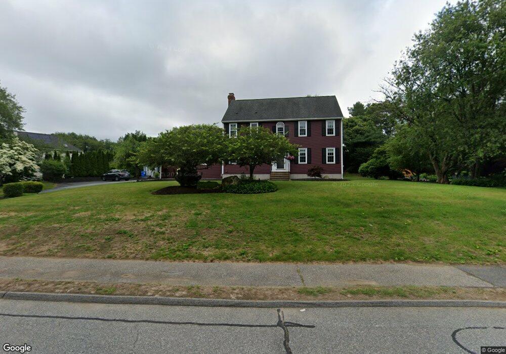
2 Coldbrook Rd Millbury, MA 01527
Estimated Value: $692,912 - $830,000
4
Beds
3
Baths
2,370
Sq Ft
$327/Sq Ft
Est. Value
About This Home
This home is located at 2 Coldbrook Rd, Millbury, MA 01527 and is currently estimated at $774,478, approximately $326 per square foot. 2 Coldbrook Rd is a home located in Worcester County with nearby schools including Elmwood Street Elementary School, Raymond E. Shaw Elementary School, and Millbury Junior/Senior High School.
Ownership History
Date
Name
Owned For
Owner Type
Purchase Details
Closed on
Oct 11, 2016
Sold by
Raymond Roger
Bought by
Capistron Nicholas and Capistron Teresa M
Current Estimated Value
Home Financials for this Owner
Home Financials are based on the most recent Mortgage that was taken out on this home.
Original Mortgage
$389,405
Outstanding Balance
$306,796
Interest Rate
3.43%
Mortgage Type
New Conventional
Estimated Equity
$467,682
Purchase Details
Closed on
Jul 17, 2013
Sold by
Raymond Roger and Raymond Deborah A
Bought by
Raymond Roger
Home Financials for this Owner
Home Financials are based on the most recent Mortgage that was taken out on this home.
Original Mortgage
$194,000
Interest Rate
3.92%
Mortgage Type
New Conventional
Purchase Details
Closed on
May 6, 1991
Sold by
Valley Homes Inc
Bought by
Raymond Roger and Raymond Deborah A
Create a Home Valuation Report for This Property
The Home Valuation Report is an in-depth analysis detailing your home's value as well as a comparison with similar homes in the area
Home Values in the Area
Average Home Value in this Area
Purchase History
| Date | Buyer | Sale Price | Title Company |
|---|---|---|---|
| Capistron Nicholas | $409,900 | -- | |
| Capistron Nicholas A | $409,900 | -- | |
| Raymond Roger | -- | -- | |
| Raymond Roger J | -- | -- | |
| Raymond Roger J | -- | -- | |
| Raymond Roger | $179,000 | -- | |
| Raymond Roger J | $179,000 | -- |
Source: Public Records
Mortgage History
| Date | Status | Borrower | Loan Amount |
|---|---|---|---|
| Open | Capistron Nicholas A | $389,405 | |
| Closed | Capistron Nicholas A | $389,405 | |
| Previous Owner | Raymond Roger J | $194,000 |
Source: Public Records
Tax History
| Year | Tax Paid | Tax Assessment Tax Assessment Total Assessment is a certain percentage of the fair market value that is determined by local assessors to be the total taxable value of land and additions on the property. | Land | Improvement |
|---|---|---|---|---|
| 2025 | $8,369 | $625,000 | $144,400 | $480,600 |
| 2024 | $7,676 | $580,200 | $133,700 | $446,500 |
| 2023 | $6,965 | $482,000 | $93,700 | $388,300 |
| 2022 | $6,162 | $410,800 | $90,000 | $320,800 |
| 2021 | $6,079 | $394,000 | $90,000 | $304,000 |
| 2020 | $4,365 | $388,400 | $90,000 | $298,400 |
| 2019 | $5,744 | $362,400 | $78,400 | $284,000 |
| 2018 | $5,887 | $360,300 | $92,000 | $268,300 |
| 2017 | $5,481 | $333,600 | $92,000 | $241,600 |
| 2016 | $5,312 | $322,700 | $92,000 | $230,700 |
| 2015 | $5,229 | $317,700 | $97,900 | $219,800 |
| 2014 | $4,682 | $273,800 | $87,000 | $186,800 |
Source: Public Records
Map
Nearby Homes
- 46 Lexington Rd
- Lot 1 Cooper Rd
- 8 Autumn Gate Cir
- 2 Riverlin Pkwy
- 28 Cortland Way
- 9 Danielle Dr
- 26 Leslie Ln
- 7 Canal St
- 17 Lincoln Ave
- 18 Lincoln Ave
- 75 Potter Hill Rd
- 57 Barbara Jean St
- 37-39 Main St
- 2 Jessica j Dr
- 75 Main St
- 19 Fitzpatrick Rd
- 5 Ann Dr Unit 5
- 8 Sycamore Cir
- 2 Wilson Rd Unit B
- 2 Wilson Rd Unit A
Your Personal Tour Guide
Ask me questions while you tour the home.