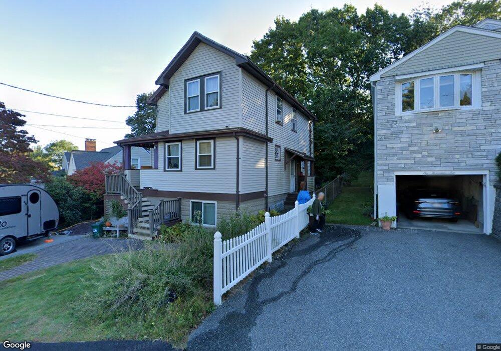
2 Governor Rd Arlington, MA 02474
Arlington Heights NeighborhoodEstimated Value: $927,000 - $1,034,860
3
Beds
1
Bath
1,494
Sq Ft
$651/Sq Ft
Est. Value
About This Home
This home is located at 2 Governor Rd, Arlington, MA 02474 and is currently estimated at $972,465, approximately $650 per square foot. 2 Governor Rd is a home located in Middlesex County with nearby schools including M. Norcross Stratton Elementary School, Ottoson Middle School, and Arlington High School.
Create a Home Valuation Report for This Property
The Home Valuation Report is an in-depth analysis detailing your home's value as well as a comparison with similar homes in the area
Home Values in the Area
Average Home Value in this Area
Tax History
We collect this data history from publicly available records. To have your information removed, we recommend requesting removal directly through your county’s website.
| Year | Tax Paid | Tax Assessment Tax Assessment Total Assessment is a certain percentage of the fair market value that is determined by local assessors to be the total taxable value of land and additions on the property. | Land | Improvement |
|---|---|---|---|---|
| 2025 | $9,229 | $856,900 | $459,800 | $397,100 |
| 2024 | $8,651 | $816,900 | $454,200 | $362,700 |
| 2023 | $8,473 | $755,800 | $409,300 | $346,500 |
| 2022 | $8,075 | $707,100 | $392,500 | $314,600 |
| 2021 | $7,918 | $698,200 | $392,500 | $305,700 |
| 2020 | $7,724 | $698,400 | $392,500 | $305,900 |
| 2019 | $7,275 | $646,100 | $398,100 | $248,000 |
| 2018 | $6,613 | $545,200 | $297,200 | $248,000 |
| 2017 | $6,496 | $517,200 | $269,200 | $248,000 |
| 2016 | $6,476 | $505,900 | $257,900 | $248,000 |
| 2015 | $6,140 | $453,100 | $218,700 | $234,400 |
Source: Public Records
Map
Nearby Homes
- 163 Woodside Ln
- 67 Ronald Rd
- 34 Washington St Unit 34
- 12 Vista Cir
- 52-56 Dudley St
- 119 Ridge St
- 64 Overlook Rd
- 167-169 Summer St
- 115 Ridge St
- 323 Ridge St
- 993 Massachusetts Ave Unit 113
- 990 Massachusetts Ave Unit 11
- 31 Coleman Rd Unit 1
- 28 Forest St
- 9 Bow St
- 21 Fessenden Rd Unit 23
- 29 Coleman Rd Unit A
- 1205 Massachusetts Ave
- 78 Hutchinson Rd
- 49 Walnut St
- 6 Governor Rd
- 70 Hemlock St
- 11 Governor Rd
- 10 Governor Rd
- 68 Hemlock St
- 68 Hemlock St Unit 1
- 77 Hemlock St
- 2 Janet Rd
- 69 Hemlock St
- 64 Hemlock St
- 64 Hemlock St Unit 1
- 64 Hemlock St Unit 2
- 83 Charles St
- 80 Hemlock St
- 18 Governor Rd
- 58 Hemlock St Unit 60
- 58 Hemlock St Unit 1
- 58-60 Hemlock St
- 19 Governor Rd
- 91 Hemlock St
Your Personal Tour Guide
Ask me questions while you tour the home.