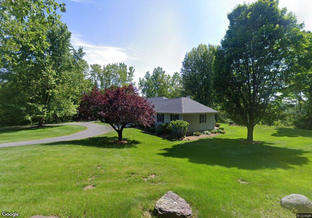
2 Line Rd Holyoke, MA 01040
Estimated Value: $466,000 - $617,000
3
Beds
2
Baths
2,020
Sq Ft
$256/Sq Ft
Est. Value
About This Home
This home is located at 2 Line Rd, Holyoke, MA 01040 and is currently estimated at $516,814, approximately $255 per square foot. 2 Line Rd is a home located in Hampden County with nearby schools including Lt. Elmer J. McMahon Elementary School, Lt. Clayre Sullivan Elementary School, and Holyoke High School.
Ownership History
Date
Name
Owned For
Owner Type
Purchase Details
Closed on
Mar 18, 2009
Sold by
Callahan Maureen H and Callahan William
Bought by
Egan Maurice F and Callahan Maureen H
Current Estimated Value
Purchase Details
Closed on
Mar 30, 2007
Sold by
Callahan William and Callahan Helen
Bought by
Callahan Maureen H and Callahan William
Purchase Details
Closed on
Dec 17, 1993
Sold by
Western View Dev Corp
Bought by
Callahan William and Callahan Helan
Create a Home Valuation Report for This Property
The Home Valuation Report is an in-depth analysis detailing your home's value as well as a comparison with similar homes in the area
Home Values in the Area
Average Home Value in this Area
Purchase History
| Date | Buyer | Sale Price | Title Company |
|---|---|---|---|
| Egan Maurice F | -- | -- | |
| Callahan Maureen H | -- | -- | |
| Callahan William | $39,500 | -- |
Source: Public Records
Mortgage History
| Date | Status | Borrower | Loan Amount |
|---|---|---|---|
| Previous Owner | Callahan William | $50,000 |
Source: Public Records
Tax History
| Year | Tax Paid | Tax Assessment Tax Assessment Total Assessment is a certain percentage of the fair market value that is determined by local assessors to be the total taxable value of land and additions on the property. | Land | Improvement |
|---|---|---|---|---|
| 2025 | $7,698 | $440,900 | $113,000 | $327,900 |
| 2024 | $7,430 | $392,100 | $107,500 | $284,600 |
| 2023 | $7,110 | $379,000 | $107,500 | $271,500 |
| 2022 | $6,866 | $356,500 | $107,500 | $249,000 |
| 2021 | $6,677 | $346,500 | $107,500 | $239,000 |
| 2020 | $6,352 | $332,900 | $107,500 | $225,400 |
| 2019 | $6,223 | $322,600 | $107,500 | $215,100 |
| 2018 | $6,372 | $333,100 | $107,500 | $225,600 |
| 2017 | $6,386 | $333,100 | $107,500 | $225,600 |
| 2016 | $6,308 | $329,900 | $110,500 | $219,400 |
| 2015 | $6,281 | $329,900 | $110,500 | $219,400 |
Source: Public Records
Map
Nearby Homes
- 7 Western View Rd
- 28 Cook Rd
- 62 Campbell Dr
- 11 Cook Rd
- 36 County Rd
- 14 Melinda Ln
- 29 Sandra Rd
- 36 Line St
- 11 Laurel Dr
- 121 W Meadowview Rd
- 1 Plain St
- 32 Maple Crest Cir Unit G
- 3 Homestead Ave
- 1 Homestead Ave
- 2 Homestead Ave
- 36 & 36R Holly Cir
- 21 Francis Ave
- 37 Bemis Rd
- 74 Granville St
- 1225 Hampden St
- 6 Line Rd
- 15 Lemay Dr
- 0 Southampton Rd
- 19 Western View Rd
- 14 Western View Rd
- 225 Southampton Rd
- 203 Southampton Rd
- 17 Western View Rd
- 206 Southampton Rd
- 101 Cross Rd
- 7 Line Rd
- 208 Southampton Rd
- 12 Western View Rd
- 107 Cross Rd Unit 107
- 214 Southampton Rd
- 210 Southampton Rd
- 199 Southampton Rd
- 1 White Birch Way
- 10 Western View Rd
- 115 Cross Rd
Your Personal Tour Guide
Ask me questions while you tour the home.