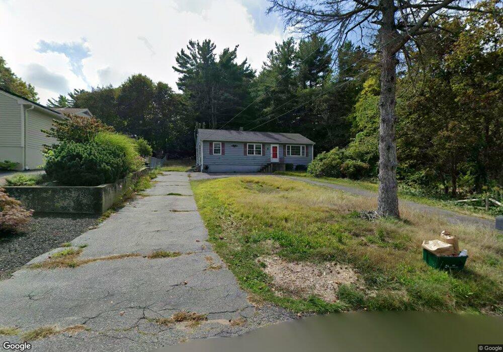
2 Malcolm Rd Gloucester, MA 01930
West Gloucester NeighborhoodEstimated Value: $521,000 - $675,000
3
Beds
1
Bath
1,144
Sq Ft
$518/Sq Ft
Est. Value
About This Home
This home is located at 2 Malcolm Rd, Gloucester, MA 01930 and is currently estimated at $592,869, approximately $518 per square foot. 2 Malcolm Rd is a home located in Essex County with nearby schools including West Parish, Ralph B O'maley Middle School, and Gloucester High School.
Ownership History
Date
Name
Owned For
Owner Type
Purchase Details
Closed on
Jun 14, 1991
Sold by
Zinner Clifford J
Bought by
Goulart Jose H
Current Estimated Value
Home Financials for this Owner
Home Financials are based on the most recent Mortgage that was taken out on this home.
Original Mortgage
$115,000
Interest Rate
9.39%
Mortgage Type
Purchase Money Mortgage
Create a Home Valuation Report for This Property
The Home Valuation Report is an in-depth analysis detailing your home's value as well as a comparison with similar homes in the area
Home Values in the Area
Average Home Value in this Area
Purchase History
| Date | Buyer | Sale Price | Title Company |
|---|---|---|---|
| Goulart Jose H | $136,500 | -- |
Source: Public Records
Mortgage History
| Date | Status | Borrower | Loan Amount |
|---|---|---|---|
| Closed | Goulart Jose H | $112,000 | |
| Closed | Goulart Jose H | $115,000 |
Source: Public Records
Tax History
| Year | Tax Paid | Tax Assessment Tax Assessment Total Assessment is a certain percentage of the fair market value that is determined by local assessors to be the total taxable value of land and additions on the property. | Land | Improvement |
|---|---|---|---|---|
| 2025 | $4,603 | $473,600 | $185,200 | $288,400 |
| 2024 | $4,478 | $460,200 | $176,300 | $283,900 |
| 2023 | $4,493 | $424,300 | $157,400 | $266,900 |
| 2022 | $4,421 | $376,900 | $137,000 | $239,900 |
| 2021 | $4,442 | $357,100 | $124,500 | $232,600 |
| 2020 | $4,118 | $334,000 | $124,500 | $209,500 |
| 2019 | $4,066 | $320,400 | $124,500 | $195,900 |
| 2018 | $3,995 | $309,000 | $124,500 | $184,500 |
| 2017 | $3,890 | $294,900 | $118,600 | $176,300 |
| 2016 | $3,638 | $267,300 | $123,700 | $143,600 |
| 2015 | $3,589 | $262,900 | $123,700 | $139,200 |
Source: Public Records
Map
Nearby Homes
- 5 Lepage Ln
- 24 Cobblestone Ln Unit 603
- 145 Essex Ave Unit 512
- 145 Essex Ave Unit 402
- 5 Samoset Rd Unit B
- 18 Lyndale Ave
- 5 Marshfield St
- 6 Stanwood Point Unit B
- 13 Leslie o Johnson Rd
- 15 Harvard St
- 3 Rockland St
- 20 Beacon St
- 20 Beacon St Unit 2
- 20 Beacon St Unit 1
- 368 Essex Ave
- 6 Monroe Ct
- 120 Washington St
- 33 Middle St
- 35 Middle St Unit 4
- 8 Mystic Ave
Your Personal Tour Guide
Ask me questions while you tour the home.