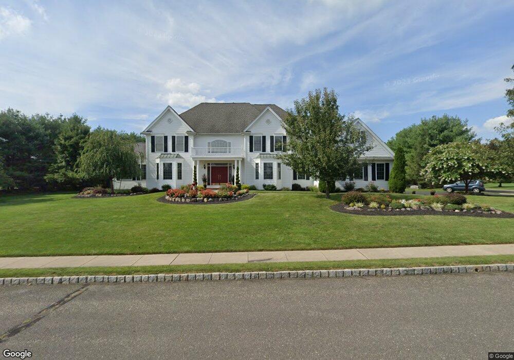
2 Michael Dr Cream Ridge, NJ 08514
Estimated Value: $1,242,867 - $1,458,000
6
Beds
6
Baths
5,245
Sq Ft
$250/Sq Ft
Est. Value
About This Home
This home is located at 2 Michael Dr, Cream Ridge, NJ 08514 and is currently estimated at $1,310,217, approximately $249 per square foot. 2 Michael Dr is a home located in Monmouth County with nearby schools including Newell Elementary School, Stonebridge Middle School, and Allentown High School.
Ownership History
Date
Name
Owned For
Owner Type
Purchase Details
Closed on
Aug 20, 2008
Sold by
Wachovia Bank
Bought by
Illes William and Illes Nancy
Current Estimated Value
Home Financials for this Owner
Home Financials are based on the most recent Mortgage that was taken out on this home.
Original Mortgage
$526,500
Outstanding Balance
$348,731
Interest Rate
6.69%
Mortgage Type
Negative Amortization
Estimated Equity
$961,486
Purchase Details
Closed on
Aug 22, 2001
Sold by
Dr Horton Inc
Bought by
Jones Cynthia Seymour
Home Financials for this Owner
Home Financials are based on the most recent Mortgage that was taken out on this home.
Original Mortgage
$387,100
Interest Rate
6.99%
Create a Home Valuation Report for This Property
The Home Valuation Report is an in-depth analysis detailing your home's value as well as a comparison with similar homes in the area
Home Values in the Area
Average Home Value in this Area
Purchase History
| Date | Buyer | Sale Price | Title Company |
|---|---|---|---|
| Illes William | $585,000 | None Available | |
| Jones Cynthia Seymour | $475,000 | -- |
Source: Public Records
Mortgage History
| Date | Status | Borrower | Loan Amount |
|---|---|---|---|
| Open | Illes William | $526,500 | |
| Previous Owner | Jones Cynthia Seymour | $387,100 |
Source: Public Records
Tax History
| Year | Tax Paid | Tax Assessment Tax Assessment Total Assessment is a certain percentage of the fair market value that is determined by local assessors to be the total taxable value of land and additions on the property. | Land | Improvement |
|---|---|---|---|---|
| 2025 | $18,869 | $1,174,300 | $256,500 | $917,800 |
| 2024 | $18,721 | $875,200 | $167,600 | $707,600 |
| 2023 | $18,721 | $842,900 | $167,600 | $675,300 |
| 2022 | $16,005 | $728,000 | $117,600 | $610,400 |
| 2021 | $16,005 | $660,000 | $107,600 | $552,400 |
| 2020 | $15,727 | $651,500 | $107,600 | $543,900 |
| 2019 | $15,633 | $652,200 | $107,600 | $544,600 |
| 2018 | $15,571 | $640,000 | $107,600 | $532,400 |
| 2017 | $15,306 | $637,500 | $137,600 | $499,900 |
| 2016 | $14,941 | $629,900 | $142,600 | $487,300 |
| 2015 | $14,880 | $634,000 | $162,600 | $471,400 |
| 2014 | $15,134 | $649,800 | $127,600 | $522,200 |
Source: Public Records
Map
Nearby Homes
- 2 Matthew Ct
- 193 Burlington Path Rd
- 168 Burlington Path Rd
- 0 Route 537 Unit 22533818
- 95 Holmes Mill Rd
- 151 Walnford Rd
- L:24 01 Route 537
- 7 Longview Trail
- 11 Mulberry Dr
- 857 Monmouth Rd
- 807 Monmouth Rd
- 17 Cutter Ct
- 47 Imlaystown Rd
- 11 Shevchenko Ave
- 393 E Millstream Rd
- 170-174 W Millstream Rd
- 23 Kuzyk Rd
- 43 Kuzyk Rd
- 724 Monmouth Rd Unit 34
- 134 Crosswicks Ellisdale Rd
- 1 Michael Dr
- 4 Michael Dr
- 3 Francesca Ln
- 7 Victoria Ct
- 9 Victoria Ct
- 3 Michael Dr
- 5 Victoria Ct
- 202 Burlington Path Rd
- 6 Michael Dr
- 8 Victoria Ct
- 5 Michael Dr
- 3 Victoria Ct
- 200 Burlington Path Rd
- 6 Victoria Ct
- 10 Victoria Ct
- 197 Burlington Path Rd
- 191 Burlington Path Rd
- 8 Michael Dr
- 12 Victoria Ct
- 189 Burlington Path Rd
Your Personal Tour Guide
Ask me questions while you tour the home.