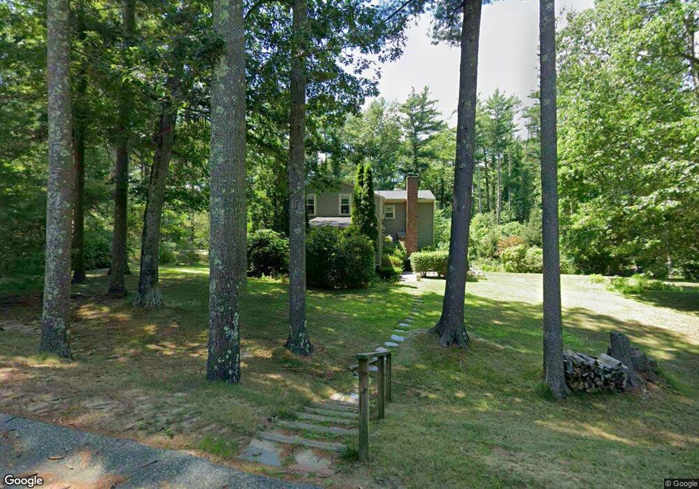
2 Perry Dr Duxbury, MA 02332
Estimated Value: $1,377,253 - $1,511,000
4
Beds
3
Baths
2,574
Sq Ft
$565/Sq Ft
Est. Value
About This Home
This home is located at 2 Perry Dr, Duxbury, MA 02332 and is currently estimated at $1,453,563, approximately $564 per square foot. 2 Perry Dr is a home located in Plymouth County with nearby schools including Chandler Elementary School, Alden School, and Duxbury Middle School.
Ownership History
Date
Name
Owned For
Owner Type
Purchase Details
Closed on
Aug 15, 2012
Sold by
Dumont Stephen and Dumont Pamela J
Bought by
Gallagher Francis
Current Estimated Value
Home Financials for this Owner
Home Financials are based on the most recent Mortgage that was taken out on this home.
Original Mortgage
$502,000
Outstanding Balance
$328,920
Interest Rate
3%
Mortgage Type
New Conventional
Estimated Equity
$1,124,643
Purchase Details
Closed on
Sep 19, 2008
Sold by
Mcgrath Neal and Mcgrath Lorraine
Bought by
Dumont Stephen and Dumont Pamela J
Purchase Details
Closed on
Jun 29, 2005
Sold by
Mcinerney Rt and Mcinerney
Bought by
Mcgrath Neal and Mcgrath Lorraine
Purchase Details
Closed on
Dec 5, 1990
Sold by
Ryan Judith
Bought by
Mcinerney Robert
Create a Home Valuation Report for This Property
The Home Valuation Report is an in-depth analysis detailing your home's value as well as a comparison with similar homes in the area
Home Values in the Area
Average Home Value in this Area
Purchase History
| Date | Buyer | Sale Price | Title Company |
|---|---|---|---|
| Gallagher Francis | $627,500 | -- | |
| Dumont Stephen | $710,000 | -- | |
| Mcgrath Neal | $800,000 | -- | |
| Mcinerney Robert | $330,000 | -- | |
| Dumont Stephen S | $710,000 | -- | |
| Mcgrath Neal D | $800,000 | -- | |
| Mcinerney Robert G | $330,000 | -- |
Source: Public Records
Mortgage History
| Date | Status | Borrower | Loan Amount |
|---|---|---|---|
| Open | Gallagher Francis | $502,000 | |
| Closed | Mcinerney Robert G | $502,000 | |
| Previous Owner | Mcinerney Robert G | $220,000 |
Source: Public Records
Tax History
| Year | Tax Paid | Tax Assessment Tax Assessment Total Assessment is a certain percentage of the fair market value that is determined by local assessors to be the total taxable value of land and additions on the property. | Land | Improvement |
|---|---|---|---|---|
| 2025 | $12,228 | $1,205,900 | $526,800 | $679,100 |
| 2024 | $11,081 | $1,101,500 | $418,500 | $683,000 |
| 2023 | $9,996 | $935,100 | $409,300 | $525,800 |
| 2022 | $10,661 | $830,300 | $347,000 | $483,300 |
| 2021 | $10,818 | $747,100 | $309,800 | $437,300 |
| 2020 | $10,507 | $716,700 | $275,000 | $441,700 |
| 2019 | $10,620 | $723,400 | $271,900 | $451,500 |
| 2018 | $10,191 | $672,200 | $238,100 | $434,100 |
| 2017 | $10,060 | $648,600 | $232,100 | $416,500 |
| 2016 | $9,866 | $634,500 | $218,000 | $416,500 |
| 2015 | $9,970 | $639,100 | $218,000 | $421,100 |
Source: Public Records
Map
Nearby Homes
- 315 Church St
- 74 Teakettle Ln
- 11 Simmons Dr
- 4 Rachael's Ln
- 10 S Pasture Ln
- 66 Simmons Dr
- 118 Enterprise St
- 225 Lincoln St Unit D8
- 225 Lincoln St Unit D8
- 757 West St
- 16 Fieldstone Farm Way
- 15 Fieldstone Farm Way
- 4 Fieldstone Farm Way
- 26 Bowsprit Ln
- 738 Mayflower St
- 45 Red Gold Farm Rd
- 1141 Tremont St
- 184 King Phillips Pathe
- Two Railroad Ave Unit 9
- Two Railroad Ave Unit 10
Your Personal Tour Guide
Ask me questions while you tour the home.