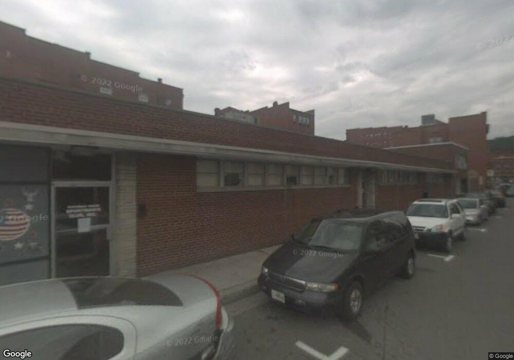
2 Pershing St Cumberland, MD 21502
Estimated Value: $166,023
Studio
--
Bath
6,493
Sq Ft
$26/Sq Ft
Est. Value
About This Home
This home is located at 2 Pershing St, Cumberland, MD 21502 and is currently estimated at $166,023, approximately $25 per square foot. 2 Pershing St is a home located in Allegany County with nearby schools including West Side Elementary School, Braddock Middle School, and Allegany High School.
Ownership History
Date
Name
Owned For
Owner Type
Purchase Details
Closed on
Apr 28, 2009
Sold by
Carter Ronald and Blank Johnny
Bought by
Blank Johnny
Current Estimated Value
Purchase Details
Closed on
Aug 18, 1999
Sold by
R & G Properties
Bought by
Carter Ronald and Blank Johnny
Purchase Details
Closed on
Jun 1, 1984
Sold by
Pershing Bldg Co Corp
Bought by
R-G Properties
Home Financials for this Owner
Home Financials are based on the most recent Mortgage that was taken out on this home.
Original Mortgage
$230,000
Interest Rate
14.29%
Create a Home Valuation Report for This Property
The Home Valuation Report is an in-depth analysis detailing your home's value as well as a comparison with similar homes in the area
Purchase History
| Date | Buyer | Sale Price | Title Company |
|---|---|---|---|
| Blank Johnny | $96,000 | -- | |
| Carter Ronald | $160,000 | -- | |
| R-G Properties | $260,000 | -- |
Source: Public Records
Mortgage History
| Date | Status | Borrower | Loan Amount |
|---|---|---|---|
| Previous Owner | R-G Properties | $230,000 |
Source: Public Records
Tax History
| Year | Tax Paid | Tax Assessment Tax Assessment Total Assessment is a certain percentage of the fair market value that is determined by local assessors to be the total taxable value of land and additions on the property. | Land | Improvement |
|---|---|---|---|---|
| 2025 | $1,445 | $157,700 | $46,200 | $111,500 |
| 2024 | $1,477 | $157,700 | $46,200 | $111,500 |
| 2023 | $1,481 | $159,200 | $46,200 | $113,000 |
| 2022 | $1,687 | $159,200 | $46,200 | $113,000 |
| 2021 | $1,489 | $159,200 | $46,200 | $113,000 |
| 2020 | $1,563 | $168,300 | $46,200 | $122,100 |
| 2019 | $1,559 | $168,300 | $46,200 | $122,100 |
| 2018 | $1,586 | $168,300 | $46,200 | $122,100 |
| 2017 | $1,775 | $188,600 | $0 | $0 |
| 2016 | $1,793 | $187,133 | $0 | $0 |
| 2015 | $1,780 | $185,667 | $0 | $0 |
| 2014 | $1,780 | $184,200 | $0 | $0 |
Source: Public Records
Map
Nearby Homes
- 124 Bedford St
- 217 E Union St
- 147 Polk St
- 229 E Union St
- 315 Frederick St
- 214 S Central Ave
- 306 E Harrison St
- 308 E Harrison St
- 116 Decatur St
- 301 Baltimore Ave
- 230 Bedford St
- 20 N Lee St
- 303 Washington St
- 308 Cumberland St
- 521 Woodside Ave
- 532 Woodside Ave
- 17 N Chase St
- 530 Woodside Ave
- 402 Goethe St
- 703 Baker St
- 18 S Mechanic St
- 14 S Mechanic St
- 3 Pershing St
- 10 S Mechanic St
- 12 S Mechanic St
- 47 Baltimore St
- 60 Pershing St
- 37 Baltimore St
- 55 Baltimore St
- 29 Baltimore St
- 66 Pershing St
- 57 Baltimore St
- 50 N Centre St
- 59 Baltimore St
- 15 S Liberty St
- 301 N Mechanic St
- 19 S Liberty St
- 11 S Liberty St
- 65 Baltimore St
- 19 S Mechanic St
Your Personal Tour Guide
Ask me questions while you tour the home.