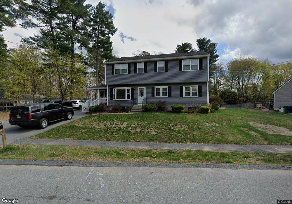
2 Phillip Rd Billerica, MA 01821
Estimated Value: $542,000 - $827,404
3
Beds
4
Baths
2,864
Sq Ft
$243/Sq Ft
Est. Value
About This Home
This home is located at 2 Phillip Rd, Billerica, MA 01821 and is currently estimated at $695,601, approximately $242 per square foot. 2 Phillip Rd is a home located in Middlesex County with nearby schools including Billerica Memorial High School and Knowledge Beginnings South.
Ownership History
Date
Name
Owned For
Owner Type
Purchase Details
Closed on
Sep 26, 2016
Sold by
Shapleigh Kevin S and Shapleigh Janette M
Bought by
Shapleigh Ft and Shapleigh
Current Estimated Value
Purchase Details
Closed on
Aug 31, 2000
Sold by
Hastings Robert P Est and Hastings
Bought by
Shapleigh Kevin S and Shapleigh Janette M
Create a Home Valuation Report for This Property
The Home Valuation Report is an in-depth analysis detailing your home's value as well as a comparison with similar homes in the area
Purchase History
| Date | Buyer | Sale Price | Title Company |
|---|---|---|---|
| Shapleigh Ft | -- | -- | |
| Shapleigh Kevin S | $170,000 | -- |
Source: Public Records
Mortgage History
| Date | Status | Borrower | Loan Amount |
|---|---|---|---|
| Previous Owner | Shapleigh Kevin S | $50,000 | |
| Previous Owner | Shapleigh Kevin S | $50,000 | |
| Previous Owner | Shapleigh Kevin S | $240,000 |
Source: Public Records
Tax History
| Year | Tax Paid | Tax Assessment Tax Assessment Total Assessment is a certain percentage of the fair market value that is determined by local assessors to be the total taxable value of land and additions on the property. | Land | Improvement |
|---|---|---|---|---|
| 2025 | $8,508 | $748,300 | $299,700 | $448,600 |
| 2024 | $8,185 | $725,000 | $290,200 | $434,800 |
| 2023 | $7,973 | $671,700 | $264,100 | $407,600 |
| 2022 | $7,174 | $567,600 | $225,700 | $341,900 |
| 2021 | $6,925 | $532,700 | $198,200 | $334,500 |
| 2020 | $6,774 | $521,500 | $190,400 | $331,100 |
| 2019 | $6,456 | $478,900 | $190,400 | $288,500 |
| 2018 | $6,227 | $438,800 | $169,300 | $269,500 |
| 2017 | $5,887 | $417,800 | $167,500 | $250,300 |
| 2016 | $5,853 | $413,900 | $163,600 | $250,300 |
| 2015 | $5,742 | $409,000 | $158,700 | $250,300 |
| 2014 | $5,775 | $404,100 | $153,700 | $250,400 |
Source: Public Records
Map
Nearby Homes
- 28 Woodlawn Ave
- 15 Phillip Rd
- 14 Cedarwood Rd
- 6 Balsamwood Ave
- 90 Rangeway Rd Unit 204
- 216 Rangeway Rd Unit 1101
- 175 Rangeway Rd
- 405 Boston Rd Unit 6
- 5 Kenmar Dr Unit 9
- 3 Kenmar Dr Unit 3
- 22 Kenmar Dr Unit 200
- 20 Kenmar Dr Unit 189
- 10 Kenmar Dr Unit 40
- 18 Moosewood St
- 41 Boston Rd Unit 485
- 41 Boston Rd Unit 464
- 36 Allen Rd
- 22 Osceola Ln
- 44 Oak St
- 26 Sprague Ave
- 4 Phillip Rd
- 21 New Foster Ave
- 2 Diane Dr
- 1 Diane Dr
- 6 Phillip Rd
- 43 Applewood Ave
- 26 New Foster Ave
- 5 Phillip Rd
- 24 New Foster Ave
- 31 New Foster Ave
- 15 New Foster Ave Unit 17
- 22 New Foster Ave
- 25 Diane Dr
- 3 Diane Dr
- 30 New Foster Ave
- 8 Phillip Rd
- 4 Diane Dr
- 47 Applewood Ave Unit 49
- 31 Applewood Ave
- 7 Phillip Rd
Your Personal Tour Guide
Ask me questions while you tour the home.