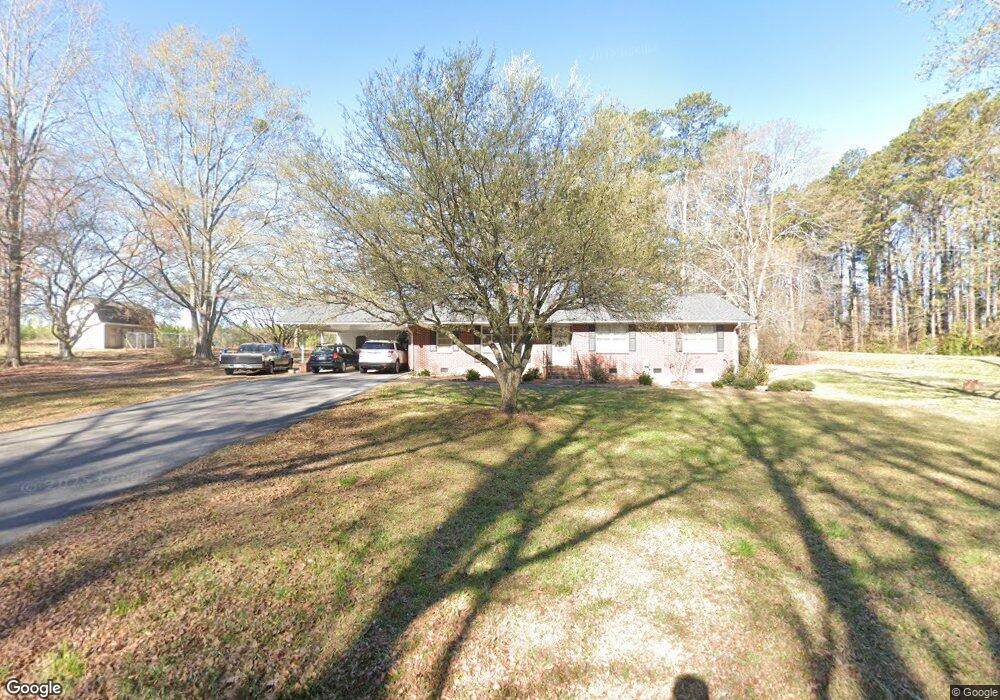
2 Pine St Honea Path, SC 29654
Estimated Value: $230,000 - $271,000
3
Beds
--
Bath
1,895
Sq Ft
$130/Sq Ft
Est. Value
About This Home
This home is located at 2 Pine St, Honea Path, SC 29654 and is currently estimated at $246,588, approximately $130 per square foot. 2 Pine St is a home located in Anderson County with nearby schools including Belton Honea Path High School and Whispering Pines Mennonite School.
Ownership History
Date
Name
Owned For
Owner Type
Purchase Details
Closed on
Apr 25, 2025
Sold by
Hawkins Brandon T and Hawkins Kathryn E
Bought by
Pruitt Richard Henry Amos
Current Estimated Value
Home Financials for this Owner
Home Financials are based on the most recent Mortgage that was taken out on this home.
Original Mortgage
$237,500
Outstanding Balance
$235,142
Interest Rate
6.65%
Mortgage Type
New Conventional
Estimated Equity
$11,446
Purchase Details
Closed on
Sep 11, 2018
Sold by
Hughes Walter Michael and Hughes Benjamin Bolt
Bought by
Hawkins Brandon T and Hawkins Kathryn E
Home Financials for this Owner
Home Financials are based on the most recent Mortgage that was taken out on this home.
Original Mortgage
$131,313
Interest Rate
4.6%
Mortgage Type
New Conventional
Purchase Details
Closed on
Dec 1, 2017
Sold by
Hughes Barbara M
Bought by
Hughes Benjamin Bolt and Hughes Walter Michael
Create a Home Valuation Report for This Property
The Home Valuation Report is an in-depth analysis detailing your home's value as well as a comparison with similar homes in the area
Home Values in the Area
Average Home Value in this Area
Purchase History
| Date | Buyer | Sale Price | Title Company |
|---|---|---|---|
| Pruitt Richard Henry Amos | $250,000 | None Listed On Document | |
| Hawkins Brandon T | $130,000 | None Available | |
| Hughes Benjamin Bolt | -- | None Available |
Source: Public Records
Mortgage History
| Date | Status | Borrower | Loan Amount |
|---|---|---|---|
| Open | Pruitt Richard Henry Amos | $237,500 | |
| Previous Owner | Hawkins Brandon T | $131,313 |
Source: Public Records
Tax History
| Year | Tax Paid | Tax Assessment Tax Assessment Total Assessment is a certain percentage of the fair market value that is determined by local assessors to be the total taxable value of land and additions on the property. | Land | Improvement |
|---|---|---|---|---|
| 2025 | $1,370 | $5,050 | $480 | $4,570 |
| 2024 | $1,370 | $5,050 | $480 | $4,570 |
| 2023 | $1,335 | $5,050 | $480 | $4,570 |
| 2022 | $1,273 | $5,050 | $480 | $4,570 |
| 2021 | $1,104 | $4,290 | $300 | $3,990 |
| 2020 | $1,090 | $4,290 | $300 | $3,990 |
| 2019 | $1,081 | $4,290 | $300 | $3,990 |
| 2018 | $3,047 | $7,490 | $450 | $7,040 |
| 2017 | -- | $4,990 | $300 | $4,690 |
| 2016 | $452 | $4,590 | $240 | $4,350 |
| 2015 | $472 | $4,590 | $240 | $4,350 |
| 2014 | $475 | $4,590 | $240 | $4,350 |
Source: Public Records
Map
Nearby Homes
- 701 W Greer St
- 310 Oak Dr
- 7 Carlisle Dr
- 00 Brook St
- 417 N Main St
- 107 Brookside Cir
- 104 Albert Dr
- 511 N Main St
- 00 Ervin St
- 704 Sherwood Ave
- 600 N Main St
- 5 George St
- 302 W Hampton Ave
- 1 E McGee St
- 229 Armstrong Rd
- 11306 Belton Honea Path Hwy
- 673 N Hwy 178
- 108 W Hampton Ave
- 305 Tribble St
- 307 Tribble St
Your Personal Tour Guide
Ask me questions while you tour the home.