Estimated Value: $354,000 - $393,000
About This Home
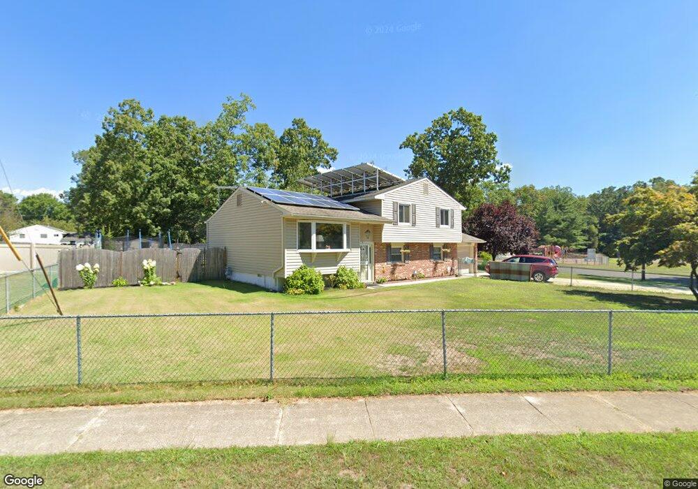
This home is located at 2 Princeton Rd, Atco, NJ 08004 and is currently estimated at $368,807, approximately $191 per square foot. 2 Princeton Rd is a home located in Camden County with nearby schools including Winslow Township High School, Our Lady Of Mt Carmel School, and The Archway School.
Ownership History
We collect this data history from publicly available records. To have your information removed, we recommend requesting removal directly through your county’s website.
Purchase Details
Home Financials for this Owner
Home Financials are based on the most recent Mortgage that was taken out on this home.Purchase Details
Home Financials for this Owner
Home Financials are based on the most recent Mortgage that was taken out on this home.Purchase Details
Home Values in the Area
Average Home Value in this Area
Purchase History
We collect this data history from publicly available records. To have your information removed, we recommend requesting removal directly through your county’s website.
| Date | Buyer | Sale Price | Title Company |
|---|---|---|---|
| $174,000 | -- | ||
| $95,505 | -- | ||
| $80,000 | -- |
Mortgage History
We collect this data history from publicly available records. To have your information removed, we recommend requesting removal directly through your county’s website.
| Date | Status | Borrower | Loan Amount |
|---|---|---|---|
| Open | $139,200 | ||
| Previous Owner | $94,774 | ||
| Closed | $0 |
Tax History
We collect this data history from publicly available records. To have your information removed, we recommend requesting removal directly through your county’s website.
| Year | Tax Paid | Tax Assessment Tax Assessment Total Assessment is a certain percentage of the fair market value that is determined by local assessors to be the total taxable value of land and additions on the property. | Land | Improvement |
|---|---|---|---|---|
| 2025 | $6,846 | $172,100 | $42,000 | $130,100 |
| 2024 | $6,538 | $172,100 | $42,000 | $130,100 |
| 2023 | $6,538 | $172,100 | $42,000 | $130,100 |
| 2022 | $6,337 | $172,100 | $42,000 | $130,100 |
| 2021 | $6,264 | $172,100 | $42,000 | $130,100 |
| 2020 | $6,209 | $172,100 | $42,000 | $130,100 |
| 2019 | $6,172 | $172,100 | $42,000 | $130,100 |
| 2018 | $6,087 | $172,100 | $42,000 | $130,100 |
| 2017 | $5,979 | $172,100 | $42,000 | $130,100 |
| 2016 | $5,903 | $172,100 | $42,000 | $130,100 |
| 2015 | $5,817 | $172,100 | $42,000 | $130,100 |
| 2014 | $5,688 | $172,100 | $42,000 | $130,100 |
Map
- 11 Yale Rd
- 10 Dartmouth Dr
- 22 Josie Ln
- 14 Briarcliff Rd
- 7 Woodstream Dr
- 11 Windingbrook Ct
- 442 Waterfords Edge Ct
- 24 Oakton Dr
- 462 Atco Ave
- 2107 Cooper Rd
- 275 White Horse Pike
- 19 Woodvale Dr
- 1 Lily Ct
- 40 Windingbrook Dr
- 2297 Memorial Ct
- 48 Senators Way
- 3203-3 Route 73
- 80 Senators Way
- 280 Front St
- 2544 Andria Ct
Ask me questions while you tour the home.