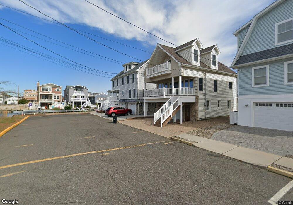
2 Riddle Way Manasquan, NJ 08736
Estimated Value: $1,635,000 - $2,295,160
6
Beds
2
Baths
3,470
Sq Ft
$593/Sq Ft
Est. Value
About This Home
This home is located at 2 Riddle Way, Manasquan, NJ 08736 and is currently estimated at $2,057,290, approximately $592 per square foot. 2 Riddle Way is a home located in Monmouth County with nearby schools including Manasquan Elementary School, Manasquan High School, and St. Catharine School.
Ownership History
Date
Name
Owned For
Owner Type
Purchase Details
Closed on
Oct 24, 2002
Sold by
Adlouni Abdallah
Bought by
Rufolo Joseph and Rufolo Mary
Current Estimated Value
Purchase Details
Closed on
Dec 18, 1996
Sold by
Wood Robert
Bought by
Adlouni Abdallah and Adlouni Laurel
Home Financials for this Owner
Home Financials are based on the most recent Mortgage that was taken out on this home.
Original Mortgage
$85,000
Interest Rate
7.5%
Create a Home Valuation Report for This Property
The Home Valuation Report is an in-depth analysis detailing your home's value as well as a comparison with similar homes in the area
Home Values in the Area
Average Home Value in this Area
Purchase History
| Date | Buyer | Sale Price | Title Company |
|---|---|---|---|
| Rufolo Joseph | $340,000 | -- | |
| Adlouni Abdallah | $105,000 | -- |
Source: Public Records
Mortgage History
| Date | Status | Borrower | Loan Amount |
|---|---|---|---|
| Previous Owner | Adlouni Abdallah | $85,000 |
Source: Public Records
Tax History
| Year | Tax Paid | Tax Assessment Tax Assessment Total Assessment is a certain percentage of the fair market value that is determined by local assessors to be the total taxable value of land and additions on the property. | Land | Improvement |
|---|---|---|---|---|
| 2025 | $16,699 | $939,200 | $377,800 | $561,400 |
| 2024 | $16,070 | $939,200 | $377,800 | $561,400 |
| 2023 | $16,070 | $939,200 | $377,800 | $561,400 |
| 2022 | $15,469 | $939,200 | $377,800 | $561,400 |
| 2021 | $15,469 | $939,200 | $377,800 | $561,400 |
| 2020 | $15,253 | $939,200 | $377,800 | $561,400 |
| 2019 | $14,680 | $939,200 | $377,800 | $561,400 |
| 2018 | $14,351 | $939,200 | $377,800 | $561,400 |
| 2017 | $13,806 | $939,200 | $377,800 | $561,400 |
| 2016 | $13,440 | $939,200 | $377,800 | $561,400 |
| 2015 | $11,797 | $659,600 | $328,700 | $330,900 |
| 2014 | $11,259 | $659,600 | $328,700 | $330,900 |
Source: Public Records
Map
Nearby Homes
- 43 Pearce Ct
- 200-202 3rd Ave
- 55 Beach Front
- 22 2nd Ave
- 133 Fletcher Ave
- 340 E Main St
- 404 Perrine Blvd
- 405 Perrine Blvd
- 569 Trout Ave
- 22 Crescent Dr
- 564 Perch Ave
- 10 Waters Edge
- 28 Wyckoff Ave Unit and 28-1/2
- 28 Wyckoff Ave
- 329 Fisk Ave
- 49 Wyckoff Ave
- 431 Beachfront
- 217 Neptune Place
- 323-325 Fisk Ave
- 219 Neptune Place
Your Personal Tour Guide
Ask me questions while you tour the home.